Bounty is an unincorporated community in Fertile Valley No. 285 Saskatchewan, Canada. The population was 5 at the 2001 Census. It previously held the status of village until November 25, 1997. The community is located on Range Road 104 and Township Road 300, about 21 kilometres (13 mi) west of Outlook. At one time Bounty was said to have nobody living in the community.

Vidora is an unincorporated community within the Rural Municipality of Reno No. 51, Saskatchewan, Canada. The community once had a population of 200 people in 1940 and has since declined to 1 resident. It previously held village status until it was dissolved as an unincorporated community on January 1, 1952. The community is located between Robsart and Consul on highway 21 & highway 13 known as the Red Coat Trail. Very little remains of the former village, only one home that is also used as a post office still stands as of 2008. There are many cement foundations and sidewalks still found scattered around the town site, including the remnants of the old bank vault to the former Municipality Office that was moved to Consul.
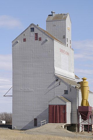
Arena was once a hamlet in the southwestern part of the province of Saskatchewan, Canada.

Neidpath, is a hamlet in Coulee Rural Municipality No. 136, Saskatchewan, Canada. The hamlet is located on Highway 363 and Highway 720 about 25 km east of the city of Swift Current.

Leroy is a town in the Canadian province of Saskatchewan.
Milestone is a town in southeast Saskatchewan, Canada, on Highway 39. The town was named after C. W. Milestone in 1893. The town serves as a service centre for the neighbouring countryside with the area's economy dominated by agriculture.
Piapot is a hamlet within the Rural Municipality of Piapot No. 110, Saskatchewan, Canada. Listed as a designated place by Statistics Canada, the hamlet had a population of 50 in the Canada 2016 Census.
Dilke is a village in the Canadian province of Saskatchewan within the Rural Municipality of Sarnia No. 221 and Census Division No. 6.
Grand Coulee, formally Hungry Hollow, is a town in the Canadian province of Saskatchewan. It is about 18 kilometres (11 mi) west of downtown Regina. It is home to an annual event called the "Home Town Hoedown".
Lang is a village in the Canadian province of Saskatchewan within the Rural Municipality of Scott No. 98 and Census Division No. 2. The village is located approximately 70 km southeast of the City of Regina.
McTaggart is a village in the Canadian province of Saskatchewan within the Rural Municipality of Weyburn No. 67 and Census Division No. 2.
Minton is a village in the Canadian province of Saskatchewan within the Rural Municipality of Surprise Valley No. 9 and Census Division No. 2. It is on Highway 6 just north of its intersection with Highway 18, about 19 kilometres (12 mi) north of the Raymond-Regway Border Crossing on the Montana-Saskatchewan border. The village was named after Minton, Shropshire in England. The name was given by the Canadian Pacific Railway.
Oxarat is an unincorporated community within Rural Municipality of Reno No. 51, Saskatchewan, Canada. The former town-site is located 15 km west of Highway 21, about 15 kilometres (9.3 mi) north of the village of Consul and Highway 13.
Anerley is an unincorporated community in the western region of Saskatchewan located about 4 km north of Highway 44, about 20 km southwest of the Outlook and is about 125 km south west of Saskatoon.
Ardill is a hamlet in RM of Lake Johnston No. 102, Saskatchewan, Canada. Listed as a designated place by Statistics Canada, the hamlet had a listed population of 0 in the Canada 2006 Census.
Ceylon is a village in the Canadian province of Saskatchewan within the Rural Municipality of The Gap No. 39 and Census Division No. 2. It is located alongside Gibson Creek, which is a tributary of Long Creek. No shops or businesses other than the bar remain.
Hatton, also known as Forres, is an unincorporated community in Maple Creek Rural Municipality No. 111, Saskatchewan, Canada. The community is located on Highway 635, 10 km north of the Trans Canada Highway, and 20 km northwest of Maple Creek. Not much is left of the once prosperous town of 800 citizens, but an old pioneer cemetery and schoolhouse that is now a private residence.
Cummings is an unincorporated community within the Rural Municipality of Maple Creek No. 111, Saskatchewan, Canada. The community is located on Range road 295, 30 km northwest of Maple Creek.
Cullen is a former hamlet in Benson Rural Municipality No. 35, Saskatchewan, Canada.
Woodley is an unincorporated community in Benson Rural Municipality No. 35, Saskatchewan, Canada. Woodley, like many other small communities throughout Saskatchewan, has struggled to maintain a steady population which made Woodley a ghost town.


