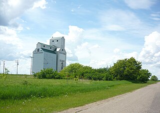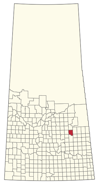
Oungre is a hamlet in the Canadian province of Saskatchewan. It is at the junction of Highway 18 and Highway 35 in the RM of Souris Valley No. 7.

Oungre is a hamlet in the Canadian province of Saskatchewan. It is at the junction of Highway 18 and Highway 35 in the RM of Souris Valley No. 7.
In the 2021 Census of Population conducted by Statistics Canada, Oungre had a population of 10 living in 9 of its 11 total private dwellings, a change of -50% from its 2016 population of 20. With a land area of 0.16 km2 (0.062 sq mi), it had a population density of 62.5/km2 (161.9/sq mi) in 2021. [1]

The Rural Municipality of Fillmore No. 96 is a rural municipality (RM) in the Canadian province of Saskatchewan within Census Division No. 2 and SARM Division No. 1. It is located in the south-east portion of the province along Highway 33.
Candiac is an organized hamlet located at the intersection of Highway 48 and Highway 617 in the southeast quadrant of Saskatchewan, Canada. It is directly south of Wolseley, and between Montmartre and Glenavon, approximately one hour's drive southeast of the provincial capital Regina. It is no longer listed as a separate community by Statistics Canada, and is considered part of the Rural Municipality of Montmartre No. 126. The population within the community's boundary is less than 50. Besides some bush on the northern end of the town, it is surrounded by open fields and pasture.
Halbrite is a village in the Canadian province of Saskatchewan within the Rural Municipality of Cymri No. 36 and Census Division No. 2. The village is located approximately 20 kilometres south-east of the city of Weyburn on Highway 39 at the intersections of Highway 606 and 705.
Bjorkdale is a village in the Canadian province of Saskatchewan within the Rural Municipality of Bjorkdale No. 426 and Census Division No. 14. The village is at the junctions of Highways 23, 679, and 776, approximately 78 kilometres (48 mi) east of the city of Melfort.
Duff is a special service area in the Canadian province of Saskatchewan within the Rural Municipality of Stanley No. 215 and Census Division No. 5. It is approximately 122 kilometres (76 mi) north-east of the city of Regina, 66 kilometres (41 mi) south-west of Yorkton, and 20 kilometres (12 mi) west of Melville. The community is situated along Highway 10.

Macoun is a village in the Canadian province of Saskatchewan within the Rural Municipality of Cymri No. 36 and Census Division No. 2. The village is located 28 kilometres (17 mi) northwest of the city of Estevan on Highway 39.
Minton is a village in the Canadian province of Saskatchewan within the Rural Municipality of Surprise Valley No. 9 and Census Division No. 2. It is on Highway 6 just north of its intersection with Highway 18, about 19 kilometres (12 mi) north of the Raymond-Regway Border Crossing on the Montana-Saskatchewan border. The village was named after Minton, Shropshire in England. The name was given by the Canadian Pacific Railway.

Beaubier is a hamlet in the Canadian province of Saskatchewan. Access is from Highway 707.
Big Beaver is an organized hamlet in the Canadian province of Saskatchewan. It is situated at the junction of Highways 18 and 34 in the Rural Municipality of Happy Valley No. 10. North of Big Beaver along Highway 34 is the Big Muddy Badlands. South of town, at the end of Highway 34, is the now closed US border crossing of Big Beaver. The port was closed to northbound traffic in 2011 and to southbound traffic in 2013.
Chelan is a hamlet in the Canadian province of Saskatchewan.

Corning is a hamlet in the Canadian province of Saskatchewan.

Delmas is a hamlet in the Rural Municipality of Battle River No. 438, Saskatchewan, Canada. Listed as a designated place by Statistics Canada, the hamlet had a population of 128 in the Canada 2016 Census. The hamlet is located approximately 32.6 kilometres (20.3 mi) west of North Battleford on Highway 16.

Edgeley is a hamlet in the Canadian province of Saskatchewan and formerly the location of some half-dozen grain elevators.
North Weyburn is a hamlet in the Canadian province of Saskatchewan.
Taylor Beach is a hamlet in the Canadian province of Saskatchewan.
Wishart is a hamlet in Emerald Rural Municipality No. 277 in the Canadian province of Saskatchewan. It is listed as a designated place by Statistics Canada. The hamlet had a population of 95 in the Canada 2006 Census. It previously held the status of village until January 1, 2002. The hamlet is located 32 km southwest of the village of Elfros at the intersection of highway 639 and highway 743.

Torquay is a village in the Canadian province of Saskatchewan within the Rural Municipality of Cambria No. 6 and Census Division No. 2. It was named after Torquay in Devon, England.
Osage is a village in the Canadian province of Saskatchewan within the Rural Municipality of Fillmore No. 96 and Census Division No. 2. The village is located on Highway 33, that runs south-east from Regina to Stoughton. The village has a grain elevator, post office, service station, and a two-sheet natural ice curling rink. Children from the area attend school in Fillmore, 13 km away. Osage celebrated its centennial in 2006.
Cole Bay is a northern hamlet in Saskatchewan's northern boreal forest. It is located on the southern shore of Canoe Lake. The population in the Canada Census of 2011 was 230, an increase of 47.4% over 156 in 2006.

The Rural Municipality of Sasman No. 336 is a rural municipality (RM) in the Canadian province of Saskatchewan within Census Division No. 10 and SARM Division No. 4.
49°08′44″N103°48′06″W / 49.14556°N 103.80167°W