Griffin, Saskatchewan

Last updated

Griffin
Griffin, Sk.jpg
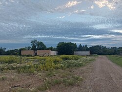
Abandoned school in Griffin
Canada Saskatchewan location map.svg
Red pog.svg
Griffin
Location in Saskatchewan
Canada location map 2.svg
Red pog.svg
Griffin
Griffin (Canada)
Coordinates: 49°40′00″N103°26′02″W / 49.66667°N 103.43389°W / 49.66667; -103.43389
Country Canada
Province Saskatchewan
Region Southeast Saskatchewan
Census division 2
Rural Municipality Griffin
Government
   Federal Electoral District M.P. Robert Kitchen (CPC - Souris-Moose Mountain)
   Provincial Constituency M.L.A. Dan D'Autremont (SK - Cannington)
Area
  Land0.62 km2 (0.24 sq mi)
Population
 (2016)
  Total111
  Density177.9/km2 (461/sq mi)
Time zone CST
Postal code
S0C 1G0
Area code 306
Highways Highway 13 Highway 606
Railways Canadian Pacific
[1] [2] [3] [4]

Griffin is a special service area within the Rural Municipality of Griffin No. 66 in the Canadian province of Saskatchewan. [5] Listed as a designated place by Statistics Canada, the community had a population of 111 (a 73.4% increase from 2011) in the Canada 2016 Census. [6] The community is also the seat of the Rural Municipality of Griffin No. 66. [7]

Contents

Demographics

In the 2021 Census of Population conducted by Statistics Canada, Griffin had a population of 128 living in 45 of its 55 total private dwellings, a change of 15.3% from its 2016 population of 111. With a land area of 0.61 km2 (0.24 sq mi), it had a population density of 209.8/km2 (543.5/sq mi) in 2021. [8]

Canada census – Griffin, Saskatchewan community profile
2016 2011
Population111 (+ 73.4% from 2011)64 (+ 30.6% from 2006)
Land area0.62 km2 (0.24 sq mi)0.62 km2 (0.24 sq mi)
Population density177.9/km2 (461/sq mi)102.5/km2 (265/sq mi)
Median age28.5 (M: 29.5, F: 27.8)32.5 (M: 30.8, F: 36.8)
Total private dwellings5436
Median household income$Not Available$Not Available
References: 2016 [9] 2011 [10] earlier [11] [12]

See also

Related Research Articles

<span class="mw-page-title-main">Alsask</span> Special service area in Saskatchewan, Canada

Alsask is a special service area in the Rural Municipality of Milton No. 292, in the province of Saskatchewan, Canada. Alsask is located 60 km (37 mi) west of the city of Kindersley. Highway 44 runs to the east of Alsask, and Highway 7 lies a few kilometres to the north. The community had a population of 113 in the 2021 Canadian census.

Amsterdam is a hamlet within the Rural Municipality of Buchanan No. 304, Saskatchewan, Canada. Listed as a designated place by Statistics Canada, the hamlet had a population of 25 in the Canada 2016 Census. The hamlet is located 63.9 km north of the city of Yorkton and 1.5 km west of Highway 9. The community was founded at the turn of the 20th century by Dutch immigrants, hence the name. In its prime, the community had a post office, grain elevator, garage, and a school. It, like many small towns, has been hit hard by the gradual trend toward urbanization. The hamlet now has fewer than 25 people; most are of Ukrainian descent.

<span class="mw-page-title-main">Simpson, Saskatchewan</span> Village in Saskatchewan, Canada

Simpson is a village in the Canadian province of Saskatchewan within the Rural Municipality of Wood Creek No. 281 and Census Division No. 11. It is between the cities of Regina and Saskatoon on Highway 2. The administrative office for the Rural Municipality of Wood Creek No. 281 is located in the village. The post office was founded in 1911 by Herman Bergren and Joseph Newman during construction of the Canadian Pacific Railway. It is named after George Simpson, a governor of the Hudson's Bay Company.

<span class="mw-page-title-main">Aneroid, Saskatchewan</span> Special service area in Saskatchewan, Canada

Aneroid is a special service area in the Rural Municipality of Auvergne No. 76 in southwestern Saskatchewan, Canada. The community is located approximately 70 km southeast of Swift Current at the intersection of Highway 13 and Highway 612.

<span class="mw-page-title-main">Antler, Saskatchewan</span> Special service area in Saskatchewan, Canada

Antler is a special service area in the Rural Municipality of Antler No. 61, Saskatchewan, Canada. Listed as a designated place by Statistics Canada, the community had a population of 40 in the Canada 2016 Census.

<span class="mw-page-title-main">Rural Municipality of Griffin No. 66</span> Rural Municipality in Saskatchewan, Canada

The Rural Municipality of Griffin No. 66 is a rural municipality (RM) in the Canadian province of Saskatchewan within Census Division No. 2 and SARM Division No. 1.

<span class="mw-page-title-main">Domremy, Saskatchewan</span> Special service area in Saskatchewan, Canada

Domremy, Saskatchewan is a special service area in the Rural Municipality of St. Louis No. 431, in the Canadian province of Saskatchewan. It held village status prior to December 31, 2006. The population was 124 people in 2006. Domremy is located on Highway 320 near Highway 2 and Highway 225 in central Saskatchewan. Domremy had a post office established as early as May 1, 1896 in the District of Saskatchewan, NWT.

Piapot is a hamlet within the Rural Municipality of Piapot No. 110, Saskatchewan, Canada. Listed as a designated place by Statistics Canada, the hamlet had a population of 50 in the Canada 2016 Census.

Richmound is a village in the Canadian province of Saskatchewan within the Rural Municipality of Enterprise No. 142 and Census Division No. 8. It is approximately 80 kilometres (50 mi) northeast of Medicine Hat, Alberta. The economy is driven in large part by the oil and gas sector as well as agriculture. The area was originally settled by Germans, mostly Catholics from South Russia.

Lake Lenore is a village in the Canadian province of Saskatchewan within the Rural Municipality of St. Peter No. 369 and Census Division No. 15. The village is located 144 kilometres (89 mi) northeast of the city of Saskatoon. To the north of the village is Lenore Lake, which is designated as a migratory bird sanctuary, an Important Bird Area (IBA) of Canada, and has a National Wildlife Area on Raven Island. Services in Lake Lenore include a school, Co-op Grocery and Agro Service Station, a Credit Union, and Public Library.

Mantario is a special service area in the Rural Municipality of Chesterfield No. 261 in the Canadian province of Saskatchewan.It held village status prior to June 30, 2007. The population was five people in 2011. The community is located 70 kilometres (43 mi) southwest of the town of Kindersley on Highway 44.

Meath Park is a village in the Canadian province of Saskatchewan within the Rural Municipality of Garden River No. 490 and Census Division No. 15.

Beaver Creek is a hamlet in the Rural Municipality of Dundurn No. 314, Saskatchewan, Canada. Listed as a designated place by Statistics Canada, the hamlet had a population of 107 in the Canada 2016 Census.

Hendon is a hamlet in the Rural Municipality of Lakeview No. 337, Saskatchewan, Canada. Listed as a designated place by Statistics Canada, the hamlet had a population of 20 in the Canada 2016 Census.

Kuroki is a hamlet in the Rural Municipality of Sasman No. 336, Saskatchewan, Canada. Listed as a designated place by Statistics Canada, the hamlet had a population of 50 in the Canada 2016 Census. The community is named after the Japanese general Kuroki Tamemoto.

North Shore Fishing Lake is a hamlet in the Rural Municipality of Sasman No. 336, Saskatchewan, Canada. Listed as a designated place by Statistics Canada, the hamlet had a population of 50 in the Canada 2016 Census. It is located on the north-eastern shore of Fishing Lake.

Quinton is a village in the Canadian province of Saskatchewan within the Rural Municipality of Mount Hope No. 279 and Census Division No. 10. The village is located on Highway 15 between the Town of Raymore and the Village of Punnichy. It is near the administrative office of the Kawacatoose First Nations.

Shackleton is a special service area in the Rural Municipality of Miry Creek No. 229, Saskatchewan, Canada. It previously held the status of village until December 31, 2013. The community is located 81 km (50 mi) northwest of the City of Swift Current on Highway 32.

Sovereign is a special service area within the Rural Municipality of St. Andrews No. 287, Saskatchewan, Canada. In 2016, Sovereign had a population of 25 people. It had village status prior to December 31, 2005. The community is located 26 km south east of the Town of Rosetown on Highway 15.

Leslie is a special service area in the Rural Municipality of Elfros No. 307, Saskatchewan, Canada. Listed as a designated place by Statistics Canada, the community had a population of 15 in the Canada 2016 Census. The community is located just off of Highway 16 between Foam Lake and Elfros.

References

  1. National Archives, Archivia Net, Post Offices and Postmasters, archived from the original on 2006-10-06
  2. Government of Saskatchewan, MRD Home, Municipal Directory System, archived from the original on November 21, 2008
  3. Canadian Textiles Institute. (2005), CTI Determine your provincial constituency, archived from the original on 2007-09-11
  4. Commissioner of Canada Elections, Chief Electoral Officer of Canada (2005), Elections Canada On-line, archived from the original on April 21, 2007
  5. "Municipal Directory System" (PDF). Government of Saskatchewan. p. 227. Retrieved November 19, 2016.
  6. Canada 2016 Census: Designated places in Saskatchewan
  7. Rural Municipality of Griffin No. 66
  8. "Population and dwelling counts: Canada and designated places". Statistics Canada. February 9, 2022. Retrieved Aug 31, 2022.
  9. "2016 Community Profiles". 2016 Canadian Census . Statistics Canada. August 12, 2021.
  10. "2011 Community Profiles". 2011 Canadian Census . Statistics Canada. March 21, 2019.
  11. "2006 Community Profiles". 2006 Canadian Census . Statistics Canada. August 20, 2019.
  12. "2001 Community Profiles". 2001 Canadian Census . Statistics Canada. July 18, 2021.