Highway 39 is one of Canada's busiest highways, facilitating transport for $6 billion in trade goods via approximately 100,000 trucks over the year.[4] About 71.3 kilometres (44.3mi) of the highway between Weyburn and Corinne is part of the CanAm Highway[5] route. Other Saskatchewan highways on the CanAm route include 35, 6, 3, and 2.[6][7] Highway 39 is divided, or twinned, in two areas — east of Estevan for 10 kilometres (6.2mi) to the junction with Highway 18[8] and north-west of Weyburn for 1.7 kilometres (1.1mi). The junction of Highway 39 with the Trans–Canada divided four-lane highway is done via a partial cloverleaf interchange.
Over the last number of years, multiple projects have been completed to improve traffic flow and to make the highway safer.[9] Highway 39 has been dubbed "Heaven's Flowered Highway" due to the number of deaths on the highway and the flowers and crosses lining it to honour the victims. Groups have been calling for the corridor of Highways 39 and 6 from the U.S. border to Regina to be twinned to improve safety, trade, and traffic flow.[10][11]
Travel route
Highway 39 begins at the Portal–North Portal Border Crossing, which has Saskatchewan's only duty-free shop.[12] From there, the highway heads north-west towards the Souris River valley. On the south side of the valley, and adjacent to the highway, is the Short Creek Cairn. The cairn commemorates a North-West Mounted Police camp from the 1874 Great March West. The actual camp was located nearby at the mouth of Short Creek on the Souris River near Roche Percee. From the cairn, Highway 39 descends into the valley, which is where the village of Roche Percee and Roche Percee Recreation Site[13] are situated.[14] Roche Percee is named after a geophysical rock formation in the area.[15] Just east of Roche Percee are two arches created by limestone rocks upon which historic animals, and initials are carved. The local Indigenous people found this site to be a power centre. As the highway crosses the river and climbs up and out of the Souris River valley, it passes by two large dragline surface coal mines. With an abundance of coal, the first operational mine opened in 1891. The coal was shipped downstream by barge to Winnipeg until the CPR's Soo Line came through in 1893. Underground mines began being replaced in the 1930s and, by the 1950s, all underground mining had been replaced by dragline surface mines.[16]
From the coal mines, Highway 39 opens up into a divided highway, is joined by, and has a 10-kilometre (6.2mi)concurrency with, Highway 18, and heads west towards the city of Estevan.[17] At the eastern outskirts of Estevan, Highway 39 diverges north and bypasses the city while Highway 39A continues through it. The 13-kilometre (8.1mi) Estevan Bypass opened in November 2015.[18]
Estevan is the eighth largest city in Saskatchewan and is known as "The Energy City" as there is an abundance of coal, oil, and natural gas resources near the city. Also nearby is Rafferty Dam, Boundary Dam Power Station, and Shand Power Station.[19] Boundary Dam Power Station is the location of the Boundary Dam Carbon Capture Project.[20] In June 2024, Saskatchewan's premier Scott Moe announced that small modular reactors were coming to Saskatchewan and "that the government was officially looking at just the Estevan area for the first reactor in Saskatchewan."[21]
As the Highway 39 / Estevan Bypass skirts around the northern limits of Estevan, it is intersected by Highway 47. Highway 47 heads north to Stoughton and south through Estevan (intersecting with Highway 39A) to the Noonan–Estevan Border Crossing. Highway 39 is rejoined by Highway 39A north-west of Estevan where continues in a north-westerly direction towards the city of Weyburn. Along the way, the highway provides access to many small communities, such as Hitchcock, Macoun,[22]Midale, Halbrite,[23] and Ralph. This section of highway parallels the Souris River and its reservoirs from Estevan to Weyburn and provides access to two regional parks: Mainprize Regional Park[24] and Nickle Lake Regional Park.[25]
Weyburn, "The Opportunity City", has also been dubbed the Soo Line City due its connection with Chicago on the Soo Line of the Canadian Pacific Railway (CPR).[26] Weyburn is at the crossroads of three major highways — 35, 39, and 13[27][28] and is near the upper delta of the 760-kilometre (470mi) long Souris River. The Souris River continues south-east through North Dakota eventually meeting the Assiniboine River in Manitoba.[26] In the 19th century, this area was known as an extension of the Greater Yellow Grass Marsh. "Extensive flood control programs have created reservoirs, parks and waterfowl centres along the Souris River."[27][29] Notable points of interest in Weyburn accessible from Highway 39 include the Soo Line Historical Museum,[30][31]Tommy Douglas statue, Weyburn Heritage Village,[32] Water Tower,[33] River Park Campground,[34] and the site of the former Saskatchewan Hospital.
From Weyburn, Highway 39 begins the CanAm section as it continues in a north-westerly direction towards Corinne and Highway 6, at which point it has a 3.7-kilometre (2.3mi)concurrency with 6. Communities along the stretch of highway from Weyburn to Corinne include McTaggart, Yellow Grass, Lang, and Milestone. At Corinne, the CanAm Highway diverges from Highway 39 and follows Highway 6 to Regina. In 2023, a two-year, $57 million twinning project from the concurrency of Highways 6 and 39 to Regina was begun. The project is split into two sections — the twinning of a 7.1-kilometre (4.4mi) segment beginning at the Highway 39 and Highway 6 concurrency south-east of Corinne to a point north of Corinne on Highway 6 and a 7.8-kilometre (4.8mi) twinning of Highway 6 from Highway 306 north to the Regina Bypass.[35]
After Corinne, Highway 39 continues north-west for the final leg of its route to the Trans-Canada Highway. This section provides access to the communities of Wilcox, Rouleau, Drinkwater, and Pasqua. Rouleau was the host town for the popular Canadian sitcom, Corner Gas, which aired from 2004 to 2009. The show was set in the fictional town of Dog River, Saskatchewan.[36] West of the northern terminus along the Trans-Canada Highway is the city of Moose Jaw.
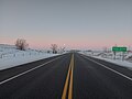
Highway 39 at Roche Percee with mine tailings on either side
Short Creek Cairn
Estevan, and the Estevan Coalfield, along the Souris River, viewed from the Space Shuttle, February 2001
CanAm Highway
The 71.7-kilometre (44.6mi) segment between Weyburn and Corinne is designated as a portion of the CanAm Highway. Near Corinne, Highway 39 is concurrent with Highway 6, at Corinne, the CanAm Highway continues north on Highway 6. South of Weyburn, the CanAm Highway crosses the Canada–United States border via Highway 35. "The projects on Highways 39 and 6 will help to improve traffic flow through these Canada/U.S. ports. 'Highways 6 and 39 are very important to Saskatchewan — serving as tourism links and major north–south trade corridors to the U.S.,' former NDP Highways and Transportation Minister Maynard Sonntag had said in 2004."[37]
History
Saskatchewan's Highway 39 traverses a course on a diagonal from the south–east at the U.S. border to north–west at the Trans-Canada Highway east of Moose Jaw. Originally, the road followed the early surveyed road allowances and the grade of the CPR or Soo Line between the United States border and east of Moose Jaw. Travel along Highway 39 before the 1940s would have been travelling on the square following the township road allowances, barbed wire fencing, and rail lines. As the surveyed township roads were the easiest to travel, the first highway was designed on 90 degree right angle corners as the distance traversed the prairie along range roads and township roads.[38][39]
By 1940, Highway 39 has been straightened out for most of its route and no longer follows the road allowances "on the square".[40] As late as 1955 though, there are still right angle segment of the highway near Corinne as well as south of Estevan to North Portal. At this point, the highway still ran through Roche Percee while now it bypasses the village to the east.[41]
In 1947 and 1948, the highway was paved from North Portal to its junction with Highway 6 at Corinne.[42] However, the paved surface fell into disrepair within a few years; a Leader-Post reporter wrote in 1953 that "practically the entire road, from North Portal through to Corinne is just a mass of large gaping potholes, ruts, and cracks, and in some places the hard surface is gone completely."[42] Saskatchewan Motor Transport association director A.R. Mang blamed the poor condition of the road on a failure to place a suitable "base course", a layer of gravel and clay, between the pavement and the road's earthen base.[43] A 1955 map shows that a segment between Estevan and Lang had reverted to gravel[41] and a 1956 highway map shows the entire segment between Weyburn and Estevan as a gravel highway.[44] These maps also show the segment between Corinne and the junction with the Trans-Canada Highway as gravel. Repairs were carried out at considerable expense,[45] but the situation required temporary bans on heavy traffic[46] and the rerouting of traffic along nearby roads.[42][45]
In 2008, a trade group called the Soo Line Corridor Association advocated twinning much of Highway 39 and part of Highway 6 to create a continuous twinned corridor stretching from Regina to North Portal to boost Saskatchewan's trade with the United States.[47] Former premier Lorne Calvert had expressed interest in the proposal.[48] In response to a fatality in 2009, another group — Time to Twin Committee — was formed to advocate for the twinning. In the decade preceding 2016, an average of three people a year had died on Highway 39. One such fatality in 2012 in a highway construction zone near Midale — that of a pregnant flagger on her first day on the job[49] — swiftly brought legislative changes for drivers in construction zones.[50]
First announced in 2008, the first phase of twinning was completed in 2017 east of Estevan.[51][52] The second was started in 2023 near Corinne.
Over the years, Highway 39 has undergone several resurfacing and improvement projects. Some of those projects include:
In 2001, 14.4km (8.9mi) was resurfaced near Milestone[53]
In 2003, a further 11km (6.8mi) was resurfaced near Milestone[3]
In 2004, 18.2km (11.3mi) north of U.S. border was resurfaced
In 2015, the Highway 39 bypass around Estevan was completed
In 2017, the first major section of twinning was completed east of Estevan
In 2020, there were multiple projects that improved over 200km (120mi) of Highway 39 between North Portal and Rouleau. This project saw 11 new passing lanes, resurfacing, culverts, and various safety upgrades. Highlights of the project include:[55]
Five sets of passing lanes, 35km (22mi) of resurfacing, culvert replacements, and the addition of an intelligent transportation system between Hitchcock and Weyburn
Four sets of passing lanes and 25km (16mi) of resurfacing from McTaggart to Milestone
32km (20mi) of improvements from Corinne to Rouleau
Highway 39A is a highway in Saskatchewan serving the city of Estevan. It runs from the Highway 18 / Highway 39 concurrency east of Estevan to Highway 39, north-west of the city. It is the original configuration for Highway 39 through Estevan and was designated after the Estevan Bypass was opened in 2015.[56]
The highway runs concurrently with Highway 18 from it southern terminus east of Estevan along 4th Street, to Souris Avenue where Highway 18 turns south and leaves the concurrency, becoming concurrent with Highway 47. It continues to 13th Avenue where Highway 47 turns north and Highway 39A continues north-west, leaving Estevan to its northern terminus with Highway 39. Highway 39A is about 11 kilometres (7mi) long.[57]
Weyburn is the tenth-largest city in Saskatchewan, Canada. The city has a population of 11,019. It is on the Souris River 110 kilometres (68 mi) southeast of the provincial capital of Regina and is 70 kilometres (43 mi) north from the North Dakota border in the United States. The name is reputedly a corruption of the Scottish "wee burn," referring to a small creek. The city is surrounded by the Rural Municipality of Weyburn No. 67.
The Souris River or Mouse River is a river in central North America. Approximately 435 miles (700 km) in length, it drains about 23,600 square miles (61,100 km2) in Canada and the United States.
Estevan is the eleventh-largest city in Saskatchewan, Canada. It is approximately 16 km (9.9 mi) north of the Canada–United States border. The Souris River runs by the city. This city is surrounded by the Rural Municipality of Estevan No. 5.
Highway 1 is the Saskatchewan section of the Trans-Canada Highway mainland route. The total distance of the Trans-Canada Highway in Saskatchewan is 654 kilometres (406 mi). The highway traverses Saskatchewan from the western border with Alberta, from Highway 1, to the Manitoba border where it continues as PTH 1. The Trans-Canada Highway Act was passed on December 10, 1949. The Saskatchewan segment was completed August 21, 1957, and completely twinned on November 6, 2008. The speed limit along the majority of the route is 110 kilometres per hour (70 mph) with urban area thoroughfares slowing to a speed of 80–100 kilometres per hour (50–62 mph). Portions of the highway—the section through Swift Current, an 8-kilometre (5 mi) section east of Moose Jaw, and a 44-kilometre (27 mi) section between the West Regina Bypass and Balgonie—are controlled-access. Highway 1 serves as a major east–west transport route for commercial traffic. It is the main link between southern Saskatchewan's largest cities, and also serves as the province's main link to the neighbouring provinces of Alberta and Manitoba.
Highway 11 is a major north-south highway in Saskatchewan, Canada that connects the province's three largest cities: Regina, Saskatoon, and Prince Albert. It is a structural pavement major arterial highway which is approximately 391 kilometres (243 mi) long. It is also known as the Louis Riel Trail (LRT) after the 19th century Métis leader. It runs from Highway 1 in Regina until Highway 2 south of Prince Albert. Historically the southern portion between Regina and Saskatoon was Provincial Highway 11, and followed the Dominion Survey lines on the square, and the northern portion between Saskatoon and Prince Albert was Provincial Highway 12.
Highway 6 is a paved undivided major provincial highway in the Canadian province of Saskatchewan. It runs from Montana Highway 16 at the Canada–US border near the Canada customs port of Regway to Highway 55 near Choiceland. Highway 6 is about 523 km (325 mi) long. The CanAm Highway comprises Saskatchewan Highways from south to north: SK 35, Sk 39, Sk 6, Sk 3, as well as Sk 2. 330 kilometres (210 mi) of Saskatchewan Highway 6 contribute to the CanAm Highway between Corinne and Melfort.
Highway 35 is a paved, undivided provincial highway in the Canadian province of Saskatchewan. It runs from the U.S. border at the Port of Oungre north to a dead end near the north shore of Tobin Lake. The southern end of Highway 35 is one segment of the CanAm Highway, which is an international highway connecting Canada, the United States, and Mexico. Highway 35 is about 569 kilometres (354 mi) long.
Goodwater is a village in the Canadian province of Saskatchewan within the Rural Municipality of Lomond No. 37 and Census Division No. 2. The village is located approximately 50 kilometres (31 mi) south of the city of Weyburn.
Highway 20 is a major road intended for travel by the public between Highway 11 Lumsden to Highway 3 at Birch Hills. Saskatchewan's main roadways are located in the central/southern geographical land area of rolling prairie and grass land in a western Canadian prairie province. This highway is one which runs south to north and is located just east of Saskatoon and just north of Regina. At the northern extremity near Lanigan, the highway helps to service the PCS Lanigan potash mining operation. Down south, the highway is popular for tourists heading out to the Qu'Appelle Valley and resorts and beaches of Last Mountain Lake.
Highway 33 is a paved provincial highway in the southern portion of the Canadian province of Saskatchewan. The highway runs from Ring Road in the city of Regina to Stoughton in a south-easterly direction. The section of highway through Regina is divided and concurrent Acrola Avenue. Highway 33, at a length of 139 kilometres (86 mi), is Canada's longest straight stretch of Highway.
Midale is a town in the Rural Municipality of Cymri No. 36, in the Canadian province of Saskatchewan. It is located on Highway 39, midway between the cities of Weyburn and Estevan. It is 160 kilometres (100 mi) south-east of Regina.
The Red Coat Trail is a 1,300-kilometre (810 mi) route that approximates the path taken in 1874 by the North-West Mounted Police in their March West from Fort Dufferin to Fort Whoop-Up.
The Rural Municipality of Coalfields No. 4 is a rural municipality (RM) in the Canadian province of Saskatchewan within Census Division No. 1 and SARM Division No. 1. Located in the southeast portion of the province, it is adjacent to the United States, neighbouring Burke County, North Dakota.
Roche Percee is a village in the Canadian province of Saskatchewan within the RM of Coalfields No. 4 and Census Division No. 1. The village is near the Canada–United States border, just off Highway 39. Roche Percee is about 20 kilometres (12 mi) east of Estevan in the Souris River valley.
The 2011 Souris/Mouse River flood in Canada and the United States occurred in June and was greater than a hundred-year flooding event for the river. The US Army Corps of Engineers estimated the flood to have a recurrence interval of two to five centuries.
McDonald Lake, also known as Rafferty Reservoir, is a reservoir in the south-eastern part of the Canadian province of Saskatchewan. It was created when the Rafferty Dam was built on the Souris River in 1994. Before the dam was built that flooded the Souris Valley, McDonald Lake was a small lake and marsh on the valley floor adjacent to the Souris River.
Long Creek is a river in central North America that begins in Saskatchewan, flows south-east into North Dakota, and then flows back north into Saskatchewan. It is a tributary of the Souris River. The Souris River drains into the Assiniboine River, which is part of the Red River drainage basin in a region called the Prairie Pothole Region of North America, which extends throughout three Canadian provinces and five U.S. states. It is also within Palliser's Triangle and the Great Plains ecoregion. In 1957, a dam was built on Long Creek near where it meets the Souris River to create Boundary Dam Reservoir.
Nickle Lake is a man-made reservoir in the Canadian province of Saskatchewan. It was created with the construction of a dam across the Souris River in the 1950s to supply water to the city of Weyburn. In the 1980s, the dam—christened Albert Douglas Dam—was expanded thereby increasing the size of the lake.
↑ McLennan, David (2006). "Roche Percée". The Encyclopedia of Saskatchewan. CANADIAN PLAINS RESEARCH CENTER, UNIVERSITY OF REGINA. Retrieved 15 February 2008.
↑ "Estevan". Tourism Saskatchewan. Government of Saskatchewan. Retrieved 17 June 2024.
1 2 Weyburn Writer's Association (2006). "Hey, seeds!". Our Roots Nos Racines. University of Calgary, Université Laval. Archived from the original on 27 May 2011. Retrieved 15 April 2008.
↑ Adamson, J (14 October 2003). "Canadian maps 1926 Highway Map". Department of Highways. Canadian Maps Online Digitization Project. Retrieved 10 February 2008.
↑ Anderson, Frank w. (1998). The Yellowhead Trail in Manitoba and Saskatchewan. Saskatoon, Saskatchewan: Frank W. Anderson. p.50.
This page is based on this Wikipedia article Text is available under the CC BY-SA 4.0 license; additional terms may apply. Images, videos and audio are available under their respective licenses.


