Saskatchewan Highway 155

Last updated

Saskatchewan Highway 155 (jct).svg
Highway 155
Route information
Maintained by Ministry of Highways and Infrastructure
Length298.9 km [1]  (185.7 mi)
Existed1947–present
Major junctions
South endSaskatchewan Highway 55 (jct).svg Highway 55 in Green Lake
Major intersectionsSaskatchewan Highway 165 (jct).svg Highway 165 near Beauval
North endSaskatchewan Highway 955 (jct).svg Highway 955 in La Loche
Location
Country Canada
Province Saskatchewan
Highway system
    Saskatchewan Highway 135 (jct).svg Highway 135 Saskatchewan Highway 165 (jct).svg Highway 165

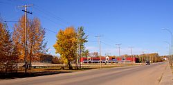
    Highway 155, formerly known as Buffalo Narrows Road, is a paved, undivided provincial highway in the Canadian province of Saskatchewan. It runs from Highway 55 near Green Lake until La Loche, where it intersects with Highway 955. The highway services several communities and provincial recreation sites and is entirely within the Northern Saskatchewan Administration District. It is about 299 kilometres (186 mi) long.

    Contents

    Communities accessible directly from Highway 155 are Green Lake, Little Amyot Lake, Buffalo Narrows, Bear Creek, and La Loche. Some of the parks accessed from the highway include Beatty Lake Recreation Site, [2] Beaver / Cowan Rivers Recreation Site, Taylor Lake Recreation Site, [3] Lac Île-à-la-Crosse (South Bay) Recreation Site (also known as 'Ile a la Crosse War Veterans Park Campground'), [4] Little Amyot Lake Recreation Site, [5] Buffalo Narrows Sand Dunes Park, [6] and Waterhen River Recreation Site.

    History

    Highway 155 was begun in 1947 as a development road. It reached Buffalo Narrows in 1957 where a ferry was needed to cross the Kisis Channel. [7] The road closely followed the path of the old wagon trail established by the Hudson's Bay Company. [8] The official opening of Highway 155 from Green Lake to Buffalo Narrows was held in August 1963 in Green Lake. The old trail to La Loche was rebuilt soon after to become part of Highway 155.

    A bridge built in 1981 now crosses the Kisis Channel next to where the ferry was once located. The Kisis Channel connects Churchill Lake to Peter Pond Lake. In the 1980s, the highway was straightened and paved.

    Hwy 155 at Buffalo Narrows looking north Town centre in Buffalo Narrows, Saskatchewan.JPG
    Hwy 155 at Buffalo Narrows looking north
    Highway 155 as it enters La Loche from the south. Highway 955 intersects on the left. (Canada Day 2008) GEDC0382 edited.JPG
    Highway 155 as it enters La Loche from the south. Highway 955 intersects on the left. (Canada Day 2008)

    Major intersections

    From south to north:

    Locationkm [1] miDestinationsNotes
    Green Lake 0.00.0Saskatchewan Highway 55 (jct).svg Highway 55  Meadow Lake, Prince Albert Southern terminus
    94.358.6Saskatchewan Highway 165 (jct).svg Highway 165 east Beauval, Hwy 2
    99.461.8Saskatchewan Highway 965 (jct).svg Highway 965 west Canoe Narrows
    153.695.4Saskatchewan Highway 908 (jct).svg Highway 908 east Ile a la Crosse
    186.2115.7Saskatchewan Highway 925 (jct).svg Highway 925 west Dillon
    Buffalo Narrows 195.2121.3Crosses Kisis Channel (connects Peter Pond Lake and Churchill Lake)
    254.8158.3Saskatchewan Highway 909 (jct).svg Highway 909 north Turnor Lake South of Bear Creek
    288.3179.1Saskatchewan Highway 956 (jct).svg Highway 956 west Black Point, Garson Lake Winter road connection to Fort McMurray, Alberta
    La Loche 298.9185.7Saskatchewan Highway 955 (jct).svg Highway 955 north Cluff Lake mine Northern terminus
    1.000 mi = 1.609 km; 1.000 km = 0.621 mi

    See also

    References

    1. 1 2 "Highway 155 in Saskatchewan" (Map). Google Maps . Retrieved 17 February 2018.
    2. "Beatty Lake Campground". Tourism Saskatchewan. Government of Saskatchewan. Retrieved 1 September 2023.
    3. "Taylor Lake Recreation Site". BRMB Maps. 2024 Mussio Ventures Ltd. Retrieved 17 March 2024.
    4. "Ile a la Crosse War Veteran's Park Campground". Tourism Saskatchewan. Government of Saskatchewan. Retrieved 14 April 2024.
    5. "Little Amyot Lake Recreation Site". Tourism Saskatchewan. Government of Saskatchewan. Retrieved 15 March 2024.
    6. "Big Buffalo Beach". Tourism Saskatchewan. Government of Saskatchewan. Retrieved 1 September 2023.
    7. "North - Buffalo Narrows - Hwy 155". Tourism Saskatchewan. Government of Saskatchewan. Retrieved 1 August 2025.
    8. Dunfield, H. C. "Northernmost Highway Serves Historic Frontier Area". Star-Phoenix. Saskatoon. pp. 8 (1963-08-20).