Saskatchewan Highway 316

Last updated

Saskatchewan Highway 316 (jct).svg

Highway 316

Route information
Maintained by Ministry of Highways and Infrastructure
Length17 km (11 mi)
Major junctions
South endSaskatchewan Highway 16.svg Hwy 16 (TCH) near Clavet
Major intersectionsSaskatchewan Highway 394 (jct).svg Hwy 394
North endSaskatchewan Highway 5 (jct).svg Hwy 5
Location
Country Canada
Province Saskatchewan
Rural municipalities Blucher No. 343
Highway system
    Saskatchewan Highway 312 (jct).svg Hwy 312 Saskatchewan Highway 317 (jct).svg Hwy 317

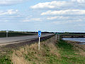
    Highway 316 is a provincial highway in the Canadian province of Saskatchewan. The highway is in the RM of Blucher No. 343 and runs from Highway 16 near Clavet north to Highway 5. It is a primary weight highway and the land around it is an industrial and commercial area. The highway intersects with Highway 394 and the Canadian National and Canadian Pacific Railways. [1] [2] It is about 17 kilometres (11 mi) long.

    Contents

    Nearby attractions

    See also

    Related Research Articles

    <span class="mw-page-title-main">Sussex, New Brunswick</span> Town in New Brunswick, Canada

    Sussex is a town in Kings County, New Brunswick, Canada. Sussex is located in south central New Brunswick, between the province's three largest cities, Saint John, Moncton, and Fredericton.

    <span class="mw-page-title-main">PotashCorp</span> Company

    The Potash Corporation of Saskatchewan, also known as PotashCorp, was a company based in Saskatoon, Saskatchewan. The company merged with Calgary-based Agrium to form Nutrien, in a transaction that closed on January 1, 2018.

    Saskatchewan Highway 7 is a major paved undivided provincial highway in the Canadian province of Saskatchewan, running from the Alberta border to Saskatoon. Highway 7 continues west into Alberta where it becomes Alberta Highway 9.

    Highway 2 is a provincial highway in the Canadian province of Saskatchewan. It is the longest highway in Saskatchewan at 809 km (503 mi). The highway has a few divided sections but is mostly undivided. However, only about 18 kilometres (11 mi) near Moose Jaw, 11 kilometres (7 mi) near Chamberlain, and 21 kilometres (13 mi) near Prince Albert are divided highway. Highway 2 is a major north-south route beginning at the Canada–US border at the Port of West Poplar River and Opheim, Montana customs checkpoints. Montana Highway 24 continues south. It passes through the major cities of Moose Jaw in the south and Prince Albert in the north. Highway 2 overlaps Highway 11 between the towns of Chamberlain and Findlater. This 11 kilometres (7 mi) section of road is a wrong-way concurrency. The highway ends at La Ronge, where it becomes Highway 102.

    Highway 394, also known as Patience Lake Road, is an unsigned provincial highway in the Canadian province of Saskatchewan. It starts near an intersection between Highway 16 and Zimmerman Road near Saskatoon, and goes eastward to Highway 316 north of Clavet. It is about 10.5 kilometres (6.5 mi) long.

    <span class="mw-page-title-main">Saskatchewan Highway 5</span> Provincial highway in Saskatchewan, Canada

    Highway 5 is a major highway in the Canadian province of Saskatchewan. It begins in downtown Saskatoon and runs eastward to the Manitoba border near Togo, where it becomes Provincial Road 363. The highway is approximately 393 kilometres (244 mi) long. Between the early 1900s (decade) and 1976, Provincial Highway 5 was a trans-provincial highway travelling approximately 630 kilometres (390 mi) in length. At this time it started at the Alberta border in Lloydminster and traveled east to the Manitoba border.

    <span class="mw-page-title-main">Saskatchewan Highway 955</span> Provincial highway in Saskatchewan, Canada

    Highway 955, also known as Semchuk Trail, is a provincial highway in the Canadian province of Saskatchewan. It runs from Highway 155 near La Loche to Cluff Lake mine. The mine has been closed since the early 2000s and its adjacent airstrip is also closed now, meaning there are no formal services at the northern turn-around point. Drivers using the route need to carry extra fuel and other supplies, including spare tires owing to the sharp gravel used on the road. The name "Semchuk Trail" comes from Martin Semchuk who, along with John F. Midgett, and Jonas Clarke, were involved in building the original trail in 1955–56.

    Highway 914 is a provincial highway in the north-west and far north regions of the Canadian province of Saskatchewan. The highway begins at a turn in Highway 165 and officially ends at Key Lake mine. It does not intersect with any provincially-owned highways between Highway 165 and Key Lake Mine. Along its entire length, it passes through only one community, Pinehouse. It is about 268 kilometres (167 mi) long.

    <span class="mw-page-title-main">Saskatchewan Highway 9</span> Provincial highway in Saskatchewan, Canada

    Highway 9 is a paved, undivided provincial highway in the Canadian province of Saskatchewan. It runs from North Dakota Highway 8 at the US border near Port of Northgate until it transitions into Provincial Road 283 at the Manitoba provincial boundary.

    The Saskota Flyway is known as the International Road to Adventure, because it takes you from Hudson Bay, Saskatchewan, all the way south to Bismarck, North Dakota.

    Highway 20 is a major road intended for travel by the public between Highway 11 Lumsden to Highway 3 at Birch Hills. Saskatchewan's main roadways are located in the central/southern geographical land area of rolling prairie and grass land in a western Canadian prairie province. This highway is one which runs south to north and is located just east of Saskatoon and just north of Regina. At the northern extremity near Lanigan, the highway helps to service the PCS Lanigan potash mining operation. Down south, the highway is popular for tourists heading out to the Qu'Appelle Valley and resorts and beaches of Last Mountain Lake.

    <span class="mw-page-title-main">Saskatchewan Highway 39</span> Provincial highway in Saskatchewan, Canada

    Highway 39 is a provincial paved highway in the southern portion of the Canadian province of Saskatchewan connecting North Portal and Moose Jaw in the north. This is a primary Saskatchewan highway maintained by the provincial and federal governments that provides a major trucking and tourism route between the United States at Portal, North Dakota and the Trans-Canada Highway near Moose Jaw.

    Highway 40 is a provincial highway in the north-west portion of the Canadian province of Saskatchewan connecting Alberta to Highway 3, four kilometres (2.5 mi) west of Shellbrook, Saskatchewan. Areas of this highway between the Alberta border and North Battleford are called the Poundmaker Trail. Pitikwahanapiwiyin, commonly known as Poundmaker, was a Plains Cree chief known as a peacemaker and defender of his people. This is a primary Saskatchewan highway maintained by the provincial government. The highway is about 280 kilometres (174 mi) long and is entirely paved.

    <span class="mw-page-title-main">Colonsay, Saskatchewan</span> Town in Saskatchewan, Canada

    Colonsay is a town in the Rural Municipality of Colonsay No. 342, in the Canadian province of Saskatchewan. Colonsay is located on Highway 16 running east–west in central Saskatchewan near the intersection with Highway 2.

    Churchbridge is a town in the province of Saskatchewan, Canada, located at the junction of the Yellowhead Highway, and Highway 80. Churchbridge is a part of the Rural Municipality of Churchbridge No. 211, which is located within Saskatchewan Association of Rural Municipalities (SARM) Division No. 1 and census division Number 5.

    The economy of Saskatchewan has been associated with agriculture resulting in the moniker "Bread Basket of Canada" and Bread Basket of the World. According to the Government of Saskatchewan, approximately 95% of all items produced in Saskatchewan, depend on the basic resources available within the province. Various grains, livestock, oil and gas, potash, uranium, wood and their spin off industries fuel the economy.

    Palo is a hamlet in Rosemound Rural Municipality No.378, Saskatchewan, Canada. Palo used to have a Grand Trunk Pacific Railway station, and is near Canadian National Railway's Wainwright Subdivision. Palo is still home to the Palo mine facility.

    <span class="mw-page-title-main">Patience Lake</span> Lake in Saskatchewan, Canada

    Patience Lake is a lake in the central part of the Canadian province of Saskatchewan. The lake is east of Saskatoon in the Rural Municipality of Blucher No. 343. The lake serves as a groundwater discharge region for higher elevations to the east and west.

    Indi Lake is a man-made lake in central Saskatchewan, Canada, south of Saskatoon in the Rural Municipality of Dundurn No. 314. The lake was created for irrigation and recreation in 1967 by a dam located at its south end. The lake is part of a greater irrigation and aqueduct system built in the 1960s in Saskatchewan and was named after Indi, an unincorporated railway point nearby on the Canadian National Railway (CNR).

    Bradwell Reservoir is a man-made reservoir in the Canadian province of Saskatchewan in the Rural Municipality of Blucher No. 343. The reservoir was built as part of the South Saskatchewan River Project. That project involved the damming of the South Saskatchewan River with the Gardiner and Qu'Appelle River Dams creating Lake Diefenbaker. From Lake Diefenbaker, a series of aqueducts were built allowing for irrigation and the creation of several reservoirs, including Bradwell Reservoir. The reservoir is owned and operated by the Saskatchewan Water Security Agency. Bradwell Reservoir supplies water to the Nutrien Allan Potash Mine near Allan.

    Dellwood Reservoir is a reservoir in the Canadian province of Saskatchewan in the Rural Municipality of Usborne No. 310. The reservoir was built along the course of Dellwood Brook as part of South Saskatchewan River Project. That project, originating at Gardiner Dam of Lake Diefenbaker, involved the building of aqueducts and a series of reservoirs to supply water for irrigation, consumption, and industry. The reservoir is about 22 kilometres (14 mi) north-east of the town of Watrous and access is from Highway 668.

    References

    1. Sask Biz. "Community Profiles" . Retrieved 17 May 2007.
    2. Canadian Online Map Digitization Project, J. Adamson. "1941 Waghorn's Map of Saskatchewan". rootsweb. Retrieved 17 May 2007.
    3. "Potash Operations". Nutrien. Nutrien Ltd. Retrieved 12 August 2023.