Arran is a special service area in the Canadian province of Saskatchewan within the Rural Municipality of Livingston No. 331 and Census Division No. 9. It held village status between 1916 and 2022.

The Rural Municipality of Heart's Hill No. 352 is a rural municipality (RM) in the Canadian province of Saskatchewan within Census Division No. 13 and SARM Division No. 6. Located in the west-central portion of the province, it is adjacent to the Alberta boundary.

Carievale is a village in the Canadian province of Saskatchewan within the Rural Municipality of Argyle No. 1 and Census Division No. 1. The village lies at the intersection of Highway 8 and Highway 18.

Bracken is a village in the Canadian province of Saskatchewan within the Rural Municipality of Lone Tree No. 18 and Census Division No. 4. The village is named after John Bracken, Premier of Manitoba and leader of the Progressive Conservative Party of Canada, who was a professor at the University of Saskatchewan. The small village is located approximately 160 km south of the City of Swift Current on Highway 18, directly north of Grasslands National Park, and approximately 20 km north of the Montana-Saskatchewan border.
Bjorkdale is a village in the Canadian province of Saskatchewan within the Rural Municipality of Bjorkdale No. 426 and Census Division No. 14. The village is at the junctions of Highways 23, 679, and 776, approximately 78 kilometres (48 mi) east of the city of Melfort.
Dubuc is a village in the Canadian province of Saskatchewan within the Rural Municipality of Grayson No. 184 and Census Division No. 5. The village is located 55 kilometres south of the city of Yorkton and 30 km west of Esterhazy.
Gerald is a village in the Canadian province of Saskatchewan within the Rural Municipality of Spy Hill No. 152 and Census Division No. 5.

Laird is a village in the Canadian province of Saskatchewan within the Rural Municipality of Laird No. 404 and Census Division No. 15. Laird is located in the Saskatchewan River Valley. The village is named after David Laird, Lieutenant Governor of the Northwest Territories.
MacNutt is a village in the Canadian province of Saskatchewan within the Rural Municipality of Churchbridge No. 211 and Census Division No. 5. The former District of Landestreu was renamed in 1909 to honour Thomas MacNutt, the area Member of the Legislative Assembly at the time. The village was settled between the late 1880s and the 1910s by immigrants of predominantly German origin.
Pennant is a village in the Canadian province of Saskatchewan within the Rural Municipality of Riverside No. 168 and Census Division No. 8.
Webb is a village in the Canadian province of Saskatchewan within the Rural Municipality of Webb No. 138 and Census Division No. 8.

The Rural Municipality of Langenburg No. 181 is a rural municipality (RM) in the Canadian province of Saskatchewan within Census Division No. 5 and SARM Division No. 1. It is located in the east-central portion of the province.

The Rural Municipality of Terrell No. 101 is a rural municipality (RM) in the Canadian province of Saskatchewan within Census Division No. 3 and SARM Division No. 2. It is located in the southwest portion of the province.
Quinton is a village in the Canadian province of Saskatchewan within the Rural Municipality of Mount Hope No. 279 and Census Division No. 10. The village is located on Highway 15 between the Town of Raymore and the Village of Punnichy. It is near the administrative office of the Kawacatoose First Nations.
Success is a special service area in the Canadian province of Saskatchewan within the Rural Municipality of Riverside No. 168 and Census Division No. 8. It held village status between 1912 and 2022.
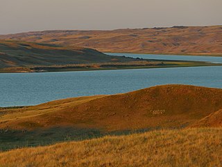
Tantallon is a village in the Canadian province of Saskatchewan within the Rural Municipality of Spy Hill No. 152 and Census Division No. 5. It is in the Qu'Appelle Valley along the Qu'Appelle River about 39 km east of Round Lake (Saskatchewan). The community celebrated its centennial in 2004.
Yarbo is a village in the Canadian province of Saskatchewan within the Rural Municipality of Langenburg No. 181 and Census Division No. 5. The village is located 24 km south of the Town of Churchbridge on Highway 80.
Leslie Beach is a resort village in the Canadian province of Saskatchewan within Census Division No. 10. It is on the shores of Fishing Lake in the Rural Municipality of Foam Lake No. 276.

The Rural Municipality of Spy Hill No. 152 is a rural municipality (RM) in the Canadian province of Saskatchewan within Census Division No. 5 and SARM Division No. 1. It is located in the east-central portion of the province.
The Rural Municipality of Riverside No. 168 is a rural municipality (RM) in the Canadian province of Saskatchewan within Census Division No. 8 and SARM Division No. 3.

