Arran is a special service area in the Canadian province of Saskatchewan within the Rural Municipality of Livingston No. 331 and Census Division No. 9. It held village status between 1916 and 2022.
Atwater is a village in the Canadian province of Saskatchewan within the Rural Municipality of Fertile Belt No. 183 and Census Division No. 5. The village is approximately 45 kilometres (28 mi) southeast of the city of Melville on Highway 629.

The Rural Municipality of The Gap No. 39 is a rural municipality (RM) in the Canadian province of Saskatchewan within Census Division No. 2 and SARM Division No. 2.

The Rural Municipality of Wellington No. 97 is a rural municipality (RM) in the Canadian province of Saskatchewan within Census Division No. 2 and SARM Division No. 1. It is located in the southeast portion of the province.

The Rural Municipality of Winslow No. 319 is a rural municipality (RM) in the Canadian province of Saskatchewan within Census Division No. 13 and SARM Division No. 6.

Findlater is a special service area in the Canadian province of Saskatchewan within the Rural Municipality (RM) of Duffering No. 190 and Census Division No. 6. It is 75 km northwest of Regina, Saskatchewan's capital, on Highway 11, and 15 km from the Town of Chamberlain. The original settlers had been looking for the neighbouring community of Chamberlain but, due to fatigue amongst the tribesmen, decided to rest at the site. They quickly settled and developed basic living amenities despite promises from the tribe leaders that they would soon move on and "find the new village". This continued for several months as the settlement evolved – tribesmen receiving the same responses to questions of the new community; "We'll find it later", or simply, "findlater". After a year the community was a well established populous and the name "Findlater" had been adopted fondly as homage to the promised community that had brought them there. It is believed (inaccurately) by some that the name comes from Findlater Castle in Banffshire, Scotland.
Hubbard is a village in the Canadian province of Saskatchewan within the Rural Municipality of Ituna Bon Accord No. 246 and Census Division No. 10.
Lancer is a special service area in the Canadian province of Saskatchewan within the Rural Municipality of Miry Creek No. 229 and Census Division No. 8. It held village status between 1913 and 2022.
Pennant is a village in the Canadian province of Saskatchewan within the Rural Municipality of Riverside No. 168 and Census Division No. 8.
Plunkett is a special service area in the Canadian province of Saskatchewan within the Rural Municipality of Viscount No. 341 and Census Division No. 11. It held village status between 1921 and 2022.

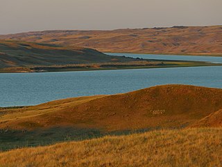
Sceptre is a special service area in the Canadian province of Saskatchewan within the Rural Municipality of Clinworth No. 230 and Census Division No. 8. It held village status between 1913 and 2022.
Primate is a special service area within the Rural Municipality of Eye Hill No. 382, Saskatchewan, Canada that held village status prior to 2016.
Spy Hill is a village in the Canadian province of Saskatchewan within the Rural Municipality of Spy Hill No. 152 and Census Division No. 5. It is at the intersection of Highway 8 and Highway 600. The community's school closed due to a lack of students, who are now bused approximately 27 km (17 mi) to Langenburg). The Northland Power - Spy Hill Power Plant is located in the community.
Stockholm is a village in the Canadian province of Saskatchewan within the Rural Municipality of Fertile Belt No. 183 and Census Division No. 5. It is 72 km (45 mi) south of the city of Yorkton along Highways 9 and 22. The municipal office for the Rural Municipality of Fertile Belt No. 183 is located in Stockholm.
Tribune is an unincorporated community in the Rural Municipality of Souris Valley No. 7, Saskatchewan, Canada that held village status prior to 2018. It is located approximately 25 kilometres (16 mi) from the Canada–US border along Saskatchewan Highway 35. In 2016, the population was 45.
The Rural Municipality of Sutton No. 103 is a rural municipality (RM) in the Canadian province of Saskatchewan within Census Division No. 3 and SARM Division No. 2.
The Rural Municipality of Riverside No. 168 is a rural municipality (RM) in the Canadian province of Saskatchewan within Census Division No. 8 and SARM Division No. 3.

The Rural Municipality of Clinworth No. 230 is a rural municipality (RM) in the Canadian province of Saskatchewan within Census Division No. 8 and SARM Division No. 3.

The Rural Municipality of Pleasantdale No. 398 is a rural municipality (RM) in the Canadian province of Saskatchewan within Census Division No. 14 and SARM Division No. 4.

The Rural Municipality of Reford No. 379 is a rural municipality (RM) in the Canadian province of Saskatchewan within Census Division No. 13 and SARM Division No. 6.


