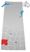
Estuary, Saskatchewan

Last updated

Estuary, Saskatchewan
Canada Saskatchewan location map.svg
Red pog.svg
Location of Estuary in Saskatchewan
Canada location map 2.svg
Red pog.svg
Estuary, Saskatchewan (Canada)
Coordinates: 50°55′59″N109°54′00″W / 50.933°N 109.900°W / 50.933; -109.900
Country Canada
Province Saskatchewan
Region Southwest Saskatchewan
Census division 15
Rural Municipality Deer Forks
EstablishedApril 19, 1914
Incorporated (village)between 1914-1917
Restructured (hamlet)1930
Government
   Reeve Doug Smith
  AdministratorTim C. Lozinsky
  Governing body Deer Forks No. 232
Population
 (2006)
  Total1
Postal code
N/A
Area code(s) 306
Highways Highway 635
Waterways South Saskatchewan River
[1] [2] [3] [4]

Estuary is a hamlet in RM of Deer Forks No. 232 in the Canadian province of Saskatchewan. Nothing or very little remains of the former village of 800, but a private residence and a pioneer cemetery on a small hill known as Cemetery Hill, overlooking the South Saskatchewan River.

Contents

History

The development of a townsite was registered on April 19, 1914 along the future site of the Canadian Pacific Railway branch line between Leader, Saskatchewan and Empress, Alberta. With the railway came a flood of settlers to the area, most of whom were Germans. By the time World War I began the growth of the new community of Estuary swelled from a few hardy pioneers to a booming 800 citizens.

From 1914 to 1954 Estuary had some 163 businesses, including its own power plant, a weekly newspaper, a theater, six blacksmith shops, 10 livery barns, six rooming houses, six hardware stores, 10 cafes/restaurants, 13 service stations, 23 grocery stores including a department store, and seven grain elevators.

The decline

Throughout Estuary's short history there have been many mysterious fires, two of which were devastating to the town. One in 1917 destroyed 18 properties and another in 1928. Several other minor fires which were just as mysterious were set. Because of Estuary's serious decline after the end of World War I it was believed that the fires were deliberately set in order to collect insurance.

In 1919 the town was hit hardest when the Canadian Pacific Railway decided to go ahead with plans to build a branch line from Leader to the new town of Burstall, causing a reduction of grain coming into town. Feeling betrayed by the railway company many residents picked up and left never to come back, taking everything with them including their homes and businesses.

The 1930s brought another blow to the once prosperous village, starting with the restructuring of the community's village status to a hamlet in 1930. By 1951 the fuel dealership shut its doors, soon after in 1966 the community's last store was closed. The railway station was bought and moved away in 1970. The last remaining businesses, the three remaining grain elevators, were closed and demolished in 1982.

See also

Related Research Articles

Coleville, Saskatchewan Village in Saskatchewan, Canada

Coleville is a village in the Canadian province of Saskatchewan within the Rural Municipality of Oakdale No. 320 and Census Division No. 13. The village's main economic factors are oil and farming, namesake of the Coleville oilfields. The village is named for Malcolm Cole who became the community's first postmaster in 1908.

Lafleche, Saskatchewan Town in Saskatchewan, Canada

Lafleche is a small town in southwest Saskatchewan, Canada in the rural municipality of Wood River.

St. Walburg, Saskatchewan Town in Saskatchewan, Canada

St. Walburg is a town in west-central Saskatchewan's prairie region on Saskatchewan Highway 26. St. Walburg is surrounded by the Rural Municipality of Frenchman Butte No. 501. The Bronson Provincial Forest is 10 kilometres (6.2 mi) to the north.

Robsart, Saskatchewan Unincorporated hamlet in Saskatchewan, Canada

Robsart is an unincorporated hamlet within the rural municipality of Reno No. 51, in the province of Saskatchewan, Canada. Robsart had a population of 20 at the 2016 Canada Census. Robsart previously incorporated an independent village since 1912 until it was dissolved into an unincorporated community on January 1, 2002 under the jurisdiction of the rural municipality of Reno No. 51. Robsart is located 48 km southwest of the town of Eastend at the junction of Highway 18 and Highway 13 approximately 170 km south-east of Medicine Hat, Alberta, 68 km south of the Town of Maple Creek.

Girvin, Saskatchewan Hamlet in Saskatchewan, Canada

Girvin is a former village of 20 people in Saskatchewan, Canada. It is located midway between Regina and Saskatoon on Highway 11 between the towns of Davidson and Craik. The village was formally dissolved in 2005; its remaining population is now counted as part of the rural municipality of Arm River.

Vidora Unincorporated community in Saskatchewan, Canada

Vidora is an unincorporated community within the Rural Municipality of Reno No. 51, Saskatchewan, Canada. The community once had a population of 200 people in 1940 and has since declined to 1 resident. It previously held the status of a village until it was dissolved as an unincorporated community on January 1, 1952. The community is located between Robsart and Consul on highway 21 & highway 13 known as the Red Coat Trail. Very little remains of the former village, only one home that is also used as a post office still stands as of 2008. There are many cement foundations and sidewalks still found scattered around the town site, including the remnants of the old bank vault to the former Municipality Office that was moved to Consul.

Orkney, Saskatchewan Unorganized hamlet in Saskatchewan, Canada

Orkney is an unincorporated community within the Rural Municipality of Val Marie No. 17, Saskatchewan, Canada. Founded in 1924 when the Canadian Pacific Railway constructed its branch line to Val Marie, it was incorporated as a village in June 1928. Orkney is 10 miles from the Canada-United States border. Listed as a designated place by Statistics Canada, the hamlet had a population of 4 in the Canada 2011 Census.

Neidpath, Saskatchewan Hamlet in Saskatchewan, Canada

Neidpath, is a hamlet in Coulee Rural Municipality No. 136, Saskatchewan, Canada. The hamlet is located on Highway 363 and Highway 720 about 25 km east of the city of Swift Current.

White Bear, Saskatchewan Unincorporated community in Saskatchewan, Canada

White Bear is an unincorporated community in the Rural Municipality of Lacadena No. 228, Saskatchewan, Canada. Listed as a designated place by Statistics Canada, the hamlet had a population of 15 in the Canada 2006 Census. The community is approximately 55 mi (89 km) northwest of Swift Current on the north side of the South Saskatchewan River.

Parkbeg Hamlet in Saskatchewan, Canada

Parkbeg is a hamlet in Wheatlands Rural Municipality No. 163, Saskatchewan, Canada. The hamlet is located at the junction of Highway 1 and Highway 627 approximately 58 km directly west of the City of Moose Jaw on the Trans Canada Highway.

Anerley, Saskatchewan Unincorporated community in Saskatchewan, Canada

Anerley is an unincorporated community in the western region of Saskatchewan located about 4 km north of Highway 44, about 20 km southwest of the Outlook and is about 125 km south west of Saskatoon.

Instow, Saskatchewan Unincorporated community in Saskatchewan, Canada

Instow is an unincorporated community within the Rural Municipality of Bone Creek No. 108, Saskatchewan, Canada. The community is located on Highway 13 also known as the historic Red Coat Trail, about 10 km northeast of the town of Shaunavon.

Kuroki, Saskatchewan Organized hamlet in Saskatchewan, Canada

Kuroki is a hamlet in the Rural Municipality of Sasman No. 336, Saskatchewan, Canada. Listed as a designated place by Statistics Canada, the hamlet had a population of 50 in the Canada 2016 Census. The community is named after the Japanese general Kuroki Tamemoto.

Shipman, Saskatchewan

Shipman is a hamlet in the Canadian province of Saskatchewan. Listed as a designated place by Statistics Canada, the hamlet had a population of 15 in the Canada 2006 Census, and is currently listed as having 10 residents.

Hoosier, Saskatchewan

Hoosier is an unincorporated hamlet in Antelope Park Rural Municipality No. 322, Saskatchewan, Canada. The hamlet is approximately 40 km north west of the Town of Kindersley at the intersection of Highway 317 and Highway 772. The Canadian Pacific Railway played a big role in the town's economy when it was completed in 1913, in the early years of Hoosier's history. Due to the closure of a branch line in 1981, the tracks from Dodsland to Hoosier were pulled and the last of the community's grain elevators was demolished, causing Hoosier's population to decline.

Hughton, Saskatchewan Ghost Town in Saskatchewan, Canada

Hughton is a hamlet in Monet No. 257, Saskatchewan, Canada. The hamlet is located at along Highway 44 approximately 158 km (98 mi) southwest of the City of Saskatoon.

Winter, Saskatchewan Unincorporated in Saskatchewan, Canada

Winter is an unincorporated locality in Senlac Rural Municipality No. 411, Saskatchewan, Canada. It is located on Highway 787 & 675, 50 km northwest of Unity, the nearest town. It is 15 km North of Rutland and 35 km South of Neilburg. Winter is located at Mile 77.3 on the Canadian National Railway. The community gets its name from Mr. O. Winter, who was a contractor for the Grand Trunk Pacific Railway. Mr. Winter named the siding after himself. This line was named alphabetically, from the east "Vera", after Winter's daughter, and to the west "Yonker", named after his mother's family. Winter had a store with post office, an elevator, a GTPR station, a lumber yard and a school that closed in 1968. Winter community well was said to have soft water.

Horizon, Saskatchewan Unincorporated Community in Saskatchewan, Canada

Horizon, located on the south side of Channel Lake, is a hamlet in Bengough Rural Municipality No. 40, Saskatchewan, Canada. It previously held the status of a village until December 31, 1973. The hamlet is located 60 km (37 mi) east of the Town of Assiniboia on highway 13.

Forward, Saskatchewan

Forward is a hamlet in Norton Rural Municipality No. 69, Saskatchewan, Canada. It previously held the status of a village until December 31, 1947.

Peterson, Saskatchewan Hamlet in Saskatchewan, Canada

Peterson is a hamlet located on Highway 5 in the rural municipality of Bayne No. 371, Saskatchewan. The village was founded when the railway was built in 1911–12.

References

  1. National Archives, Archivia Net, Post Offices and Postmasters
  2. Government of Saskatchewan, MRD Home, Municipal Directory System, archived from the original on November 21, 2008
  3. Canadian Textiles Institute. (2005), CTI Determine your provincial constituency, archived from the original on September 11, 2007
  4. Commissioner of Canada Elections, Chief Electoral Officer of Canada (2005), Elections Canada On-line, archived from the original on April 21, 2007
  5. "Table 6: Population by census divisions of Saskatchewan classified by municipalities for census years, 1921 and 1926". Census of Prairie Provinces, 1926. Ottawa: Department of Trade and Commerce. 1929.

Coordinates: 50°55′59″N109°54′00″W / 50.933°N 109.900°W / 50.933; -109.900