
Springfeld
Location of Springfeld in Saskatchewan
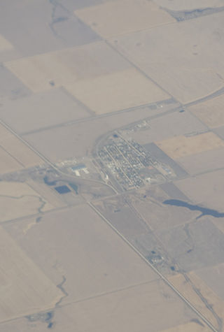
Springfeld is an unincorporated community in Saskatchewan. According to a 2016 Census, Springfeld, also referred to as Springfield, is home to 878 residents. [1]
Springfeld is an unincorporated community in Saskatchewan. According to a 2016 Census, Springfeld, also referred to as Springfield, is home to 878 residents. [1]

Aneroid is a special service area in the Rural Municipality of Auvergne No. 76 in southwestern Saskatchewan, Canada. The community is located approximately 70 km southeast of Swift Current at the intersection of Highway 13 and Highway 612.

Division No. 8 is one of eighteen census divisions in the province of Saskatchewan, Canada, as defined by Statistics Canada. It is located in the west-southwestern part of the province, bordering Alberta. The most populous community in this division is Swift Current.
Waldeck is a village in the Canadian province of Saskatchewan within the Rural Municipality of Excelsior No. 166 and Census Division No. 7. Waldeck is 18 kilometres (11 mi) northeast of the city of Swift Current on the Trans-Canada Highway. Waldeck is situated in the Swift Current River Valley.
Morse is a former provincial electoral division for the Legislative Assembly of the province of Saskatchewan, Canada, centred on the town of Morse, Saskatchewan. The district was created before the 3rd Saskatchewan general election in 1912, and abolished before the 23rd Saskatchewan general election in 1995. It was the riding of Premier Ross Thatcher.
Beechy is a village in the Canadian province of Saskatchewan within the Rural Municipality of Victory No. 226 and Census Division No. 7. The village is located in the Coteau Hills region of the province, at the intersection of Highway 342 and Highway 737. As of 2006, the village's population is 243.

Stewart Valley is a village in the Canadian province of Saskatchewan within the Rural Municipality of Saskatchewan Landing No. 167 and Census Division No. 8. It is on Highway 4, just south of the South Saskatchewan River, approximately 35 km (22 mi) north of the City of Swift Current in southern Saskatchewan. It is along the remains of the historic Swift Current-Battleford Trail.

Herbert is a town located in the Rural Municipality of Morse No. 165, in southwest Saskatchewan, Canada. The community is 48 km east of the city of Swift Current, and 197 km west of Regina, the provincial capital, on the Trans-Canada Highway. Its population as of 2016 was 856.

Morse is a town in southern Saskatchewan, Canada. It is situated on the Trans Canada Highway near the north shore of Reed Lake. The town is named after the western Superintendent of the Canadian Pacific Railroad at the time.
Dilke is a village in the Canadian province of Saskatchewan within the Rural Municipality of Sarnia No. 221 and Census Division No. 6.

Holdfast is a village in the Canadian province of Saskatchewan within the Rural Municipality of Sarnia No. 221 and Census Division No. 6. The village is located 2 km east of Highway 2 on Highway 732, about 97.6 km northwest of the City of Regina.
Hazenmore is a village in the Canadian province of Saskatchewan within the Rural Municipality of Pinto Creek No. 75 and Census Division No. 3.

Kinley is a village in the Canadian province of Saskatchewan within the Rural Municipality of Perdue No. 346 and Census Division No. 12. The village of Kinley is located about 55 km west of the City of Saskatoon on Highway 14, between the communities of Perdue 10 km west and Asquith 17 km east.
Lucky Lake is a village in the Canadian province of Saskatchewan within the Rural Municipality of Canaan No. 225 and Census Division No. 7. The Village is located at the junction of Highway 42, Highway 45 and Highway 646 approximately 90 km northeast of Swift Current, Saskatchewan.

Zealandia is a town in the Canadian province of Saskatchewan. It is one of the smallest communities in the province to be designated as a town.

The Rural Municipality of Victory No. 226 is a rural municipality (RM) in the Canadian province of Saskatchewan within Census Division No. 7 and SARM Division No. 3.
Nut Mountain is an unincorporated community in the Rural Municipality of Sasman No. 336, Saskatchewan, Canada. Listed as a designated place by Statistics Canada, the community had a population of 10 in the Canada 2016 Census.
Biggar is a former provincial electoral division for the Legislative Assembly of the province of Saskatchewan, Canada, centred on the town of Biggar. This district was created before the 3rd Saskatchewan general election in 1912. The riding was dissolved and combined with the Rosetown district to form Rosetown-Biggar before the 23rd Saskatchewan general election in 1995. It was the constituency of Premier Woodrow S. Lloyd.
Main Centre is a hamlet in the Canadian province of Saskatchewan. Listed as a designated place by Statistics Canada, the hamlet had a reported population of 5 living in 3 of its 4 total private dwellings in the Canada 2011 Census.

Wymark is a hamlet in Swift Current Rural Municipality No. 137, Saskatchewan, Canada. Listed as a designated place by Statistics Canada, the hamlet had a population of 144 in the Canada 2006 Census. The hamlet is located on Highway 628 about 2 km north of Highway 363, and 15 km south of Swift Current. When the existing railway was extended to branch off in another direction, a town formed at this junction. This "Y" formation of the railway, resulted in the town being named Wymark.

Speers is a village in the Canadian province of Saskatchewan within the Rural Municipality of Douglas No. 436 and Census Division No. 16. The village is located approximately 50 kilometres (31 mi)} southeast of the City of North Battleford on Highway 40.
50°04′59″N107°27′00″W / 50.083°N 107.450°W
| | This Saskatchewan location article is a stub. You can help Wikipedia by expanding it. |
