Wymark, Saskatchewan

Last updated

Wymark
Organized Hamlet
Aerial - Wymark, Saskatchewan 01 - white balanced (10530204624).jpg
Aerial view of Wymark (2013) from south by southeast
CAN SK Swift Current map 2021.png
Red pog.svg
Wymark
Canada Saskatchewan location map.svg
Red pog.svg
Wymark
Coordinates: 50°06′35″N107°44′13″W / 50.1097°N 107.7369°W / 50.1097; -107.7369
Country Canada
Province Saskatchewan
Region Southwest
Rural Municipality Swift Current
Post Office EstablishedJanuary 1, 1913
Government
   Reeve Jerry Knipfel
  AdministratorDave Dmytruk
  Governing body Swift Current No. 137
Area
  Total
0.30 km2 (0.12 sq mi)
Population
 (2011) [1]
  Total
130
  Density434.1/km2 (1,124/sq mi)
Time zone CST
Postal code
S0N 2Y0
Area code 306
Highways Highway 379
[2] [3] [4]

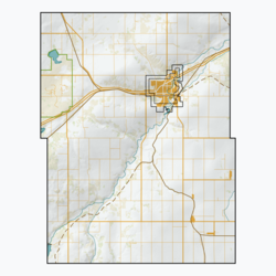
Wymark is a hamlet in the Rural Municipality of Swift Current No. 137, Saskatchewan, Canada. Listed as a designated place by Statistics Canada, the hamlet had a population of 144 in the Canada 2006 Census, [5] overall down from 200 according to the 1931 census. [6] The hamlet is located on Highway 379 about 2 km east of Highway 4, and 15 km south of Swift Current.

Contents

Etymology

Wymark was named after William Wymark Jacobs, an English writer best known for his 1902 story The Monkey's Paw . [7]

Demographics

In the 2021 Census of Population conducted by Statistics Canada, Wymark had a population of 148 living in 54 of its 57 total private dwellings, a change of

See also

References

  1. "2011 Community Profiles". Statistics Canada. Government of Canada. Archived from the original on December 26, 2018. Retrieved August 21, 2014.
  2. National Archives, Archivia Net. "Post Offices and Postmasters". Archived from the original on October 6, 2006. Retrieved August 21, 2014.
  3. Canadian Textiles Institute. (2005), CTI Determine your provincial constituency, archived from the original on September 11, 2007, retrieved December 9, 2009
  4. Commissioner of Canada Elections, Chief Electoral Officer of Canada (2005), Elections Canada On-line | Home, archived from the original on April 21, 2007, retrieved December 9, 2009
  5. Canada 2006 Census: Designated places in Saskatchewan
  6. "Census of Saskatchewan 1936" (PDF). Government of Canada. p. 112. Retrieved February 3, 2025.
  7. Barry, Bill (September 2005). Geographic Names of Saskatchewan . Regina, Saskatchewan: People Places Publishing, Ltd. p. 466. ISBN   1-897010-19-2.
  8. "Population and dwelling counts: Canada and designated places". Statistics Canada. February 9, 2022. Retrieved August 31, 2022.

50°06′35″N107°44′13″W / 50.10972°N 107.73694°W / 50.10972; -107.73694