Town of Imperial | |
|---|---|
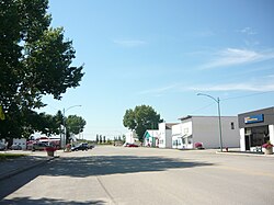 Royal Street | |
 Town of Imperial Location of Imperial  Town of Imperial Town of Imperial (Canada) | |
| Coordinates: 51°20′38″N105°26′35″W / 51.344°N 105.443°W | |
| Country | Canada |
| Province | Saskatchewan |
| Census division | 11 |
| Rural Municipality | Big Arm |
| Post office Founded | March 1, 1907 |
| Incorporated (Village) | July 4, 1911 |
| Incorporated (Town) | April 1, 1962 |
| Government | |
| • Mayor | Ted Abrey |
| • Town Administrator | Joslin Freeman |
| • Governing body | Imperial Town Council |
| Area | |
• Total | 1.20 km2 (0.46 sq mi) |
| Population (2021) | |
• Total | 372 |
| • Density | 308.7/km2 (800/sq mi) |
| Time zone | CST |
| Postal code | S0G 2J0 |
| Area code | 306 |
| Highways | Highway 2 |
| Waterways | Last Mountain Lake |
| Website | Town of Imperial |
| [1] [2] [3] [4] | |
Imperial is a town in the Canadian province of Saskatchewan. The town is located along Highway 2.