Griswold, Manitoba

Last updated
Griswold
Canada Manitoba location map 2.svg
Red pog.svg
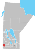
Griswold
Location of Griswold in Manitoba
Coordinates: 49°46′30″N100°28′15″W / 49.77500°N 100.47083°W / 49.77500; -100.47083 Coordinates: 49°46′30″N100°28′15″W / 49.77500°N 100.47083°W / 49.77500; -100.47083
Country Flag of Canada (Pantone).svg  Canada
Province Flag of Manitoba.svg  Manitoba
Region Westman
Census Division No. 6
Government
  Governing BodyRural Municipality of Sifton Council
   MP Larry Maguire
   MLA Vacant
Time zone UTC−6 (CST)
  Summer (DST) UTC−5 (CDT)
Postal Code
R0M 0S0
Area code(s) 204, 431
NTS Map062F16
GNBC CodeGAJXS

Griswold is an unincorporated place located within the Rural Municipality of Sifton in south-western Manitoba, Canada. It is located approximately 38 kilometers (24 miles) southwest of Brandon, Manitoba. [1]

Related Research Articles

Manitoba Province of Canada

Manitoba is a province of Canada at the longitudinal centre of the country. It is Canada's fifth-most populous province, with a population of 1,342,153 as of 2021, of widely varied landscape, from arctic tundra and the Hudson Bay coastline in the north to dense boreal forest, large freshwater lakes, and prairie grassland in the central and southern regions.

University of Manitoba University in Winnipeg, Manitoba, Canada

The University of Manitoba is a Canadian public research university in the province of Manitoba. Founded in 1877, it is the first university of western Canada.

Winnipeg Capital city of Manitoba, Canada

Winnipeg is the capital and largest city of the province of Manitoba in Canada. It is centred on the confluence of the Red and Assiniboine rivers, near the longitudinal centre of North America. As of 2021, Winnipeg had a city population of 749,607 and a metropolitan population of 834,678, making it the sixth-largest city, and eighth-largest metropolitan area in Canada.

Brandon, Manitoba City in Manitoba, Canada

Brandon is the second-largest city in the province of Manitoba, Canada. It is located in the southwestern corner of the province on the banks of the Assiniboine River, approximately 214 km (133 mi) west of the provincial capital, Winnipeg, and 120 km (75 mi) east of the Saskatchewan border. Brandon covers an area of 77.41 km2 (29.89 sq mi) with a population of 51,313, and a census metropolitan area population of 54,268. It is the primary hub of trade and commerce for the Westman Region as well as parts of southeastern Saskatchewan and northern North Dakota, an area with a combined population of over 180,000 people.

Flin Flon City in Manitoba and Saskatchewan, Canada

Flin Flon is a mining city, located on a correction line on the border of the Canadian provinces of Manitoba and Saskatchewan, with the majority of the city located within Manitoba. Residents thus travel southwest into Saskatchewan, and northeast into Manitoba. The city is incorporated in and is jointly administered by both provinces.

Roblin is an unincorporated urban community in the Municipality of Roblin, Manitoba, Canada. It is located approximately 400 km (250 mi) northwest of Winnipeg.

Selkirk, Manitoba City in Manitoba, Canada

Selkirk is a city in the western Canadian province of Manitoba, located on the Red River about 22 kilometres (14 mi) northeast of the provincial capital Winnipeg. It has a population of 10,278 as of the 2016 census.

Emerson is an unincorporated community recognized as a local urban district in south central Manitoba, Canada, located within the Municipality of Emerson – Franklin. It has a population of 678 as of the 2016 Canada census.

McCreary is an unincorporated urban community in the Municipality of McCreary, Manitoba, Canada.

Pilot Mound, Manitoba Place in Manitoba, Canada

Pilot Mound is an unincorporated community recognized as a local urban district that also once held town status in the Canadian province of Manitoba. It is located within the Municipality of Louise, approximately 60 km west of the City of Morden.

Carberry, Manitoba Town in Manitoba, Canada

Carberry is a town in southwestern Manitoba, Canada. It is situated 3 kilometres south of the Trans-Canada Highway on Highway 5 in the Municipality of North Cypress – Langford, and has a population of 1,738 people.

Ethelbert is an unincorporated urban community in the Municipality of Ethelbert, Manitoba, Canada.

Rural Municipality of Piney Rural municipality in Manitoba, Canada

The Rural Municipality of Piney is a rural municipality in southeastern Manitoba, Canada, along the border with Minnesota in the United States.

Rural Municipality of Armstrong Rural municipality in Manitoba, Canada

Armstrong is a rural municipality in the province of Manitoba in Western Canada. It lies in the southern area of the Interlake and was named after James William Armstrong, a Manitoba politician.

Pembina Valley Provincial Park

Pembina Valley Provincial Park is a provincial park in southern Manitoba, Canada. It is located 47 kilometres south-west of Morden, Manitoba, Canada on Highway 3, Highway 31, and Highway 201, and covers approximately 1.8 square kilometres. The park is considered to be a Class III protected area under the IUCN protected area management categories.

Roland is a rural municipality located in the Pembina Valley Region of Manitoba, Canada. According to the Canada 2016 Census, it has a population of 1,129.

Killarney-Turtle Mountain is a rural municipality (RM) located in the Westman Region of Manitoba, Canada. It is located to the immediate north of the Canada–United States border opposite Rollete and Towner Counties, North Dakota.

Minto, Manitoba

Minto is an unincorporated community recognized as a local urban district located in the Municipality of Grassland, Manitoba, Canada.

References

  1. "Geographical Names of Canada - Querying Distances". nrcan.gc.ca. 2011-10-24. Archived from the original on 2014-04-16. Retrieved 2013-02-23.