Cromer, Manitoba

Last updated

Cromer
Cromer Mb.jpg
Cromer, Manitoba
Canada Manitoba location map 2.svg
Red pog.svg
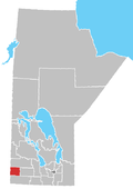
Cromer
Location of Cromer in Manitoba
Coordinates: 49°43′53″N101°14′6″W / 49.73139°N 101.23500°W / 49.73139; -101.23500
Country Flag of Canada (Pantone).svg  Canada
Province Flag of Manitoba.svg  Manitoba
Region Westman Region
Census Division No. 6
Government
  Governing BodyRural Municipality of Pipestone Council
   MP Larry Maguire
   MLA Doyle Piwniuk
Time zone UTC−6 (CST)
  Summer (DST) UTC−5 (CDT)
Postal Code
R0M 0J0
Area code 204
NTS Map062F11
GNBC CodeGAFUR

Cromer, Manitoba is a village located in the Rural Municipality of Pipestone, in south-western Manitoba, Canada in a region called Westman.

Contents

In 1884 the Post Office was opened at LSD 26-8-28W and was known as Elm Valley. [1] The name was changed to Cromer when the Canadian Northern Railway came through in 1907.

The community is situated alongside Pipestone Creek in the Pipestone Valley. The valley was formed almost 20,000 years ago during the melting of the last glaciation. The melting waters formed the Pipestone Spillway, which is the valley seen today. The village sits at the intersections of roads 256 and 255 and consists of several businesses, residences, and churches. There is also an ice rink and a 9-hole golf course. [2]

Enbridge Line 2B starts just north of the village at the Tundra Oil & Gas plant.

Going south into Cromer on highway 256 by the grain elevator Cromer Manitoba.jpg
Going south into Cromer on highway 256 by the grain elevator
Cromer United Church
The Cromer United church, Manitoba Municipal Heritage Site No. 89 Cromer United Church.jpg
The Cromer United church, Manitoba Municipal Heritage Site No. 89

The Cromer United Church, built in 1911, is designated "Manitoba Municipal Heritage Site No. 89" [3] and part of the Canadian Register of Historic Places. [4] It was originally called Cromer Methodist Church and was built for the Methodist congregation and its architecture is a modest Gothic Revival-style wooden church. As a heritage site, it was recognised on 10 December 1992 and was listed in the Canadian Register on 17 February 2006.

Notable residents

See also

Related Research Articles

<span class="mw-page-title-main">Deloraine, Manitoba</span> Place in Manitoba, Canada

Deloraine is an unincorporated urban community in the Municipality of Deloraine – Winchester within the Canadian province of Manitoba that held town status prior to January 1, 2015. It is situated near the Turtle Mountains in the southwestern corner of the province. Located in the Westman Region, the community is 100 km (62 mi) south of Brandon. Deloraine originally incorporated as a village in 1904 and then as a town in 1907. Its town status was relinquished in 2015 when it amalgamated with the Rural Municipality of Winchester.

<span class="mw-page-title-main">Westman Region</span> Region in Manitoba, Canada

The Westman Region is an informal geographic region of the Canadian province of Manitoba located in the southwestern corner of the province.

<span class="mw-page-title-main">Canora, Saskatchewan</span> Town in Saskatchewan, Canada

Canora is a town, located at the junction of highways No. 5 and 9 in east central Saskatchewan, about 50 km north of Yorkton. It is centrally located on the corners of four adjacent rural municipalities, including the RM of Good Lake. The community is home to approximately 3,500 residents and is part of the Canora-Pelly electoral district. The community was founded along the Canadian Northern Railway tracks - one of the companies that evolved into the Canadian National Railway (CN), and two CN freight lines still run through Canora. The Canora railway station, downtown on the CN east-west line before the switch to the northbound line, is served by Via Rail on its passenger service from Winnipeg to Churchill, Manitoba. As of 2016, 53% of the town’s residents are either from Ukraine or of Ukrainian descent, with the language still widely spoken in the community.

Ashern is a local urban district located in the Municipality of West Interlake in Manitoba's Interlake Region.

<span class="mw-page-title-main">Rural Municipality of St. Andrews</span> Rural municipality in Manitoba, Canada

St. Andrews is a rural municipality (RM) in Manitoba, Canada. It lies west of the Red River; its southern border is approximately 8 kilometres (5.0 mi) north of Winnipeg.

<span class="mw-page-title-main">Benito, Manitoba</span> Unincorporated urban community in Manitoba, Canada

Benito is an unincorporated urban community in the Municipality of Swan Valley West, Manitoba, Canada.

<span class="mw-page-title-main">Waskada</span> Former village in Manitoba, Canada

Waskada is an unincorporated urban community in the Municipality of Brenda – Waskada within the Canadian province of Manitoba that held village status prior to January 1, 2015. It is located in the southwest corner of the province, close to the United States and Saskatchewan borders. It was settled as early as 1883 and incorporated as a village in 1948. Waskada has a population of 183, and covers a land area of 0.77 km2. Though traditionally a farming community, a recent oil boom has also brought economic activity to the area.

<span class="mw-page-title-main">St. Brieux</span> Town in Saskatchewan, Canada

St. Brieux is a town in the Canadian province of Saskatchewan. It is located near Highway 368 and Highway 779. St. Brieux is located north of the village of Lake Lenore on the eastern shore of St. Brieux Lake. St. Brieux Regional Park and Golf Course is adjacent to the west side of the town.

<span class="mw-page-title-main">Harris, Saskatchewan</span> Village in Saskatchewan, Canada

Harris is a village in the Canadian province of Saskatchewan within the Rural Municipality of Harris No. 316 and Census Division No. 12. It was the site of the Great Ruby Hoax in 1914. Harris was named for Richard Elford Harris, an early settler to the area.

<span class="mw-page-title-main">Katepwa</span> Resort village in Saskatchewan, Canada

Katepwa is a resort village in the Canadian province of Saskatchewan within Census Division No. 6. It is on the eastern and southern shores of Katepwa Lake in the Rural Municipality of Abernethy No. 186. The name Katepwa likely comes from the Cree word Kahtapwao meaning "What is calling?" The name was given to the last in the chain of four lakes, Katepwa Lake. Legend has it that spirits inhabited the shores of the lake and First Nation people would hear voices on the lake.

<span class="mw-page-title-main">Rural Municipality of Mountain View No. 318</span> Rural Municipality in Saskatchewan, Canada

The Rural Municipality of Mountain View No. 318 is a rural municipality (RM) in the Canadian province of Saskatchewan within Census Division No. 12 and SARM Division No. 6.

Alexander, Manitoba, is a local urban district in the Rural Municipality of Whitehead, situated on Highway 1, west of Brandon.

<span class="mw-page-title-main">Ewart, Manitoba</span> Place in Manitoba, Canada

Ewart is a locality in southwestern Manitoba, Canada. All that remains of the settlement is a cairn, an abandoned house, and the former schoolhouse. Little is known about the schoolhouse but it did exist as early as 1914.

<span class="mw-page-title-main">Cartwright – Roblin Municipality</span> Rural municipality in Manitoba, Canada

Cartwright–Roblin Municipality is a rural municipality in the Canadian province of Manitoba.

<span class="mw-page-title-main">Municipality of Two Borders</span> Rural municipality in Manitoba, Canada

The Municipality of Two Borders is a rural municipality (RM) in the Canadian province of Manitoba. It is located in the extreme south-west corner of the province in the Westman Region.

Moose Mountain Upland, Moose Mountain Uplands, or commonly Moose Mountain, is a hilly plateau located in the south-east corner of the Canadian province of Saskatchewan, that covers an area of about 13,000 km2 (5,000 sq mi). The upland rises about 200 m (660 ft) above the broad, flat prairie which is about 600 m (2,000 ft) above sea level. The highest peak is "Moose Mountain" at 830 m (2,720 ft) above sea level. The area was named Moose Mountain because of the large number of moose that lived in the area. When it was originally used by fur traders, Métis, and the Indigenous peoples, the plateau was called Montagne a la Bosse, which is French for "The Mountain of The Bump or Knob."

<span class="mw-page-title-main">Pipestone Creek (Saskatchewan)</span> River in central North America

Pipestone Creek is a river in the Souris River watershed. Its flow begins in southeastern Saskatchewan, just south of the town of Grenfell and travels in a southeastern direction into Manitoba in the Westman Region where it empties into Oak Lake through the Oak Lake Marsh.

<span class="mw-page-title-main">Oak Lake (Manitoba)</span> Lake in Manitoba, Canada

Oak Lake is a lake in the south-western part of the Canadian province of Manitoba in a region called Westman. Oak Lake is a kettle lake and is an aquifer supplier for numerous nearby residential areas and farms. The lake is in the RM of Sifton and sits at an elevation of 426 metres above sea level. Provincial Road 254 provides access to the lake.

References

  1. 1981 Trails Along the Pipestone - a history book of the Municipality of Pipestone.
  2. "Cromer Golf Course in Cromer, Manitoba, Canada".
  3. "HistoricPlaces.ca - HistoricPlaces.ca".
  4. "Manitoba Municipal Heritage Site No. 89 - Cromer United Church | Municipal Heritage Sites | Historic Resources Branch".
  5. Beth Bilson, Profile of Mary Carter Archived 2017-07-10 at the Wayback Machine . Encyclopedia of Saskatchewan. Retrieved 2016-11-29.