Hargrave, Manitoba

Last updated

Hargrave
Canada Manitoba location map 2.svg
Red pog.svg
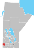
Hargrave
Location of Hargrave in Manitoba
Coordinates: 49°55′2″N101°4′19″W / 49.91722°N 101.07194°W / 49.91722; -101.07194
Country Flag of Canada (Pantone).svg  Canada
Province Flag of Manitoba.svg  Manitoba
Region Westman Region
Census Division No. 6
Government
  Governing BodyRural Municipality of Wallace Council
   MP Greg Nesbitt
   MLA Vacant
Time zone UTC−6 (CST)
  Summer (DST) UTC−5 (CDT)
Postal Code
R0M 0W0
Area code 204
NTS Map062F14
GNBC CodeGAKIO

Hargrave is an unincorporated settlement in southwestern Manitoba, Canada. It is situated on the Trans-Canada Highway approximately 12 kilometers (8 miles) northwest of Virden, Manitoba [1] in the Rural Municipality of Wallace.

Related Research Articles

<span class="mw-page-title-main">Flin Flon</span> City in Manitoba and Saskatchewan, Canada

Flin Flon is a mining city, located on a correction line on the border of the Canadian provinces of Manitoba and Saskatchewan, with the majority of the city located within Manitoba. Residents thus travel southwest into Saskatchewan, and northeast into Manitoba. The city is incorporated in and is jointly administered by both provinces.

The Rural Municipality of Albert is a former rural municipality (RM) in the Canadian province of Manitoba. It was originally incorporated as a rural municipality on December 1, 1905. It ceased on January 1, 2015 as a result of its provincially mandated amalgamation with the RM of Arthur and the RM of Edward to form the Municipality of Two Borders.

<span class="mw-page-title-main">Demographics of Manitoba</span>

Manitoba is one of Canada's 10 provinces. It is the easternmost of the three Prairie provinces.

The Rural Municipality of South Norfolk is a former rural municipality (RM) in the Canadian province of Manitoba. It was originally incorporated as a rural municipality on December 22, 1883. It ceased on January 1, 2015, as a result of its provincially mandated amalgamation with the Town of Treherne to form the Municipality of Norfolk Treherne.

Tilston is a small community in the Municipality of Two Borders, Manitoba, Canada. The community is located at the junction of Road 256 and Road 345, approximately 144 km south-west of Brandon, Manitoba only 58 kilometers south-west of the Town of Hartney.

<span class="mw-page-title-main">Rural Municipality of Brokenhead</span> Rural municipality in Manitoba, Canada

The Rural Municipality of Brokenhead is a rural municipality (RM) in the Canadian province of Manitoba.

Napinka is an unincorporated community in southwestern Manitoba, Canada. The village of Napinka was incorporated on May 1, 1908. On January 1, 1986 the village dissolved and Napinka became part of the Rural Municipality of Brenda.

Woodnorth is an unincorporated community in southwestern Manitoba, Canada. It is located approximately 17 kilometers southwest of Virden, Manitoba in the Rural Municipality of Pipestone.

Scarth is an unincorporated community in southwestern Manitoba, Canada. It is located approximately 13 kilometers south of Virden, Manitoba in the Rural Municipality of Pipestone.

Ebor is an unincorporated community in southwestern Manitoba, Canada. It is approximately 31 kilometers southwest of Virden, Manitoba in the Rural Municipality of Pipestone.

Two Creeks is an unincorporated community in southwestern Manitoba, Canada. It is located approximately 21 kilometers northwest of Virden, Manitoba in the Rural Municipality of Wallace.

Decker is an unincorporated community in southwestern Manitoba, Canada. It is located approximately 17 kilometers northwest of Hamiota, Manitoba in the Hamiota Municipality.

Grande-Clairière is a locality in southwestern Manitoba, Canada. It is located approximately 13 kilometres northwest of Hartney, Manitoba in the Municipality of Grassland, formerly the Rural Municipality of Cameron. It was founded by French and Belgian settlers in 1890.

<span class="mw-page-title-main">Ewart, Manitoba</span> Place in Manitoba, Canada

Ewart is a locality in southwestern Manitoba, Canada. All that remains of the settlement is a cairn, an abandoned house, and the former schoolhouse. Little is known about the schoolhouse but it did exist as early as 1914.

Kola is an unincorporated community in southwestern Manitoba, Canada. It is located approximately 31 kilometres (19 mi) west of Virden and approximately 3 kilometres (1.9 mi) east of the Saskatchewan boundary in the Rural Municipality of Wallace.

<span class="mw-page-title-main">Sperling, Manitoba</span> Place in Manitoba, Canada

Sperling is an unincorporated community in south central Manitoba, Canada. It is located on Provincial Trunk Highway 3 approximately 56 kilometers southwest of Winnipeg, Manitoba in the Rural Municipality of Morris.

<span class="mw-page-title-main">Riverdale Municipality</span> Rural municipality in Manitoba, Canada

Riverdale Municipality is a rural municipality (RM) in the Canadian province of Manitoba.

<span class="mw-page-title-main">2015 Manitoba municipal amalgamations</span>

The 2015 municipal amalgamations in Manitoba was the result of new legislation in the province that required a minimum population threshold of 1,000 people in order to incorporate a municipality.

References