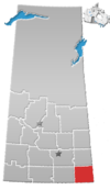
The Rural municipality of Maple Bush No.224 is located in southwestern Saskatchewan, Canada it surrounds the outskirts of Elbow.

Blucher No. 343 is a rural municipality in north-central Saskatchewan on the South Saskatchewan River. It is located in Division No. 11. In 1958, the Patience Lake mine was the first potash mine built in Canada.

MacDowall, Saskatchewan is an organized hamlet in Duck Lake No. 463 Saskatchewan, Canada. The hamlet is located approximately 30 km southwest of Prince Albert, Saskatchewan and is situated on the northern edge of the Nisbet Provincial Forest, adjacent to the Louis Riel Trail also known as Highway 11. It is a short distance northwest of the village of St. Louis, and just west of Red Deer Hill. MacDowall is located in the aspen parkland biome.
Birsay, Saskatchewan is an unincorporated community in southern Saskatchewan, Canada. It is located in the Rural Municipality of Coteau No. 255.

Meyronne is a special service area in the Canadian province of Saskatchewan.

Parkbeg is a hamlet in Wheatlands Rural Municipality No. 163, Saskatchewan, Canada. The hamlet is located at the junction of Highway 1 and Highway 627 approximately 58 km directly west of the City of Moose Jaw on the Trans Canada Highway.

St. Boswells is a hamlet in Glen Bain Rural Municipality No. 105, Saskatchewan, Canada. The hamlet is about 8 km east of Highway 19, about 25 km northwest of the town of Gravelbourg. Very little remains of the former village except a well known as the best water around, and sidewalks which mark the once prosperous business section of St. Boswells.

Beaver Creek is a hamlet in the Rural Municipality of Dundurn No. 314, Saskatchewan, Canada. Listed as a designated place by Statistics Canada, the hamlet had a population of 107 in the Canada 2016 Census.
Hitchcock Bay is a hamlet in the Canadian province of Saskatchewan. Listed as a designated place by Statistics Canada, the hamlet had a population of 15 in the Canada 2006 Census.
McCord is a hamlet in the Canadian province of Saskatchewan. McCord had a population of 40 in the Canada 2006 Census.
Scout Lake is a hamlet in the Canadian province of Saskatchewan. Listed as a designated place by Statistics Canada, the hamlet had a population of 20 in the Canada 2006 Census.
Vantage is a hamlet in Sutton Rural Municipality No. 103, Saskatchewan, Canada. Listed as a designated place by Statistics Canada, the hamlet had a reported population of zero in the Canada 2006 Census.
Grant No. 372 is a rural municipality in north-central Saskatchewan, Canada encompassing 802.93 square kilometers in area. The rural municipality maintains its office in Vonda, Saskatchewan. The rural municipality in conjunction with the provincial government is in charge of maintenance of highways in its area. As well, the municipality provides policing, fire protection and municipal governance for the rural district, with a reeve as its administrator.
Clayton No. 333 is a rural municipality in the Canadian province of Saskatchewan, located in the Census Division 9. The seat of the municipality is located in the Hamlet of Hyas.
Laird No. 404 is a rural municipality in the Canadian province of Saskatchewan, located in the Census Division 15. The seat of the municipality is located in the Town of Waldheim.
Mawer is a locality in the Rural Municipality of Eyebrow No. 193, Saskatchewan, Canada. It previously held the status of village until December 31, 1967. The community is located about 5 km (3.1 mi) south of Highway 42 on Range Road 35, approximately 10 km (6.2 mi) southeast of Central Butte. It is located on the former Grand Trunk Pacific rail line.
Mazenod is a hamlet in Sutton Rural Municipality No. 103, Saskatchewan, Canada. In 2006 the village had a population of 17 people. It previously held the status of village until January 1, 2002. The hamlet is located 93 km southwest of the City of Moose Jaw on highway 43.
Ferland is a fransaskois hamlet in Mankota Rural Municipality No. 45, Saskatchewan, Canada. It previously held the status of village until November 4, 1988. The hamlet is located 10 km east of the Village of Mankota on highway 18.
Calderbank is a hamlet in the Canadian province of Saskatchewan located in Morse No. 165.

Lacadena is an unincorporated community in Lacadena Rural Municipality No. 228, Saskatchewan, Canada. The hamlet is located approximately 106 miles (171 km) northwest of Swift Current 29 miles (47 km) west of highway 4 on highway 342.


