
Camrose is a city in central Alberta, Canada that is surrounded by Camrose County. Located along Highway 13 it had its beginnings as a railroad hub.

Sylvan Lake is a town in central Alberta, Canada. It is located approximately 25 kilometres (16 mi) west of the City of Red Deer along Highway 11 or Highway 11A. It is on the southeast edge of Sylvan Lake, a 15-kilometre-long (9.3 mi) freshwater lake that straddles the boundary between Red Deer County and Lacombe County.

Okotoks is a town in the Calgary Region of Alberta, Canada. It is on the Sheep River, approximately 38 km (24 mi) south of Downtown Calgary. Okotoks has emerged as a bedroom community of Calgary. According to the 2021 Federal Census, the town has a population of 30,214, making it the largest town in Alberta.

Cochrane is a town in the Calgary Metropolitan Region of Alberta, Canada. The town is located 18 km (11 mi) west of the Calgary city limits along Highway 1A. Cochrane is one of the fastest-growing communities in Canada, and with a population of 32,199 in 2021, it is one of the largest towns in Alberta. It is part of Calgary's census metropolitan area and a member community of the Calgary Metropolitan Region Board (CMRB). The town is surrounded by Rocky View County.

Fairview is a town in Peace Country, Alberta, Canada. It is located 82 km (51 mi) southwest of Peace River and 115 km (71 mi) north of Grande Prairie at the intersection of Highway 2 and Highway 64A.

The Municipality of Crowsnest Pass is a specialized municipality in southwest Alberta, Canada. Within the Rocky Mountains adjacent to the eponymous Crowsnest Pass, the municipality formed as a result of the 1979 amalgamation of five municipalities – the Village of Bellevue, the Town of Blairmore, the Town of Coleman, the Village of Frank, and Improvement District No. 5, which included the Hamlet of Hillcrest and numerous other unincorporated communities.

Beaumont is a city adjacent to Leduc County within the Edmonton Metropolitan Region of Alberta, Canada. It is at the intersection of Highway 625 and Highway 814, adjacent to the City of Edmonton and 6.0 kilometres (3.7 mi) northeast of the City of Leduc. The Nisku Industrial Park and the Edmonton International Airport are 4.0 kilometres (2.5 mi) to the west and 8.0 kilometres (5.0 mi) to the southwest respectively.

Kugluktuk, known as Coppermine until 1 January 1996, is a hamlet at the mouth of the Coppermine River in the Kitikmeot Region of Nunavut, Canada, on Coronation Gulf, southwest of Victoria Island. It is Nunavut's westernmost community, near the border with the Northwest Territories.

Grimshaw is a town in northern Alberta, Canada. It is approximately 25 km (16 mi) west of the Town of Peace River at the junction of Highway 2 and Highway 2A and along Mackenzie Northern Railway. By virtue of being the original starting point of Highway 35, which leads to the Northwest Territories, Grimshaw is referred to as Mile Zero of the Mackenzie Highway.

Slave Lake is a town in northern Alberta, Canada that is surrounded by the Municipal District of Lesser Slave River No. 124. It is approximately 255 km (158 mi) northwest of Edmonton. It is located on the southeast shore of Lesser Slave Lake at the junction of Highway 2 and Highway 88.
The demographics of Metro Vancouver indicate a multicultural and multiracial region. Metro Vancouver is a metropolitan area, with its major urban centre being Vancouver, British Columbia, Canada. The Vancouver census metropolitan area, as defined by Statistics Canada, encompasses roughly the same territory as the Metro Vancouver Regional District, a regional district in British Columbia. The regional district includes 23 local authorities. Figures provided here are for the Vancouver census metropolitan area and not for the City of Vancouver.

Lac des Arcs is a hamlet in Alberta, Canada within the Municipal District (MD) of Bighorn No. 8. It is located on the south side of the Bow River opposite the Hamlet of Exshaw and has an elevation of 1,320 metres (4,330 ft). Highway 1 borders Lac des Arcs on the south.
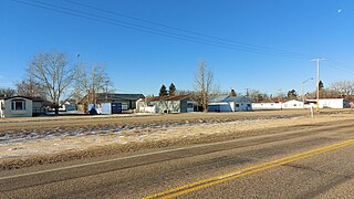
Langdon is a hamlet in southern Alberta, Canada under the jurisdiction of Rocky View County. It previously held village status between August 31, 1907, and January 1, 1946.
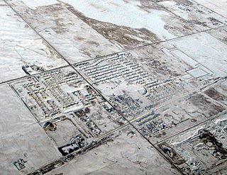
La Crete, also spelled La Crête, is a hamlet in northern Alberta, Canada, within Mackenzie County. It is located on Highway 697, approximately 57 kilometres (35 mi) southeast of High Level and 701 kilometres (436 mi) north of Edmonton.
Creelman is a village in the Canadian province of Saskatchewan within the RM of Fillmore No. 96 and Census Division No. 2. The village lies 118 km southeast of the city of Regina, on Highway 33.
St. Louis is a municipality that holds community status in Prince Edward Island, Canada.
Conklin is a hamlet in northern Alberta, Canada within the Regional Municipality (RM) of Wood Buffalo. It is located on Highway 881 between Fort McMurray and Lac La Biche. It lies near the west end of Christina Lake at an elevation of 575 metres (1,886 ft), and was named for John Conklin, a railroad employee.
The Botswana Population and Housing Census is a decennial census which is the once-a-decade population and housing count of all people in Botswana. This census is carried out by the Statistics Botswana.
The 1966 Canadian census was a detailed enumeration of the Canadian population. Census day was June 1, 1966. On that day, Statistics Canada attempted to count every person in Canada. The total population count of Canada was 20,014,880. This was a 9.7% increase over the 1961 census of 18,238,247.