Related Research Articles

Lloydminster is a city in Canada which has the unusual geographic distinction of straddling the provincial border between Alberta and Saskatchewan. The city is incorporated by both provinces as a single city with a single municipal administration.

Drumheller is a town on the Red Deer River in the badlands of east-central Alberta, Canada. It is located 110 kilometres (68 mi) northeast of Calgary and 97 kilometres (60 mi) south of Stettler. The Drumheller portion of the Red Deer River valley, often referred to as Dinosaur Valley, has an approximate width of 2 kilometres (1.2 mi) and an approximate length of 28 kilometres (17 mi).
Fort Saskatchewan is a city along the North Saskatchewan River in Alberta, Canada. It is 25 kilometres (16 mi) northeast of Edmonton, the provincial capital. It is part of the Edmonton census metropolitan area and one of 24 municipalities that constitute the Edmonton Metropolitan Region Board. Its population in the 2021 federal census was 27,464.

Indian Head is a town in southeast Saskatchewan, Canada, 69 kilometres (43 mi) east of Regina on the Trans-Canada Highway. It "had its beginnings in 1882 as the first settlers, mainly of Scottish origin, pushed into the area in advance of the railroad, most travelling by ox-cart from Brandon." "Indian" refers to Indigenous peoples in Canada. The town is known for its federally operated experimental farm and tree nursery, which has produced and distributed seedlings for shelter belts since 1901. For many years the program was run by the Prairie Farm Rehabilitation Administration (PFRA).

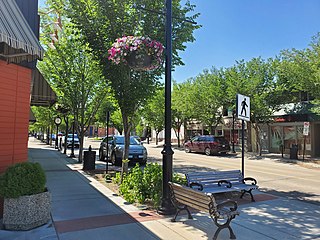
Strathmore is a town located in southern Alberta, Canada that is surrounded by Wheatland County. It is along the Trans-Canada Highway approximately 50 kilometres (30 mi) east of Calgary.

The Municipal District of Acadia No. 34 is a municipal district (MD) in southern Alberta, Canada, east of Calgary, close to the Saskatchewan border, in Census Division No. 4.
Statistics Canada conducts a national census of population and census of agriculture every five years and releases the data with a two-year lag.

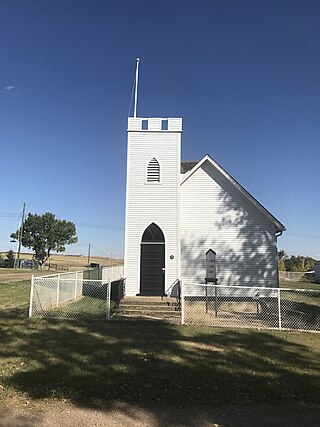
Goodwater is a village in the Canadian province of Saskatchewan within the Rural Municipality of Lomond No. 37 and Census Division No. 2. The village is located approximately 50 kilometres (31 mi) south of the city of Weyburn.
Beverly is a former urban municipality within the Edmonton Capital Region of Alberta, Canada. Beverly was incorporated as a village on March 22, 1913 and became the Town of Beverly on July 13, 1914. It later amalgamated with the City of Edmonton on December 30, 1961. The population of Beverly was 8,969 at the time of amalgamation.
The 1906 Canadian census was the first of a series of special censuses conducted by the Government of Canada, covering the rapidly expanding Northwest Provinces of Alberta, Saskatchewan, and Manitoba. These censuses were conducted every ten years from 1906 to 1946.

Mankota is a village in the Canadian province of Saskatchewan within the Rural Municipality of Mankota No. 45 and Census Division No. 3. The village is located on Highway 18, about 150 kilometres (93 mi) southeast of the city of Swift Current.
Compeer is a hamlet in east-central Alberta, Canada within Special Area No. 4. Previously an incorporated municipality, Compeer dissolved from village status on December 31, 1936, to become part of the Municipal District of Neutral Hills No. 331.
Monitor is a hamlet in east-central Alberta, Canada within Special Area No. 4. Monitor is located on Highway 41, approximately 215 kilometres (134 mi) north of Medicine Hat.
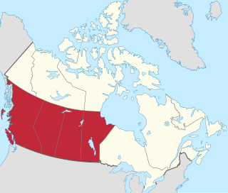
Western Canada, also referred to as the Western provinces, Canadian West, or Western provinces of Canada, and commonly known within Canada as the West, is a Canadian region that includes the four western provinces just north of the Canada–United States border namely British Columbia, Alberta, Saskatchewan and Manitoba. The people of the region are often referred to as "Western Canadians" or "Westerners", and though diverse from province to province are largely seen as being collectively distinct from other Canadians along cultural, linguistic, socioeconomic, geographic and political lines. They account for approximately 32% of Canada's total population.
The Canada 1921 census was a detailed enumeration of the Canadian population. The census count was taken as at June 1, 1921. The total population count was 8,788,483 representing a 22% increase over the 1911 census population count of 7,206,643. The 1921 census was the sixth comprehensive decennial census since Canadian Confederation on July 1, 1867. The previous census was the Northwest Provinces of Alberta, Saskatchewan, and Manitoba 1916 census and the following census was the Northwest Provinces of Alberta, Saskatchewan, and Manitoba 1926 census.
The 1916 Canadian census was the second of a series of special censuses conducted by the Government of Canada covering the rapidly expanding Northwest Provinces of Alberta, Saskatchewan, and Manitoba. These censuses were conducted every ten years from 1906 to 1946. This census was conducted as at June 1, 1916.
The 1926 Canadian census was the third of a series of special censuses conducted by the Government of Canada covering the rapidly expanding Northwest Provinces of Alberta, Saskatchewan, and Manitoba. These censuses were conducted every ten years from 1906 to 1946. This census was conducted as at June 1, 1926.
The 1936 Canadian census was the fourth of a series of special censuses conducted by the Government of Canada covering the rapidly expanding Northwest Provinces of Alberta, Saskatchewan, and Manitoba. These censuses were conducted every ten years from 1906 to 1946. This census was conducted as at June 1, 1936.
The Canada 1941 census was a detailed enumeration of the Canadian population. The total population count was 11,506,655, representing a 10.9% increase over the 1931 census population count of 10,376,786. The 1941 census was the eighth comprehensive decennial census since Canadian Confederation on July 1, 1867. The previous census was the Northwest Provinces of Alberta, Saskatchewan, and Manitoba 1936 census and the following census was the Northwest Provinces of Alberta, Saskatchewan, and Manitoba 1946 census.
The 1951 Canadian census was a detailed enumeration of the Canadian population. The total population count was 14,009,429, representing a 21.8% increase over the 1941 census population count of 11,506,655. The 1951 census was the ninth comprehensive decennial census since Canadian Confederation on July 1, 1867.
References
- ↑ "Population of Canada and the provinces". Statistics Canada. Retrieved 11 May 2021.
- ↑ "Census of Prairie Provinces, 1946" (PDF). Statistics Canada. Retrieved 23 October 2024.
- ↑ "After 1921". Library and Archives Canada. Retrieved 3 October 2015.
| | This Canadian history article is a stub. You can help Wikipedia by expanding it. |