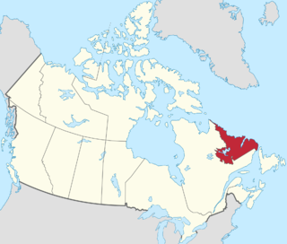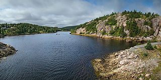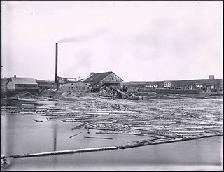
Newfoundland and Labrador is the easternmost province of Canada, in the country's Atlantic region. The province comprises the island of Newfoundland and the continental region of Labrador, having a total size of 405,212 km2 (156,453 sq mi). As of 2024 the population of Newfoundland and Labrador was estimated to be 545,247. The island of Newfoundland is home to around 94 per cent of the province's population, with more than half residing in the Avalon Peninsula. Labrador has a land border with both the province of Quebec, as well as a short border with the territory of Nunavut on Killiniq Island. The French overseas collectivity of Saint Pierre and Miquelon lies about 20 km (12 mi) west of the Burin Peninsula.

Labrador is a geographic and cultural region within the Canadian province of Newfoundland and Labrador. It is the primarily continental portion of the province and constitutes 71% of the province's area but is home to only 6% of its population. It is separated from the island of Newfoundland by the Strait of Belle Isle. It is the largest and northernmost geographical region in the four Atlantic provinces.

Avondale is a town located on Newfoundland's Avalon Peninsula in the province of Newfoundland and Labrador, Canada, which was incorporated in 1974. The community is situated at the southwestern head of Conception Bay in Division 1. It is located 59 km (37 mi) southwest of St. John's and 72 km (45 mi) northeast of Placentia.

Newfoundland was a British dominion in eastern North America, today the modern Canadian province of Newfoundland and Labrador. It included the island of Newfoundland, and Labrador on the continental mainland. Newfoundland was one of the original dominions under the Balfour Declaration of 1926, and accordingly enjoyed a constitutional status equivalent to the other dominions of the time. Its dominion status was confirmed by the Statute of Westminster, 1931, although the statute was not otherwise applicable to Newfoundland.

Channel-Port aux Basques is a town at the extreme southwestern tip of Newfoundland fronting on the western end of the Cabot Strait. A Marine Atlantic ferry terminal is located in the town which is the primary entry point onto the island of Newfoundland and the western terminus of the Newfoundland and Labrador Route 1 in the province. The town was incorporated in 1945 and its population in the 2021 census was 3,547.

Botwood is a town in north-central Newfoundland, Newfoundland and Labrador, Canada in Census Division 6. It is positioned on the west shore of the Bay of Exploits on a natural deep-water harbour. Historically, this harbour has been a significant hub for cargo ships and seaplanes. Botwood served as the North American endpoint for the first transatlantic commercial flights.

Bell Island is an island that is part of Newfoundland and Labrador, Canada's easternmost province. With an area of 34 square kilometres (13 sq mi), it is by far the largest island in Conception Bay, a large bay in the southeast of the island of Newfoundland. The provincial capital of St. John's is less than 20 kilometres (12 mi) to the east.

Grates Cove is a local service district and designated place in the Canadian province of Newfoundland and Labrador. It is the most northerly community on the Avalon Peninsula, located on the tip of the Bay de Verde Peninsula on the island of Newfoundland. Called "the Grates" by John Guy as early as 1612, the origin of the name is unknown.

Glovers Harbour, formerly known as Thimble Tickle(s), is an unincorporated community and harbour in the Canadian province of Newfoundland and Labrador. It is located in Notre Dame Bay on the northern coast of the island of Newfoundland. As a local service district, it is led by an elected committee that is responsible for the delivery of certain essential services. It is delineated as a designated place for statistical purposes.

Boyd's Cove, also known as Boyd's Harbour, is a local service district and designated place in the Canadian province of Newfoundland and Labrador that is near Lewisporte. There is an interpretive centre dedicated to the earlier indigenous Beothuk settlement at this location.

The province of Newfoundland and Labrador covers the period from habitation by Archaic peoples thousands of years ago to the present day.

Newfoundland and Labrador is a province of Canada on the country's Atlantic coast in northeastern North America. The province has an area of 405,212 square kilometres and a population in 2024 of 545,247, with approximately 95% of the provincial population residing on the Island of Newfoundland, with more than half of the population residing on the Avalon Peninsula. People from Newfoundland and Labrador are called "Newfoundlanders," "Labradorians", or "Newfoundlanders and Labradorians".
Herring Neck is a local service district and designated place in the Canadian province of Newfoundland and Labrador. It is on the northeastern extremity of New World Island, Notre Dame Bay. The community encompasses several small contiguous communities such as Merritt's Harbour, Hatchet Harbour, Salt Harbour, and Sunnyside.

L'Anse-au-Loup (Town) is located on the banks of L'Anse-au-Loup Brook and the Strait of Belle Isle, in Newfoundland and Labrador province, Canada.

Sop's Arm is a local service district and designated place in the Canadian province of Newfoundland and Labrador. The community was formed in the 1930s and 1940s by families moving from surrounding communities, including Jackson's Arm. In the 1950s and 1960s families from nearby Sop's Island moved to Sop's Arm, towing their houses across the channel of water.
Markland is a local service district and designated place in the Canadian province of Newfoundland and Labrador.

Newfoundland is a large island within the Canadian province of Newfoundland and Labrador. It is situated off the eastern coast of the North American mainland and the geographical region of Labrador.

Newfoundland was an English and, later, British colony established in 1610 on the island of Newfoundland, now the province of Newfoundland and Labrador. That followed decades of sporadic English settlement on the island, which was at first seasonal, rather than permanent. It was made a Crown colony in 1824 and a dominion in 1907. Its economy collapsed during the Great Depression and on 16 February 1934, the Newfoundland legislature agreed to the creation of a six-member Commission of Government to govern the country. In 1949, the country voted to join Canada as the province of Newfoundland.
Division No. 1, Subdivision B is an unorganized subdivision on the Avalon Peninsula in Newfoundland and Labrador, Canada. It is in Division 1 and contains the unorganized communities of Iona, Little Barasway, Placentia Junction, Point Verde and Ship Harbour.


