
Stephenville is a town in Newfoundland and Labrador, Canada, on the west coast of the island of Newfoundland.
Sandy Point or Flat Island was formerly a peninsula but is now an island on the west coast of Newfoundland which is gradually being transformed into a hidden island as a result of ocean storm-induced coastal erosion. Its former connecting isthmus is known as "The Gap" by locals after a severe winter storm during the 1960s breached the land bridge and created a gap. The island of Sandy Point was first coined a "hidden island" due to the extreme difficulty in spotting the barrier island on the horizon when approaching inner Bay St. George from the Gulf of St Lawrence by ship. This may have also served beneficial to "pirate" vessels looking to temporarily mask or hide from the regular trade route along the Gulf of St. Laurence River at the time on the lee side of Sandy Point where an anchorage was available, away from the prevailing winds. The fur trade was quite lucrative during this period, so it is somewhat conceivable that inner Bay St. George may have served as a tax or thief "hideaway" from the regular trade routes although this is somewhat speculative.
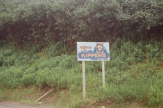
Kippens is a town located in the province of Newfoundland and Labrador, Canada on the west coast of the island of Newfoundland.
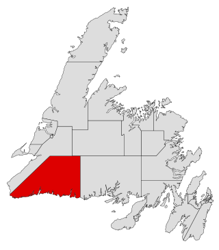
Burgeo-La Poile is a provincial electoral district for the House of Assembly of Newfoundland and Labrador, Canada. As of 2011, there are 7,527 eligible voters living within the district. The district was first created when Newfoundland joined confederation in 1949 as Burgeo and La Poile, and existed until 1975. It was recreated in 1995 following a reduction in the number of seats in the House of Assembly from 52 to 48, forming from the amalgamation of the former districts of La Poile and Burgeo-Bay D'Espoir.
The Port au Port Peninsula is a peninsula in the Canadian province of Newfoundland and Labrador. Roughly triangular in shape, it is located on the west coast of the island of Newfoundland.
Piccadilly Slant-Abraham's Cove is a local service district and designated place in the Canadian province of Newfoundland and Labrador. It is located on the island of Newfoundland, along St. George's Bay, on the Port au Port Peninsula. The DPL consists of the fishing villages of Abraham's Cove and Piccadilly.
St. George's Bay - informally referred to as Bay St. George due to its French translation Baie St-George - is a large bay in the province of Newfoundland and Labrador, Canada. It is located on the west coast of the island of Newfoundland and comprises a sub-basin of the Gulf of St. Lawrence. The estimated population of the entire bay is 16,000, based on the demographic data of each community.
The Burin Peninsula is a peninsula located on the south coast of the island of Newfoundland in the province of Newfoundland and Labrador. Marystown is the largest population centre on the peninsula.

St. George's is a Canadian community in the St. George's Bay on the southwest coast of Newfoundland of the province of Newfoundland and Labrador.

Random Island is an island located off Canada's Atlantic coast. Part of the Province of Newfoundland and Labrador, it is located on the east coast of Newfoundland and partially surrounded by the Bonavista Peninsula on the north and within the confines of Trinity Bay. The island is approximately 35 km (22 mi) long, its width varies from 15 km (9.3 mi) on the eastern end, to 6 km (3.7 mi) in the middle, to 17 km (11 mi) on the western end, with a total area of around 310 km2 (120 sq mi). According to the 2016 census, the population of the island is 1,232.

Port au Port West-Aguathuna-Felix Cove is a small town located on the Port au Port Peninsula of the Island of Newfoundland, Canada. The nearest large service area is Stephenville. The town was created in 1970 by amalgamating the small villages of Port au Port West, Aguathuna and Felix Cove. Its post office began on September 11, 1964. The first Post Mistress was Reisa Gabriel.

Route 460 is an 87.5-kilometre-long (54.4 mi) east-west Canadian provincial highway in Newfoundland and Labrador.

Stephenville Crossing is a town in the Canadian province of Newfoundland and Labrador. It is on the island of Newfoundland at the easternmost limit of Bay St. George.

Rose Blanche–Harbour le Cou Town on Newfoundland's southwest shore, about 45 km from Port aux Basques, at the end of Route 470.
The Bonavista Peninsula is a large peninsula on the east coast of the island of Newfoundland in the Canadian province of Newfoundland and Labrador. It consists of 50 incorporated towns/unincorporated communities which have a population of 12,176 as of the 2016 Canadian Census. Bonavista is the largest population centre on the peninsula.
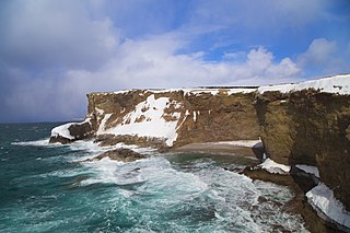
Cape St. George is a headland and community of the same name, located at the southwestern tip of the Port au Port Peninsula on the Canadian island of Newfoundland.
Port au Port East is a town in the Canadian province of Newfoundland and Labrador, situated on the shore of Isthmus Bay. The town had a population of 413 in the Canada 2021 Census. The town consists of the unincorporated communities of Port au Port and Romaines.
Port au Port Bay located on the west coast of the Island of Newfoundland formed by a long narrow point of land of the Port au Port Peninsula and the area of Newfoundland known as the Lewis Hills, in the Canadian province of Newfoundland and Labrador.
Mainland is a local service district and designated place in the Canadian province of Newfoundland and Labrador. It is on the western shore of the Port au Port Peninsula approximately 50 kilometres from the Stephenville International Airport. Mainland is a coastal community, bordered by both the ocean and forest. The main industry in the community has traditionally been fishing, but currently (2016) a large portion of the inhabitants leave the community seasonally to earn income.
Isthmus Bay is a natural bay on the island of Newfoundland in the province of Newfoundland and Labrador, Canada. It is a sub-bay of St. George's Bay and flanked by the town of Port-au-Port. It is separated from Port au Port Bay by two narrow gravel isthmi.
This page is based on this
Wikipedia article Text is available under the
CC BY-SA 4.0 license; additional terms may apply.
Images, videos and audio are available under their respective licenses.
