Cecil Calvert, 2nd Baron Baltimore was an English politician, peer and lawyer who was the first proprietor of Maryland. Born in Kent in 1605, he inherited the proprietorship after the death of his father, George Calvert, 1st Baron Baltimore, for whom it had been intended. Calvert proceeded to establish and manage the Province of Maryland as a proprietary colony for English Catholics from his English country house of Kiplin Hall in North Yorkshire.

The Avalon Peninsula is a large peninsula that makes up the southeast portion of the island of Newfoundland in Canada. It is 9,220.61 square kilometres (3,560.10 sq mi) in size.
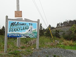
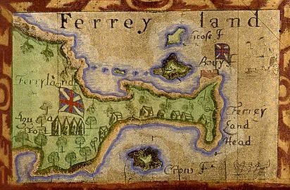
Edward Wynne was Proprietary Governor of the Ferryland colony from 1621 to 1626. Born in Wales, he was appointed by Sir George Calvert, to establish the colony, and in August 1621, he landed at "Ferryland" with 12 men. By November of that same year, the colonists had completed a large dwelling, and then by Christmas, had added a stone kitchen. In 1622, a second group of colonists led by Daniel Powell was sent to the new English Colony, bringing the population to 32, including seven women. Within a few years, the Colony had housing, a forge, a warehouse, sawmill and wharf. In 1623, the Colony became the Province of Avalon when Calvert's grant was confirmed by King Charles I of England, growing to a population of 100 by 1625. Wynne was dismissed that year, probably because he lacked the skills to govern a growing Colony of that size and because Calvert himself wanted to govern the colony directly.

The Province of Avalon was the area around the English settlement of Ferryland in what is now Newfoundland and Labrador, Canada in the 17th century, which upon the success of the colony grew to include the land held by Sir William Vaughan and all the land that lay between Ferryland and Petty Harbour.
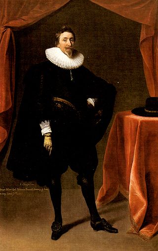
George Calvert, 1st Baron Baltimore was an English peer and politician. He achieved domestic political success as a member of parliament and later Secretary of State under King James I. He lost much of his political power after his support for a failed marriage alliance between Prince Charles and the Spanish House of Habsburg royal family. Rather than continue in politics, he resigned all of his political offices in 1625 except for his position on the Privy Council and declared his Catholicism publicly. He was created Baron Baltimore in the Peerage of Ireland upon his resignation. Baltimore Manor was located in County Longford, Ireland.
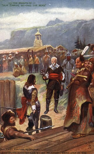
Sir David Kirke, also spelled David Ker, was an adventurer, privateer and colonial governor. He is best known for his successful capture of Québec in 1629 during the Anglo-French War and his subsequent governorship of lands in Newfoundland. A favourite of Charles I, Kirke's downfall came with that of the Crown during the English Civil War and it is believed he died in prison.

Ferryland is a provincial electoral district for the House of Assembly of Newfoundland and Labrador, Canada. As of 2011, there are 8,571 eligible voters living within the district.

Grates Cove is a local service district and designated place in the Canadian province of Newfoundland and Labrador. It is the most northerly community on the Avalon Peninsula, located on the tip of the Bay de Verde Peninsula on the island of Newfoundland. Called "the Grates" by John Guy as early as 1612, the origin of the name is unknown.
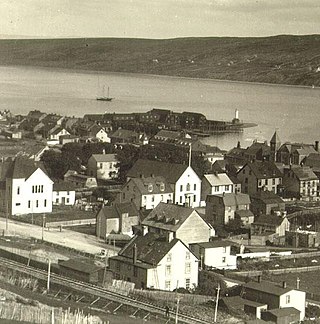
Harbour Grace is a town in Conception Bay on the Avalon Peninsula in the province of Newfoundland and Labrador, Canada. With roots dating back to the 16th century, it is one of the oldest towns in North America.
Calvert is a local service district and designated place in the Canadian province of Newfoundland and Labrador in the Southern Shore region of the province. It is 72 kilometres south of the provincial capital St. John's, 7 kilometres south of Cape Broyle, and 3 kilometres north of Ferryland. The population in 2001 was 355, a decline of 17% since 1996.
Mobile is a local service district and designated place in the Canadian province of Newfoundland and Labrador on the Avalon Peninsula.
Tors Cove is a local service district and designated place in the Canadian province of Newfoundland and Labrador. It is on the east coast of the Avalon Peninsula of the island of Newfoundland, approximately 40 kilometres south of the St. John's, the provincial capital, along Route 10. It was formerly named Toads Cove.
Renews–Cappahayden is a small fishing town on the southern shore of Newfoundland, 83 kilometres (52 mi) south of St. John's.

The East Coast Trail (ECT) is a long-distance coastal footpath located in the Canadian province of Newfoundland and Labrador. It is a developed trail over 336 kilometres (209 mi) long, the creation of which began in 1994. It is made up of 25 linked wilderness paths and passes through more than 30 communities. It was named one of the best adventure destinations by National Geographic in 2012 and is extended and improved yearly.
Aquaforte is a town on the south shore of Newfoundland's Avalon Peninsula in the province of Newfoundland and Labrador, Canada.

Pouch Cove is a town in the Canadian province of Newfoundland and Labrador. The population is 2,063 according to the Canada 2021 Census. It is located on the northeast Avalon Peninsula, 27 kilometres north of St. John's, the province's capital city.

Newfoundland is a large island within the Canadian province of Newfoundland and Labrador. It is situated off the eastern coast of the North American mainland and the geographical region of Labrador.

Newfoundland was an English and, later, British colony established in 1610 on the island of Newfoundland, now the province of Newfoundland and Labrador. That followed decades of sporadic English settlement on the island, which was at first seasonal, rather than permanent. It was made a Crown colony in 1824 and a dominion in 1907. Its economy collapsed during the Great Depression and on 16 February 1934, the Newfoundland legislature agreed to the creation of a six-member Commission of Government to govern the country. In 1949, the country voted to join Canada as the province of Newfoundland.
Division No. 1, Subdivision U is an unorganized subdivision on the Avalon Peninsula in Newfoundland and Labrador, Canada, in Division 1. It contains the unincorporated communities of Admiral's Cove, Bauline East, Bauline South, Burnt Cove, Devils Kitchen, Flat Rock, St. Michaels and Seal Cove.
Green's Harbour is a local service district and designated place in the Canadian province of Newfoundland and Labrador.