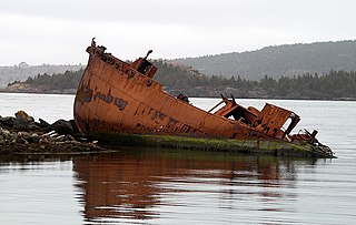
Conception Harbour is a town on the Avalon Peninsula in Newfoundland and Labrador, Canada. It is in Division 1 on Conception Bay and can be accessed via Newfoundland and Labrador Route 60.
Colliers is a town on the Avalon Peninsula in Newfoundland and Labrador, Canada. It is in Division 1 on Conception Bay.

Gambo is a town and designated place in the Canadian province of Newfoundland and Labrador. Located in the northeastern portion of the island of Newfoundland on Freshwater Bay, it is in Division No. 7.

Division 1, Newfoundland and Labrador is a census division covering the entire Avalon Peninsula including the Isthmus of Avalon of the Canadian province of Newfoundland and Labrador. Like all census divisions in Newfoundland and Labrador, but unlike the census divisions of some other provinces, the division exists only as a statistical division for census data, and is not a political entity.
Chapel Arm is a settlement in Newfoundland, Canada, located at the southeast corner of Trinity Bay, approximately 100 km (62 mi) west of St. John's and two km from the Trans-Canada Highway.

Grates Cove is a local service district and designated place in the Canadian province of Newfoundland and Labrador. It is the most northerly community on the Avalon Peninsula, located on the tip of the Bay de Verde Peninsula on the island of Newfoundland. Called "the Grates" by John Guy as early as 1612, the origin of the name is unknown.
Piccadilly Slant-Abraham's Cove is a local service district and designated place in the Canadian province of Newfoundland and Labrador. It is located on the island of Newfoundland, along St. George's Bay, on the Port au Port Peninsula. The DPL consists of the fishing villages of Abraham's Cove and Piccadilly.
Goulds is a designated place in the Canadian province of Newfoundland and Labrador. It is a rural neighbourhood within the City of St. John's southeast of the city centre.

Fortune is a Canadian town located in the province of Newfoundland and Labrador.
Musgrave Harbour is a town in the Canadian province of Newfoundland and Labrador.

Pouch Cove is a town in the Canadian province of Newfoundland and Labrador. The population is 2,063 according to the Canada 2021 Census. It is located on the northeast Avalon Peninsula, 27 kilometres north of St. John's, the province's capital city.
Admirals Beach is a rural community located in Newfoundland and Labrador, Canada.
Heart's Delight-Islington is a town on the south side of Trinity Bay in the Canadian province of Newfoundland and Labrador, located on Newfoundland and Labrador Route 80. The Post Office was established in 1954. The first Postmistress was Maggie Chislett.
Chance Cove is a town in the Canadian province of Newfoundland and Labrador. The town had a population of 213 in the Canada 2021 Census.
South River is an incorporated municipality in the Canadian province of Newfoundland and Labrador, located at the south-southeast side of Bay de Grave, in Conception Bay. The town had a population of 674 according to the 2021 Canadian Census. South River is the site of the western terminus of Newfoundland and Labrador Route 60, also known as the Conception Bay Highway, which proceeds eastward to downtown St. John's. The river itself forms a natural boundary with neighbouring Clarke's Beach and is a scheduled salmon river. A second river, known as the Gould Brook, forms another natural boundary with the unincorporated local service district of Makinsons. South River is home to the Bay de Grave Regional Fire Department, a first step in developing successful regional cooperation amongst municipalities.

St. Brendan's is a town in the Canadian province of Newfoundland and Labrador, situated in Shoal Cove on Cottel Island in Bonavista Bay. Other settlements on the island include Shalloway Cove, Haywards Cove, and Dock Cove. The town had a population of 125 in the Canada 2021 Census. St. Brendan's is inaccessible by road and is served by a daily ferry service from Burnside.
Winterton is a town in the Canadian province of Newfoundland and Labrador. It was originally named Sille Cove or Scilly Cove. In 1912 the town was named Winterton for Sir James Spearman Winter, former Prime Minister of Newfoundland.
Norman's Cove-Long Cove is a town in the Canadian province of Newfoundland and Labrador. The town had a population of 647 in the Canada 2021 Census, down from 720 in 2011.

St. Jacques-Coomb's Cove is a town in the Canadian province of Newfoundland and Labrador. The town had a population of 546 in the Canada 2021 Census. It is located on the south coast of the island of Newfoundland on the north side of Fortune Bay, on the southern tip of the Connaigre Peninsula in what is now known as the Coast of Bays Region. The town consists of six communities, St. Jacques, English Harbour West, Mose Ambrose, Boxey, Coomb's Cove, and Wreck Cove, all nestled within the inlets along the coast. They all had their beginnings in the fisheries and the fisheries have always been the mainstay of employment in the communities. In recent years aquaculture was introduced in the area, providing employment for its residents.
O'Donnells is a local service district and designated place in the Canadian province of Newfoundland and Labrador. It is southeast of Placentia. The first postmistress was Mrs. Theresa M. Hanlon on July 16, 1951. By 1956 there was a population of 244.


