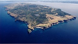
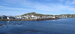
Name Water body Area km2 Location Remarks Allan's Island Atlantic Ocean 46°51′2.8″N 55°48′9.7″W / 46.850778°N 55.802694°W / 46.850778; -55.802694 Part of the town of Lamaline Baccalieu Conception Bay 5 48°07′49″N 52°48′05″W / 48.13028°N 52.80139°W / 48.13028; -52.80139 (Baccalieu Island ) Uninhabited Balcalhoa Notre Dame Bay 2.2 49°41′37″N 54°32′47″W / 49.69369°N 54.54646°W / 49.69369; -54.54646 (Balcalhoa Island ) Lighthouse Bell Conception Bay 34 47°39′N 52°56′W / 47.650°N 52.933°W / 47.650; -52.933 (Bell Island ) Includes town of Wabana Bell Atlantic Ocean 88 50°44′N 55°34′W / 50.733°N 55.567°W / 50.733; -55.567 (Bell Island ) One of the Grey Islands Belle Isle Strait of Belle Isle 52 51°55′44″N 55°21′33″W / 51.92889°N 55.35917°W / 51.92889; -55.35917 (Belle Isle ) Uninhabited Brunette Fortune Bay 20 47°16′47″N 55°54′02″W / 47.27972°N 55.90056°W / 47.27972; -55.90056 (Brunette Island ) Uninhabited Bull, Cow and Calf Atlantic Ocean 46°46′33″N 54°05′56″W / 46.77583°N 54.09889°W / 46.77583; -54.09889 (Bull, Cow and Calf ) Avalon Peninsula island cluster Carbonear Conception Bay 0.3 47°44′15″N 53°10′01″W / 47.73750°N 53.16694°W / 47.73750; -53.16694 (Carbonear Island ) Uninhabited Change Notre Dame Bay 24.4 49°40′19″N 54°24′28″W / 49.67194°N 54.40790°W / 49.67194; -54.40790 (Change Islands ) Consists of South and North Island Cod Labrador Sea 132.71 57°47′00″N 61°46′56″W / 57.783455°N 61.782345°W / 57.783455; -61.782345 (Cod Island ) Uninhabited Dildo Trinity Bay 0.9 47°33′59″N 53°35′27″W / 47.56639°N 53.59083°W / 47.56639; -53.59083 (Dildo Island ) Fogo Notre Dame Bay 254 49°40′N 54°10′W / 49.667°N 54.167°W / 49.667; -54.167 (Fogo Island ) Population in 2006: 2,706 Funk Labrador Sea 0.024 49°45′07″N 53°11′32″W / 49.75194°N 53.19222°W / 49.75194; -53.19222 (Funk Island ) Gannet Labrador Sea 2 53°56′02″N 56°30′18″W / 53.934°N 56.505°W / 53.934; -56.505 (Gannet Islands ) Ecological reserve Glover Grand Lake 190 48°47′49″N 57°39′29″W / 48.79694°N 57.65806°W / 48.79694; -57.65806 (Glover Island ) 18th-largest lake island in the world by area Granby White Bay 0.5 52°34′18″N 55°46′04″W / 52.5716406°N 55.7677249°W / 52.5716406; -55.7677249 (Granby Island ) Uninhabited Green (Catalina) Atlantic Ocean 0.6 48°30′17″N 53°02′46″W / 48.5047°N 53.0460°W / 48.5047; -53.0460 (Green Island ) East of Bonavista Peninsula Green (Fortune) Fortune Bay 0.3 46°53′N 56°05′W / 46.883°N 56.083°W / 46.883; -56.083 (Green Island ) West of Burin Peninsula Greenspond Bonavista Bay, North 2.85 49°04′N 53°34′W / 49.07°N 53.57°W / 49.07; -53.57 (Greenspond Island ) Population: 257 (2021) Groais Atlantic Ocean 41 50°56′N 55°36′W / 50.933°N 55.600°W / 50.933; -55.600 (Groais Island ) One of the Grey Islands Hawke Island Labrador Sea 56 53°03′N 55°50′W / 53.05°N 55.83°W / 53.05; -55.83 (Hawke Island ) Former whaling station Home Labrador Sea 12 60°10′28″N 64°16′16″W / 60.17444°N 64.27111°W / 60.17444; -64.27111 (Home Island ) Horse Atlantic Ocean 25 50°12′37″N 55°44′58″W / 50.21028°N 55.74944°W / 50.21028; -55.74944 (Horse Islands ) North of Baie Verte Peninsula Horse Chops Labrador Sea 5.9 53°52′N 57°02′W / 53.86°N 57.04°W / 53.86; -57.04 (Horse Chops Islands ) Hunt's Island south west coast 47°35′58″N 57°36′41″W / 47.5994445°N 57.6113889°W / 47.5994445; -57.6113889 (Hunt's Island ) Uninhabited Island of Ponds Labrador Sea 91 53°28′N 55°53′W / 53.46°N 55.89°W / 53.46; -55.89 (Island of Ponds ) Includes settlement of Black Tickle Keats Bonavista Bay 0.7 48°39′10″N 53°38′50″W / 48.65278°N 53.64722°W / 48.65278; -53.64722 (Keats Island ) Uninhabited Kelly's Conception Bay 1.9 47°32′39″N 53°00′41″W / 47.54417°N 53.01139°W / 47.54417; -53.01139 (Kelly's Island ) Uninhabited Killiniq Ungava Bay 24 60°22′N 64°37′W / 60.367°N 64.617°W / 60.367; -64.617 (Killiniq Island ) land border between Nunavut and Newfoundland (Newfoundland side) Landsat Labrador Sea 0.001 60°10′37″N 64°02′30″W / 60.17694°N 64.04167°W / 60.17694; -64.04167 (Landsat Island ) [ 1] Discovered using Landsat 1 satellite imagery; forms easternmost part of Canada; [ 1] uninhabited Little Bay Notre Dame Bay 7.1 49°38′41″N 55°47′55″W / 49.64477°N 55.79853°W / 49.64477; -55.79853 (Little Bay Islands ) Long Island Hermitage Bay 100 47°38′45″N 55°58′54″W / 47.64583°N 55.98167°W / 47.64583; -55.98167 (Long Island ) Includes town of Gaultois . Population in 2021: 100 Merasheen Placentia Bay 47°30′N 54°15′W / 47.5°N 54.25°W / 47.5; -54.25 (Merasheen Island ) Millers White Bay 0.1 49°33′32″N 56°51′11″W / 49.558875°N 56.853083°W / 49.558875; -56.853083 (Millers Island ) Uninhabited New World Notre Dame Bay 49°34′34″N 56°51′42″E / 49.57614°N 56.8617406°E / 49.57614; 56.8617406 (New World Island ) Includes the towns of Newville , Carter's Cove and Pike's Arm Newfoundland Atlantic Ocean 111,390 49°N 56°W / 49°N 56°W / 49; -56 (Newfoundland ) Most populous part of Newfoundland and Labrador Newfoundland Labrador Sea 53°51′N 56°56′W / 53.85°N 56.94°W / 53.85; -56.94 (Newfoundland Island ) A small island near Sandwich Bay North Star Labrador Sea 1 60°22′02″N 64°24′13″W / 60.36722°N 64.40361°W / 60.36722; -64.40361 (North Star Island ) The province's northernmost island, off the Labrador coast Nunaksaluk Island Labrador Sea 55°48′N 60°18′W / 55.8°N 60.3°W / 55.8; -60.3 (North Star Island ) Island off the Labrador coast Oderin Placentia Bay 1.7 47°17′36″N 54°48′16″W / 47.29322°N 54.80444°W / 47.29322; -54.80444 (Oderin Island ) Old Perlican Trinity Bay 48°05′12″N 53°01′18″W / 48.08667°N 53.02167°W / 48.08667; -53.02167 (Old Perlican Island ) Paul's Labrador Sea 56°31′N 61°30′W / 56.517°N 61.500°W / 56.517; -61.500 (Paul's Island ) Off the Labrador coast; source of the mineral labradorite Pouch Bonavista Bay 0.2 49°09′58″N 53°28′29″W / 49.16601°N 53.47482°W / 49.16601; -53.47482 (Pouch Island ) Puffin Conception Bay 48°07′32.41″N 52°48′43.35″W / 48.1256694°N 52.8120417°W / 48.1256694; -52.8120417 (Puffin Island ) Pool's Island Bonavista Bay, North 2.65 49°07′N 53°35′W / 49.11°N 53.59°W / 49.11; -53.59 (Pool's Island ) Population: 143 (2021) Quirpon Strait of Belle Isle 9.5 51°36′N 55°26′W / 51.60°N 55.43°W / 51.60; -55.43 (Quirpon Island ) Off the Great Northern Peninsula Random Trinity Bay 255 48°7′N 53°44′W / 48.117°N 53.733°W / 48.117; -53.733 (Random Island ) South of the Bonavista Peninsula Sandy Point St. George's Bay 3 48°27′N 58°29′W / 48.450°N 58.483°W / 48.450; -58.483 (Sandy Point ) Silver Fox Bonavista Bay 2 49°01′06″N 53°41′02″W / 49.01842°N 53.68388°W / 49.01842; -53.68388 (Silver Fox Island ) South Aulatsivik Atlantic Ocean 56°45′51″N 61°30′59″W / 56.76417°N 61.51639°W / 56.76417; -61.51639 (South Aulatsivik Island ) South Wolf Labrador Sea 53°40′N 55°55′W / 53.667°N 55.917°W / 53.667; -55.917 (South Wolf Island ) Uninhabited Spotted Labrador Sea 53°31′N 55°47′W / 53.51°N 55.78°W / 53.51; -55.78 (Spotted Island ) Former Pinetree Line site Stony Labrador Sea 52°59′N 55°49′W / 52.99°N 55.81°W / 52.99; -55.81 (Stony Islands ) Square Labrador Sea 52°44′01″N 55°50′14″W / 52.73352°N 55.83715°W / 52.73352; -55.83715 (Square Islands ) By White Bear Arm off the Labrador coast Swain's Bonavista Bay 49°08′21″N 53°32′45″W / 49.13929°N 53.54579°W / 49.13929; -53.54579 (Swain's Island ) Group of eight islands Trump Islands (Newfoundland and Labrador) Notre Dame Bay 49°34′30″N 54°46′09″W / 49.57500°N 54.76917°W / 49.57500; -54.76917 Uninhabited Twillingate Notre Dame Bay 49°39′N 54°45′W / 49.650°N 54.750°W / 49.650; -54.750 (Twillingate ) From the French name, Toulinquet Venison Labrador Sea 1 52°58′12″N 55°46′30″W / 52.970°N 55.775°W / 52.970; -55.775 (Venison Island ) Former wireless telegraph station Wadham Atlantic Ocean 49°35′30″N 53°45′49″W / 49.59178°N 53.76360°W / 49.59178; -53.76360 (Wadham Islands ) Woody Island Placentia Bay