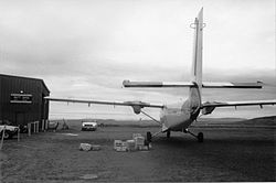
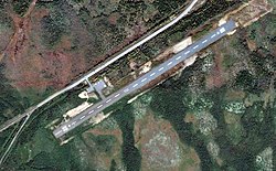
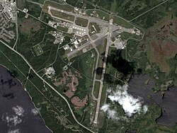
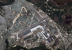
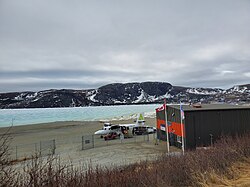
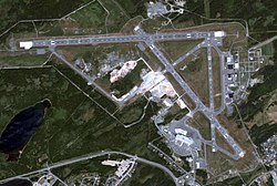
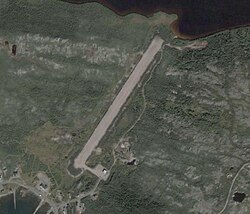
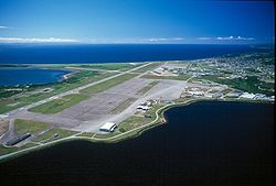
Community Airport name PU PR MI AOE [ A] Operator Elevation ICAO TC LID IATA Image Coordinates Bell Island Bell Island Airport PU Govt of Newfoundland and Labrador 191 ft (58 m) CCV4 47°38′06″N 52°58′48″W / 47.63500°N 52.98000°W / 47.63500; -52.98000 (Bell Island Airport ) Black Tickle Black Tickle Airport PU Govt of Newfoundland and Labrador 52 ft (16 m) CCE4 YBI 53°28′12″N 55°47′15″W / 53.47000°N 55.78750°W / 53.47000; -55.78750 (Black Tickle Airport ) Botwood Exploits Valley (Botwood) Airport PU Govt of Newfoundland and Labrador 319 ft (97 m) CCP2 49°03′22″N 55°26′52″W / 49.05611°N 55.44778°W / 49.05611; -55.44778 (Exploits Valley (Botwood) Airport ) Cartwright Cartwright Airport PU Govt of Newfoundland and Labrador 42 ft (13 m) CYCA YRF 53°40′58″N 57°02′31″W / 53.68278°N 57.04194°W / 53.68278; -57.04194 (Cartwright Airport ) Cartwright Eagle River ) Eagle River/Rifflin' Hitch Water Aerodrome PR Rifflin' Hitch Lodge 151 ft (46 m) CRH3 53°25′14″N 57°41′39″W / 53.42056°N 57.69417°W / 53.42056; -57.69417 (Eagle River/Rifflin' Hitch Water Aerodrome ) Charlottetown Charlottetown Airport PU Govt of Newfoundland and Labrador 210 ft (64 m) CCH4 YHG 52°45′54″N 56°06′56″W / 52.76500°N 56.11556°W / 52.76500; -56.11556 (Charlottetown Airport ) Churchill Falls Churchill Falls Airport PU Churchill Falls (Labrador) Corp 1,437 ft (438 m) CZUM ZUM 53°33′43″N 64°06′23″W / 53.56194°N 64.10639°W / 53.56194; -64.10639 (Churchill Falls Airport ) Clarenville Clarenville Airport PU Govt of Newfoundland and Labrador 196 ft (60 m) CCZ3 48°16′29″N 53°55′26″W / 48.27472°N 53.92389°W / 48.27472; -53.92389 (Clarenville Airport ) Deer Lake Deer Lake Regional Airport PU 120 (250) [ 6] Deer Lake Regional Airport Authority 72 ft (22 m) CYDF YDF 49°12′40″N 57°23′29″W / 49.21111°N 57.39139°W / 49.21111; -57.39139 (Deer Lake Regional Airport ) Fogo Fogo Aerodrome PU Govt of Newfoundland and Labrador 97 ft (30 m) CDY3 49°39′27″N 54°14′15″W / 49.65750°N 54.23750°W / 49.65750; -54.23750 (Fogo Airport ) Foxtrap Long Pond Heliport PR Cougar Helicopters 42 ft (13 m) CCX2 47°30′59″N 52°58′52″W / 47.51639°N 52.98111°W / 47.51639; -52.98111 (Long Pond Heliport ) Gander Gander International Airport PU AOE [ 7] Gander International Airport Authority 496 ft (151 m) CYQX YQX 48°56′13″N 54°34′05″W / 48.93694°N 54.56806°W / 48.93694; -54.56806 (Gander International Airport ) Gander Gander (James Paton Memorial Regional Health Centre) Heliport PR James Paton Memorial Regional Health Centre 432 ft (132 m) CGH2 48°57′19″N 54°37′38″W / 48.95528°N 54.62722°W / 48.95528; -54.62722 (Gander (James Paton Memorial Regional Health Centre) Heliport ) Grand Falls-Windsor Grand Falls-Windsor Heliport PU Town of Grand Falls-Windsor 157 ft (48 m) CFW8 48°55′29″N 55°38′50″W / 48.92472°N 55.64722°W / 48.92472; -55.64722 (Grand Falls-Windsor Heliport ) Happy Valley-Goose Bay CFB Goose Bay MI 15 [ 8] [ B] 5 Wing Ops Centre (military) 160 ft (49 m) CYYR YYR 53°19′09″N 60°25′33″W / 53.31917°N 60.42583°W / 53.31917; -60.42583 (CFB Goose Bay ) Happy Valley-Goose Bay Goose (Otter Creek) Water Aerodrome PU 15 [ 9] [ C] Goose Bay Airport Corporation 0 ft (0 m) CCB5 53°21′00″N 60°25′00″W / 53.35000°N 60.41667°W / 53.35000; -60.41667 (Goose (Otter Creek) Water Aerodrome ) Harbour Grace Harbour Grace Airport PU Town of Harbour Grace 325 ft (99 m) CHG2 47°41′08″N 53°15′14″W / 47.68556°N 53.25389°W / 47.68556; -53.25389 (Harbour Grace Airport ) Hopedale Hopedale Airport PU Govt of Newfoundland and Labrador 46 ft (14 m) CYHO YHO 55°26′54″N 60°13′43″W / 55.44833°N 60.22861°W / 55.44833; -60.22861 (Hopedale Airport ) Long Harbour River Long Harbour River Heliport PR Canadian Northern Outfitters 300 ft (91 m) CLH7 47°54′16″N 54°55′13″W / 47.90444°N 54.92028°W / 47.90444; -54.92028 (Long Harbour River Heliport ) Makkovik Makkovik Airport PU Govt of Newfoundland and Labrador 231 ft (70 m) CYFT YMN 55°04′38″N 59°11′15″W / 55.07722°N 59.18750°W / 55.07722; -59.18750 (Makkovik Airport ) Mary's Harbour Mary's Harbour Airport PU Govt of Newfoundland and Labrador 35 ft (11 m) CYMH YMH 52°18′10″N 55°50′52″W / 52.30278°N 55.84778°W / 52.30278; -55.84778 (Mary's Harbour Airport ) Miawpukek First Nation Conne River Water Aerodrome PU Micmac Air Services 350 ft (110 m) CCR8 47°55′30″N 55°34′40″W / 47.92500°N 55.57778°W / 47.92500; -55.57778 (Conne River Water Aerodrome ) Nain Nain Airport PU Govt of Newfoundland and Labrador 21 ft (6.4 m) CYDP YDP 56°33′02″N 61°40′56″W / 56.55056°N 61.68222°W / 56.55056; -61.68222 (Nain Airport ) Natuashish Natuashish Airport PU Govt of Newfoundland and Labrador 33 ft (10 m) CNH2 55°54′50″N 61°11′04″W / 55.91389°N 61.18444°W / 55.91389; -61.18444 (Natuashish Airport ) Port au Choix Port au Choix Airport PU Govt of Newfoundland and Labrador 90 ft (27 m) CCM4 50°41′20″N 57°19′53″W / 50.68889°N 57.33139°W / 50.68889; -57.33139 (Port au Choix Airport ) Port Hope Simpson Port Hope Simpson Airport PU Govt of Newfoundland and Labrador 339 ft (103 m) CCP4 YHA 52°31′41″N 56°17′10″W / 52.52806°N 56.28611°W / 52.52806; -56.28611 (Port Hope Simpson Airport ) Postville Postville Airport PU Govt of Newfoundland and Labrador 223 ft (68 m) CCD4 YSO 54°54′37″N 59°47′07″W / 54.91028°N 59.78528°W / 54.91028; -59.78528 (Postville Airport ) Rigolet Rigolet Airport PU Govt of Newfoundland and Labrador 186 ft (57 m) CCZ2 YRG 54°10′47″N 58°27′27″W / 54.17972°N 58.45750°W / 54.17972; -58.45750 (Rigolet Airport ) St. Andrew's St. Andrews (Codroy Valley) Airport PU Govt of Newfoundland and Labrador 90 ft (27 m) CDA5 47°46′33″N 59°18′45″W / 47.77583°N 59.31250°W / 47.77583; -59.31250 (St. Andrews (Codroy Valley) Airport ) St. Anthony St. Anthony Airport PU Transport Canada 108 ft (33 m) CYAY YAY 51°23′31″N 56°04′59″W / 51.39194°N 56.08306°W / 51.39194; -56.08306 (St. Anthony Airport ) St. John's St. John's International Airport PU 165 (450) [ 10] St. John's International Airport Authority Inc 461 ft (141 m) CYYT YYT 47°37′07″N 52°45′09″W / 47.61861°N 52.75250°W / 47.61861; -52.75250 (St. John's International Airport ) St. John's St. John's (Health Sciences Centre) Heliport PR Eastern Health Care 216 ft (66 m) CCK2 47°34′21″N 52°44′44″W / 47.57250°N 52.74556°W / 47.57250; -52.74556 (St. John's (Health Sciences Centre) Heliport ) St. John's St. John's (Paddys Pond) Water Aerodrome PU Avalon Float Plane Association 375 ft (114 m) CCQ5 47°28′00″N 52°54′00″W / 47.46667°N 52.90000°W / 47.46667; -52.90000 (St. John's (Paddys Pond) Water Aerodrome ) St. John's St. John's (Quinlan Heliflight Services) Heliport PR Quinlan Heliflight Services 412 ft (126 m) CDC2 47°36′30″N 52°43′37″W / 47.60833°N 52.72694°W / 47.60833; -52.72694 (St. John's (Universal) Heliport ) St. Lewis St. Lewis (Fox Harbour) Airport PU Govt of Newfoundland and Labrador 74 ft (23 m) CCK4 52°22′22″N 55°40′26″W / 52.37278°N 55.67389°W / 52.37278; -55.67389 (St. Lewis (Fox Harbour) Airport ) South Brook South Brook Water Aerodrome PR Air Sport Inc. 17 ft (5.2 m) CCT5 49°01′00″N 57°38′00″W / 49.01667°N 57.63333°W / 49.01667; -57.63333 (South Brook Water Aerodrome ) Springdale Springdale Aerodrome PU Govt of Newfoundland and Labrador 250 ft (76 m) CCD2 49°28′44″N 56°10′41″W / 49.47889°N 56.17806°W / 49.47889; -56.17806 (Springdale Airport ) Springdale Springdale/Davis Pond Water Aerodrome PR Springdale Aviation Ltd. 80 ft (24 m) CDU4 49°33′00″N 56°03′00″W / 49.55000°N 56.05000°W / 49.55000; -56.05000 (Springdale/Davis Pond Water Aerodrome ) Stephenville Stephenville International Airport PU 30 [ 11] Stephenville Dymond Airport 81 ft (25 m) CYJT YJT 48°32′29″N 58°33′00″W / 48.54139°N 58.55000°W / 48.54139; -58.55000 (Stephenville International Airport ) Thorburn Lake Thorburn Lake Water Aerodrome PR Clarenville Aviation 350 ft (110 m) CCW5 48°16′00″N 54°09′00″W / 48.26667°N 54.15000°W / 48.26667; -54.15000 (Thorburn Lake Water Aerodrome ) Voisey's Bay Mine Voisey's Bay Aerodrome PR Vale Inco 246 ft (75 m) CVB2 56°20′41″N 62°05′17″W / 56.34472°N 62.08806°W / 56.34472; -62.08806 (Voisey's Bay Aerodrome ) Wabush Wabush Airport PU Transport Canada 1,809 ft (551 m) CYWK YWK 52°55′22″N 66°51′53″W / 52.92278°N 66.86472°W / 52.92278; -66.86472 (Wabush Airport ) Wabush Wabush Water Aerodrome PR Air Tunilik 1,700 ft (520 m) CCX5 52°56′00″N 66°54′00″W / 52.93333°N 66.90000°W / 52.93333; -66.90000 (Wabush Water Aerodrome ) Winterland Winterland Airport PU 15 [ 12] Govt of Newfoundland and Labrador 156 ft (48 m) CCC2 47°08′13″N 55°19′45″W / 47.13694°N 55.32917°W / 47.13694; -55.32917 (Winterland Airport )