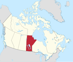
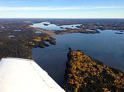
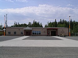
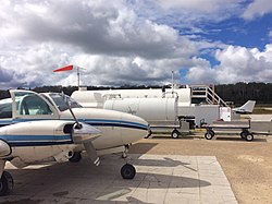
Community Airport name PU PR MI AOE [ A] Operator Elevation ICAO TC LID IATA Image Coordinates Arborg Arborg Airport PU Arborg Bifrost Airport Commission 765 ft (233 m) CJU6 50°54′46″N 97°18′16″W / 50.91278°N 97.30444°W / 50.91278; -97.30444 (Arborg Airport ) Ashern Ashern Airport PU Ashern Airport Commission 976 ft (297 m) CJE7 51°09′31″N 98°19′55″W / 51.15861°N 98.33194°W / 51.15861; -98.33194 (Ashern Airport ) Bakers Narrows Flin Flon/Bakers Narrows Water Aerodrome PU Bakers Narrows Lodge 965 ft (294 m) CFF8 54°40′43″N 101°39′37″W / 54.67861°N 101.66028°W / 54.67861; -101.66028 (Flin Flon/Bakers Narrows Water Aerodrome ) Berens River Berens River Airport PU Government of Manitoba 729 ft (222 m) CYBV YBV 52°21′32″N 97°01′06″W / 52.35889°N 97.01833°W / 52.35889; -97.01833 (Berens River Airport ) Bissett Bissett Water Aerodrome PU Blue Water Aviation 824 ft (251 m) CJY6 51°01′00″N 95°41′00″W / 51.01667°N 95.68333°W / 51.01667; -95.68333 (Bissett Water Aerodrome ) Bloodvein First Nation Bloodvein River Airport PU Government of Manitoba 729 ft (222 m) CZTA YDV 51°47′04″N 96°41′32″W / 51.78444°N 96.69222°W / 51.78444; -96.69222 (Bloodvein River Airport ) Brandon Brandon Municipal Airport PU 15 [ 5] City of Brandon 1,343 ft (409 m) CYBR YBR 49°54′36″N 99°57′07″W / 49.91000°N 99.95194°W / 49.91000; -99.95194 (Brandon Airport ) Brochet Brochet Airport PU Government of Manitoba 1,131 ft (345 m) CYBT YBT 57°53′22″N 101°40′45″W / 57.88944°N 101.67917°W / 57.88944; -101.67917 (Brochet Airport ) Carman Carman/Friendship Field Airport PR R. Diemert 882 ft (269 m) CJB2 49°29′29″N 98°01′07″W / 49.49139°N 98.01861°W / 49.49139; -98.01861 (Carman/Friendship Field Airport ) Carman Carman (South) Airport PU Carman/Dufferin Airport Commission 876 ft (267 m) CJS7 49°28′49″N 98°00′54″W / 49.48028°N 98.01500°W / 49.48028; -98.01500 (Carman (South) Airport ) Churchill Churchill Airport PU Transport Canada 96 ft (29 m) CYYQ YYQ 58°44′26″N 94°04′00″W / 58.74056°N 94.06667°W / 58.74056; -94.06667 (Churchill Airport ) Churchill Churchill (Hudson Bay Helicopters) Heliport PR Hudson Bay Helicopters 20 ft (6.1 m) CHB2 58°45′59″N 94°10′04″W / 58.76639°N 94.16778°W / 58.76639; -94.16778 (Churchill (Hudson Bay Helicopters) Heliport ) Churchill Churchill Water Aerodrome PU Wings over Kississing 46 ft (14 m) CJJ7 58°42′00″N 94°03′00″W / 58.70000°N 94.05000°W / 58.70000; -94.05000 (Churchill Water Aerodrome ) Cooks Creek Cooks Creek Aerodrome PR Thomas Stoyka 785 ft (239 m) CCC3 50°01′55″N 96°43′58″W / 50.03194°N 96.73278°W / 50.03194; -96.73278 (Cooks Creek Aerodrome ) Cross Lake Cross Lake (Charlie Sinclair Memorial) Airport PU Government of Manitoba 706 ft (215 m) CYCR YCR 54°36′39″N 97°45′37″W / 54.61083°N 97.76028°W / 54.61083; -97.76028 (Cross Lake (Charlie Sinclair Memorial) Airport ) Crystal City Crystal City-Pilot Mound/Louise Municipal Airport PR Municipality of Crystal City 1,525 ft (465 m) CKZ6 49°08′50″N 98°52′51″W / 49.14722°N 98.88083°W / 49.14722; -98.88083 (Crystal City-Pilot Mound/Louise Municipal Airport ) Dauphin Lt. Col W.G. (Billy) Barker VC Airport RCAF Station Dauphin )PU Dauphin Regional Airport Authority 999 ft (304 m) CYDN YDN 51°06′03″N 100°03′09″W / 51.10083°N 100.05250°W / 51.10083; -100.05250 (Dauphin (Lt. Col W.G. (Billy) Barker, VC Airport) ) Deloraine Deloraine Airport PU Deloraine Flying Club 1,686 ft (514 m) CJJ4 49°09′02″N 100°30′02″W / 49.15056°N 100.50056°W / 49.15056; -100.50056 (Deloraine Airport ) Easterville Easterville Airport PU Government of Manitoba 881 ft (269 m) CKM6 53°06′31″N 99°47′52″W / 53.10861°N 99.79778°W / 53.10861; -99.79778 (Easterville Airport ) Elk Island Elk Island Airport PU Elk Island Lodge 625 ft (191 m) CKZ3 54°40′14″N 94°08′44″W / 54.67056°N 94.14556°W / 54.67056; -94.14556 (Elk Island Airport ) Erickson Erickson Municipal Airport PU Erikson Flying Club 2,114 ft (644 m) CKQ6 50°29′58″N 99°53′52″W / 50.49944°N 99.89778°W / 50.49944; -99.89778 (Erickson Municipal Airport ) Fisher Branch Fisher Branch Airport PR A. Gulay 825 ft (251 m) CKX4 51°05′00″N 97°29′00″W / 51.08333°N 97.48333°W / 51.08333; -97.48333 (Fisher Branch Airport ) Flin Flon Flin Flon Airport PU City of Flin Flon 998 ft (304 m) CYFO YFO 54°40′41″N 101°40′54″W / 54.67806°N 101.68167°W / 54.67806; -101.68167 (Flin Flon Airport ) Flin Flon Flin Flon/Channing Water Aerodrome PU Wings Over Kississing 957 ft (292 m) CJK8 54°45′00″N 101°50′00″W / 54.75000°N 101.83333°W / 54.75000; -101.83333 (Flin Flon/Channing Water Aerodrome ) Fraserwood Fraserwood/Tribble Ranch Field Aerodrome PR Joachim De Smedt 861 ft (262 m) CTR8 50°35′33″N 97°17′59″W / 50.59250°N 97.29972°W / 50.59250; -97.29972 (Fraserwood/Tribble Ranch Field Aerodrome ) Gillam Gillam Airport PU Town of Gillam 476 ft (145 m) CYGX YGX 56°21′27″N 94°42′38″W / 56.35750°N 94.71056°W / 56.35750; -94.71056 (Gillam Airport ) Gillam Gillam Water Aerodrome PU Gilliam Air Services 470 ft (140 m) CJP8 56°21′14″N 94°39′26″W / 56.35389°N 94.65722°W / 56.35389; -94.65722 (Gillam Water Aerodrome ) Gimli Gimli Industrial Park Airport PU Rural Municipality of Gimli 752 ft (229 m) CYGM YGM 50°37′41″N 97°02′36″W / 50.62806°N 97.04333°W / 50.62806; -97.04333 (Gimli Industrial Park Airport ) Gladstone Gladstone Aerodrome PU Municipality of WestLake-Gladstone 900 ft (270 m) CJR5 50°09′49″N 98°56′33″W / 50.16361°N 98.94250°W / 50.16361; -98.94250 (Gladstone Airport ) Glenboro Glenboro Airport PU Glenboro Municipal Airport Commission 1,240 ft (380 m) CJJ2 49°33′00″N 99°20′00″W / 49.55000°N 99.33333°W / 49.55000; -99.33333 (Glenboro Airport ) Gods Lake Gods Lake Airport PU Gods Lake Haven 605 ft (184 m) CJB6 54°46′45″N 93°43′01″W / 54.77917°N 93.71694°W / 54.77917; -93.71694 (Gods Lake Airport ) Gods Lake Narrows Gods Lake Narrows Airport PU Government of Manitoba 617 ft (188 m) CYGO YGO 54°33′30″N 94°29′27″W / 54.55833°N 94.49083°W / 54.55833; -94.49083 (Gods Lake Narrows Airport ) Grand Rapids Grand Rapids Aerodrome PR Manitoba Hydro 861 ft (262 m) CJV8 53°10′21″N 99°19′23″W / 53.17250°N 99.32306°W / 53.17250; -99.32306 (Grand Rapids Aerodrome ) Gunisao Lake Gunisao Lake Airport PR Budd's Gunisao Lake Lodge 886 ft (270 m) CJK2 53°31′12″N 96°22′16″W / 53.52000°N 96.37111°W / 53.52000; -96.37111 (Gunisao Lake Airport ) Gunisao Lake Gunisao Lake Water Aerodrome PR Budd's Gunisao Lake Lodge 866 ft (264 m) CJW8 53°31′00″N 96°22′00″W / 53.51667°N 96.36667°W / 53.51667; -96.36667 (Gunisao Lake Water Aerodrome ) Homewood Homewood Airport PR R. Hill 815 ft (248 m) CJT8 49°30′33″N 97°51′02″W / 49.50917°N 97.85056°W / 49.50917; -97.85056 (Homewood Airport ) Ilford Ilford Airport PU Government of Manitoba 643 ft (196 m) CZBD ILF 56°03′41″N 95°36′50″W / 56.06139°N 95.61389°W / 56.06139; -95.61389 (Ilford Airport ) Island Lake Island Lake Airport PU Government of Manitoba 772 ft (235 m) CYIV YIV 53°51′26″N 94°39′13″W / 53.85722°N 94.65361°W / 53.85722; -94.65361 (Island Lake Airport ) Jenpeg Jenpeg Airport PR Manitoba Hydro 729 ft (222 m) CZJG ZJG 54°31′08″N 98°02′46″W / 54.51889°N 98.04611°W / 54.51889; -98.04611 (Jenpeg Airport ) Kaskattama River Kaskattama River Aerodrome PR Kaskattama Safari Adventures 30 ft (9.1 m) CAS3 57°02′29″N 90°06′46″W / 57.04139°N 90.11278°W / 57.04139; -90.11278 (Kaskattama River Aerodrome ) Kelsey Kelsey Airport PR Manitoba Hydro 615 ft (187 m) CZEE KES 56°02′15″N 96°30′21″W / 56.03750°N 96.50583°W / 56.03750; -96.50583 (Kelsey Airport ) Killarney Killarney Municipal Airport PR Killarney Flying Club 1,680 ft (510 m) CJS5 49°09′06″N 99°41′25″W / 49.15167°N 99.69028°W / 49.15167; -99.69028 (Killarney Municipal Airport ) Knee Lake Knee Lake Airport PR North Star Transit 625 ft (191 m) CJT3 54°54′55″N 94°47′53″W / 54.91528°N 94.79806°W / 54.91528; -94.79806 (Knee Lake Airport ) Knee Lake Knee Lake Water Aerodrome PR North Star Resort 577 ft (176 m) CKW8 54°53′27″N 94°48′27″W / 54.89083°N 94.80750°W / 54.89083; -94.80750 (Knee Lake Water Aerodrome ) Lac Brochet Lac Brochet Airport PU Government of Manitoba 1,211 ft (369 m) CZWH XLB 58°36′52″N 101°28′08″W / 58.61444°N 101.46889°W / 58.61444; -101.46889 (Lac Brochet Airport ) Lac du Bonnet Bird River (Lac du Bonnet) Airport PU Tall Timber Aviation 950 ft (290 m) CJP7 50°23′48″N 95°44′06″W / 50.39667°N 95.73500°W / 50.39667; -95.73500 (Bird River (Lac du Bonnet) Airport ) Lac du Bonnet Bird River Water Aerodrome PU Tall Timber Aviation 836 ft (255 m) CJX6 50°24′00″N 95°45′00″W / 50.40000°N 95.75000°W / 50.40000; -95.75000 (Bird River Water Aerodrome ) Lac du Bonnet Lac du Bonnet Airport PU Lac du Bonnet Regional Airport Authority 850 ft (260 m) CYAX 50°17′40″N 96°00′36″W / 50.29444°N 96.01000°W / 50.29444; -96.01000 (Lac du Bonnet Airport ) Lac du Bonnet Lac du Bonnet (North) Water Aerodrome PU Adventure Air 836 ft (255 m) CJS9 50°17′00″N 96°00′00″W / 50.28333°N 96.00000°W / 50.28333; -96.00000 (Lac du Bonnet (North) Water Aerodrome ) Laurie River Laurie River Airport PR Manitoba Hydro 1,200 ft (370 m) CJC8 56°14′55″N 101°18′15″W / 56.24861°N 101.30417°W / 56.24861; -101.30417 (Laurie River Airport ) Leaf Rapids Leaf Rapids Airport PU Community of Leaf Rapids 959 ft (292 m) CYLR YLR 56°30′48″N 99°59′07″W / 56.51333°N 99.98528°W / 56.51333; -99.98528 (Leaf Rapids Airport ) Leaf Rapids Leaf Rapids Water Aerodrome PU Wings over Kississing 849 ft (259 m) CKA3 56°33′00″N 99°56′00″W / 56.55000°N 99.93333°W / 56.55000; -99.93333 (Leaf Rapids Water Aerodrome ) Little Churchill River Little Churchill River/Dunlop's Fly In Lodge Aerodrome PR Dunlop's Fly In Lodge 700 ft (210 m) CJN7 56°34′48″N 96°14′51″W / 56.58000°N 96.24750°W / 56.58000; -96.24750 (Little Churchill River Airport ) Little Grand Rapids Little Grand Rapids Airport PU Government of Manitoba 1,008 ft (307 m) CZGR ZGR 52°02′42″N 95°27′58″W / 52.04500°N 95.46611°W / 52.04500; -95.46611 (Little Grand Rapids Airport ) Lundar Lundar Airport PU Lundar Flying Club 830 ft (250 m) CKR4 50°42′12″N 98°03′24″W / 50.70333°N 98.05667°W / 50.70333; -98.05667 (Lundar Airport ) Lyncrest Winnipeg/Lyncrest Airport PU Springfield Flying Club 775 ft (236 m) CJL5 49°51′09″N 96°58′25″W / 49.85250°N 96.97361°W / 49.85250; -96.97361 (Winnipeg/Lyncrest Airport ) Lynn Lake Lynn Lake Airport PU YYL Airport Inc. 1,170 ft (360 m) CYYL YYL 56°51′50″N 101°04′34″W / 56.86389°N 101.07611°W / 56.86389; -101.07611 (Lynn Lake Airport ) Lynn Lake Lynn Lake (Eldon Lake) Water Aerodrome PU Transwest Air 1,100 ft (340 m) CKD3 56°49′02″N 101°01′07″W / 56.81722°N 101.01861°W / 56.81722; -101.01861 (Lynn Lake (Eldon Lake) Water Aerodrome ) MacDonald Macdonald Airport PU T.R. Bailey 840 ft (260 m) CJU3 50°05′47″N 98°30′03″W / 50.09639°N 98.50083°W / 50.09639; -98.50083 (Macdonald Airport ) MacGregor MacGregor Airfield PU Gordon MacDonald 950 ft (290 m) CKF6 49°58′03″N 98°45′37″W / 49.96750°N 98.76028°W / 49.96750; -98.76028 (MacGregor Airport ) Manitou Manitou Airport PU Manitou Flying Club 1,592 ft (485 m) CKG5 49°15′00″N 98°32′00″W / 49.25000°N 98.53333°W / 49.25000; -98.53333 (Manitou Airport ) Manto Sipi Cree Nation Gods River Airport PU Government of Manitoba 627 ft (191 m) CZGI ZGI 54°50′23″N 94°04′43″W / 54.83972°N 94.07861°W / 54.83972; -94.07861 (Gods River Airport ) Mathias Colomb First Nation Pukatawagan Airport PU Government of Manitoba 960 ft (290 m) CZFG XPK 55°44′57″N 101°15′59″W / 55.74917°N 101.26639°W / 55.74917; -101.26639 (Pukatawagan Airport ) McCreary McCreary Airport PU M. Slawinski 1,000 ft (300 m) CJR8 50°45′52″N 99°29′49″W / 50.76444°N 99.49694°W / 50.76444; -99.49694 (McCreary Airport ) McGavock Lake McGavock Lake Water Aerodrome PU Laurie River Lodge 1,100 ft (340 m) CKJ3 56°34′00″N 101°30′00″W / 56.56667°N 101.50000°W / 56.56667; -101.50000 (McGavock Lake Water Aerodrome ) Melita Melita Airport PU Viola Carr 1,475 ft (450 m) CJT5 49°15′42″N 101°00′50″W / 49.26167°N 101.01389°W / 49.26167; -101.01389 (Melita Airport ) Minnedosa Minnedosa Airport PR K. Kane 1,840 ft (560 m) CJU5 50°16′19″N 99°45′47″W / 50.27194°N 99.76306°W / 50.27194; -99.76306 (Minnedosa Airport ) Molson Lake Molson Lake Airport PU Norway House Cree Nation 750 ft (230 m) CKJ8 54°15′29″N 97°00′40″W / 54.25806°N 97.01111°W / 54.25806; -97.01111 (Molson Lake Airport ) Morden Morden Regional Aerodrome PU CANPASS [ 6] City of Morden 957 ft (292 m) CJA3 49°12′38″N 98°03′38″W / 49.21056°N 98.06056°W / 49.21056; -98.06056 (Morden Regional Aerodrome ) Neepawa Neepawa Airport PU Town of Neepawa 1,277 ft (389 m) CJV5 50°13′58″N 99°30′38″W / 50.23278°N 99.51056°W / 50.23278; -99.51056 (Neepawa Airport ) Nejanilini Lake Nejanilini Lake Airport PR The Lodge at Little Duck 964 ft (294 m) CYNN 59°29′07″N 97°46′52″W / 59.48528°N 97.78111°W / 59.48528; -97.78111 (Nejanilini Lake Airport ) North Seal River North Seal River Airport PR North Seal River Inc. 962 ft (293 m) CEG8 58°58′10″N 99°58′30″W / 58.96944°N 99.97500°W / 58.96944; -99.97500 (North Seal River Airport ) Norway House Norway House Airport PU Government of Manitoba 734 ft (224 m) CYNE YNE 53°57′30″N 97°50′39″W / 53.95833°N 97.84417°W / 53.95833; -97.84417 (Norway House Airport ) Norway House Norway House Water Aerodrome PU Molson Air 712 ft (217 m) CKY3 53°59′14″N 97°48′23″W / 53.98722°N 97.80639°W / 53.98722; -97.80639 (Norway House Water Aerodrome ) Nueltin Lake Nueltin Lake Airport PR Nueltin Fly-in Lodges 971 ft (296 m) CNL9 59°42′29″N 100°07′38″W / 59.70806°N 100.12722°W / 59.70806; -100.12722 (Nueltin Lake Airport ) Oak Hammock Marsh Oak Hammock Air Park Airport PU Terry Malley 755 ft (230 m) CAV9 50°08′16″N 97°03′41″W / 50.13778°N 97.06139°W / 50.13778; -97.06139 (Oak Hammock Air Park Airport ) Oxford House Oxford House Airport PU Government of Manitoba 663 ft (202 m) CYOH YOH 54°56′00″N 95°16′44″W / 54.93333°N 95.27889°W / 54.93333; -95.27889 (Oxford House Airport ) Pikwitonei Pikwitonei Airport PU Government of Manitoba 636 ft (194 m) CZMN PIW 55°35′22″N 97°09′49″W / 55.58944°N 97.16361°W / 55.58944; -97.16361 (Pikwitonei Airport ) Pine Dock Pine Dock Water Aerodrome PR Kitchi Airways 712 ft (217 m) CKT8 51°36′39″N 96°49′02″W / 51.61083°N 96.81722°W / 51.61083; -96.81722 (Pine Dock Water Aerodrome ) Pipestone Reston/R.M. of Pipestone Airport PU Rural Municipality of Pipestone 1,488 ft (454 m) CRP2 49°34′50″N 101°03′10″W / 49.58056°N 101.05278°W / 49.58056; -101.05278 (Reston/R.M. of Pipestone Airport ) Poplar River First Nation Poplar River Airport PU Government of Manitoba 725 ft (221 m) CZNG XPP 53°59′47″N 97°16′25″W / 53.99639°N 97.27361°W / 53.99639; -97.27361 (Poplar River Airport ) Portage la Prairie Portage (District General Hospital) Heliport PR Southern Health Portage District General Hospital 857 ft (261 m) CPO2 49°57′59″N 98°16′56″W / 49.96639°N 98.28222°W / 49.96639; -98.28222 (Portage (District General Hospital) Heliport ) Portage la Prairie Portage la Prairie (North) Airport PU Portage Flying Club 860 ft (260 m) CJZ2 49°59′33″N 98°18′11″W / 49.99250°N 98.30306°W / 49.99250; -98.30306 (Portage la Prairie (North) Airport ) Portage la Prairie Portage la Prairie/Southport Airport PU Southport Aerospace Centre Inc. 884 ft (269 m) CYPG YPG 49°54′11″N 98°16′26″W / 49.90306°N 98.27389°W / 49.90306; -98.27389 (Portage la Prairie/Southport Airport ) Red Sucker Lake Red Sucker Lake Airport PU Government of Manitoba 747 ft (228 m) CYRS YRS 54°10′02″N 93°33′26″W / 54.16722°N 93.55722°W / 54.16722; -93.55722 (Red Sucker Lake Airport ) Red Sucker Lake Red Sucker Lake Water Aerodrome PU Red Sucker Lake Air Service 720 ft (220 m) CKT4 54°09′17″N 93°33′48″W / 54.15472°N 93.56333°W / 54.15472; -93.56333 (Red Sucker Lake Water Aerodrome ) Riding Mountain House Riding Mountain National Park ) Riding Mountain Airport PR Roland Kuip 1,016 ft (310 m) CRM2 50°34′25″N 99°21′41″W / 50.57361°N 99.36139°W / 50.57361; -99.36139 (Riding Mountain Airport ) Riverton Riverton Airport PU Town of Riverton 725 ft (221 m) CKG2 50°58′18″N 97°00′40″W / 50.97167°N 97.01111°W / 50.97167; -97.01111 (Riverton Airport ) Roblin Roblin Airport PU Roblin Airport Commission 1,821 ft (555 m) CKB7 51°14′04″N 101°23′33″W / 51.23444°N 101.39250°W / 51.23444; -101.39250 (Roblin Airport ) Roland Roland (Graham Field) Airport PR J.A. Graham 865 ft (264 m) CKD7 49°24′30″N 97°59′26″W / 49.40833°N 97.99056°W / 49.40833; -97.99056 (Roland (Graham Field) Airport ) Rosenort Rosenort Airport PR H. Thiesen 779 ft (237 m) CKJ2 49°27′11″N 97°25′21″W / 49.45306°N 97.42250°W / 49.45306; -97.42250 (Rosenort Airport ) Russell Russell Airport PU Russell Flying Club 1,824 ft (556 m) CJW5 50°45′57″N 101°17′42″W / 50.76583°N 101.29500°W / 50.76583; -101.29500 (Russell Airport ) St. Andrews Winnipeg/St. Andrews Airport PU St. Andrews Airport Inc. 759 ft (231 m) CYAV 50°03′23″N 97°01′57″W / 50.05639°N 97.03250°W / 50.05639; -97.03250 (Winnipeg/St. Andrews Airport ) Ste. Anne Ste-Anne (Hospital) Heliport PR Santé Sud-Southern Health 831 ft (253 m) CHS6 49°40′04″N 96°38′50″W / 49.66778°N 96.64722°W / 49.66778; -96.64722 (Ste-Anne (Hospital Heliport ) St. François Xavier St. François Xavier Airport PU Doug Brown 798 ft (243 m) CKA8 49°55′28″N 97°32′56″W / 49.92444°N 97.54889°W / 49.92444; -97.54889 (St. François Xavier Airport ) St-Pierre-Jolys St-Pierre-Jolys (Carl's Field) Aerodrome PR Mike Gauthier 824 ft (251 m) CPJ6 49°26′10″N 96°55′37″W / 49.43611°N 96.92694°W / 49.43611; -96.92694 (St-Pierre-Jolys (Carl's Field) Aerodrome ) St. Theresa Point First Nation St. Theresa Point Airport PU Government of Manitoba 766 ft (233 m) CYST YST 53°50′44″N 94°51′07″W / 53.84556°N 94.85194°W / 53.84556; -94.85194 (St. Theresa Point Airport ) Sand Lakes Provincial Park Big Sand Lake Airport PU Big Sand Lake Lodge 1,050 ft (320 m) CJQ9 57°37′10″N 99°52′31″W / 57.61944°N 99.87528°W / 57.61944; -99.87528 (Big Sand Lake Airport ) Selkirk Selkirk Airport PR Riverside Aircraft Maintenance 747 ft (228 m) CKL2 50°10′20″N 96°52′20″W / 50.17222°N 96.87222°W / 50.17222; -96.87222 (Selkirk Airport ) Selkirk Selkirk Water Aerodrome PR Riverside Aircraft Maintenance 735 ft (224 m) CKC5 50°10′00″N 96°52′00″W / 50.16667°N 96.86667°W / 50.16667; -96.86667 (Selkirk Water Aerodrome ) Shamattawa First Nation Shamattawa Airport PU Government of Manitoba 296 ft (90 m) CZTM ZTM 55°51′56″N 92°04′53″W / 55.86556°N 92.08139°W / 55.86556; -92.08139 (Shamattawa Airport ) Shoal Lake Shoal Lake Airport PU Shoal Lake Airport Authority 1,836 ft (560 m) CKL5 50°27′27″N 100°36′31″W / 50.45750°N 100.60861°W / 50.45750; -100.60861 (Shoal Lake Airport ) Shoal Lake Shoal Lake Water Aerodrome PU Shoal Lake Flying Club 1,800 ft (550 m) CKB9 50°26′00″N 100°36′00″W / 50.43333°N 100.60000°W / 50.43333; -100.60000 (Shoal Lake Water Aerodrome ) Silver Falls Silver Falls Airport PR Blue Water Aviation 775 ft (236 m) CKB8 50°30′00″N 96°05′53″W / 50.50000°N 96.09806°W / 50.50000; -96.09806 (Silver Falls Airport ) Silver Falls Silver Falls Water Aerodrome PU Blue Water Aviation Services 755 ft (230 m) CKJ5 50°30′00″N 96°06′00″W / 50.50000°N 96.10000°W / 50.50000; -96.10000 (Silver Falls Water Aerodrome ) Snow Lake Snow Lake Airport PU Town of Snow Lake 993 ft (303 m) CJE4 54°53′50″N 99°49′08″W / 54.89722°N 99.81889°W / 54.89722; -99.81889 (Snow Lake Airport ) Snow Lake Snow Lake (Gogal) Heliport PR Brad Gogal 974 ft (297 m) CSN5 52°54′48″N 100°00′59″W / 52.91333°N 100.01639°W / 52.91333; -100.01639 (Snow Lake (Gogal) Heliport ) Snow Lake Snow Lake Water Aerodrome PU Gogal Air Service 890 ft (270 m) CKM5 54°53′00″N 100°02′00″W / 54.88333°N 100.03333°W / 54.88333; -100.03333 (Snow Lake Water Aerodrome ) Somerset Somerset Aerodrome PU Rural Municipality of Lorne 1,563 ft (476 m) CKC8 49°24′01″N 98°41′33″W / 49.40028°N 98.69250°W / 49.40028; -98.69250 (Somerset Airport ) Souris Souris Glenwood Industrial Air Park PU Souris & Glenwood Airport Commission 1,480 ft (450 m) CJX5 49°38′00″N 100°12′00″W / 49.63333°N 100.20000°W / 49.63333; -100.20000 (Souris Glenwood Industrial Air Park ) South Indian Lake South Indian Lake Airport PU Government of Manitoba 951 ft (290 m) CZSN XSI 56°47′34″N 98°54′26″W / 56.79278°N 98.90722°W / 56.79278; -98.90722 (South Indian Lake Airport ) Starbuck Starbuck Aerodrome PU Winnipeg Flying Club 785 ft (239 m) CKJ7 49°42′22″N 97°40′50″W / 49.70611°N 97.68056°W / 49.70611; -97.68056 (Starbuck Aerodrome ) Steinbach Steinbach Airport PU City of Steinbach 849 ft (259 m) CJB3 49°33′03″N 96°40′50″W / 49.55083°N 96.68056°W / 49.55083; -96.68056 (Steinbach Airport ) Steinbach Steinbach (South) Airport PR Harv's Air Service 888 ft (271 m) CKK7 49°29′38″N 96°41′56″W / 49.49389°N 96.69889°W / 49.49389; -96.69889 (Steinbach (South) Airport ) Strathclair Strathclair Airport PU Strathclair Airport Commission 1,875 ft (572 m) CJY5 50°23′46″N 100°25′31″W / 50.39611°N 100.42528°W / 50.39611; -100.42528 (Strathclair Airport ) Swan River Swan River Airport PU Swan Valley Airport Commission 1,100 ft (340 m) CZJN ZJN 52°07′17″N 101°14′04″W / 52.12139°N 101.23444°W / 52.12139; -101.23444 (Swan River Airport ) Swan River Swan River/PVA1 Aerodrome PR Prairie Valley Airspray 1,420 ft (430 m) CSR2 52°10′06″N 101°35′28″W / 52.16833°N 101.59111°W / 52.16833; -101.59111 (Swan River/PVA1 Aerodrome ) Tadoule Lake Tadoule Lake Airport PU Government of Manitoba 921 ft (281 m) CYBQ XTL 58°42′22″N 98°30′44″W / 58.70611°N 98.51222°W / 58.70611; -98.51222 (Tadoule Lake Airport ) The Pas The Pas Airport PU Town of The Pas 888 ft (271 m) CYQD YQD 53°58′17″N 101°05′28″W / 53.97139°N 101.09111°W / 53.97139; -101.09111 (The Pas Airport ) The Pas The Pas/Grace Lake Airport PU Beaver Air Services 873 ft (266 m) CJR3 53°49′35″N 101°12′19″W / 53.82639°N 101.20528°W / 53.82639; -101.20528 (The Pas/Grace Lake Airport ) Thicket Portage Thicket Portage Airport PU Government of Manitoba 679 ft (207 m) CZLQ YTD 55°19′08″N 97°42′28″W / 55.31889°N 97.70778°W / 55.31889; -97.70778 (Thicket Portage Airport ) Thompson Thompson Airport PU Thompson Regional Airport Authority 735 ft (224 m) CYTH YTH 55°48′12″N 97°51′45″W / 55.80333°N 97.86250°W / 55.80333; -97.86250 (Thompson Municipal Airport ) Thompson Thompson Heliport PR Manitoba Hydro 702 ft (214 m) CKM7 55°42′27″N 97°53′29″W / 55.70750°N 97.89139°W / 55.70750; -97.89139 (Thompson Heliport ) Thompson Thompson Water Aerodrome PU Wings Over Kississing 596 ft (182 m) CKD6 55°45′00″N 97°50′00″W / 55.75000°N 97.83333°W / 55.75000; -97.83333 (Thompson Water Aerodrome ) Treherne Treherne Airport PU Boyne Valley Aviation 1,200 ft (370 m) CKU2 49°37′52″N 98°39′59″W / 49.63111°N 98.66639°W / 49.63111; -98.66639 (Treherne Airport ) Treherne Treherne (South Norfolk Airpark) Aerodrome PU Municipality of Norfolk Treherne 1,169 ft (356 m) CTN6 49°39′35″N 98°39′55″W / 49.65972°N 98.66528°W / 49.65972; -98.66528 (Treherne (South Norfolk Airpark) ) Utik Lake Utik Lake/Dennis G Punches Field Aerodrome PR North Haven Resort 675 ft (206 m) CDP3 55°17′26″N 95°48′11″W / 55.29056°N 95.80306°W / 55.29056; -95.80306 (Utik Lake/Dennis G Punches Field Aerodrome ) Virden Virden (Gabrielle Farm) Airport PU D. Gabrielle 1,440 ft (440 m) CKR7 49°47′05″N 100°57′22″W / 49.78472°N 100.95611°W / 49.78472; -100.95611 (Virden (Gabrielle Farm) Airport ) Virden Virden/R.J. (Bob) Andrew Field Regional Aerodrome PU Town of Virden 1,465 ft (447 m) CYVD 49°52′42″N 100°54′53″W / 49.87833°N 100.91472°W / 49.87833; -100.91472 (Virden/R.J. (Bob) Andrew Field Regional Aerodrome ) Wheatland Wheatland/Spud Plains Aerodrome PR Paul Adriaansen 1,542 ft (470 m) CRS5 49°59′29″N 100°18′48″W / 49.99139°N 100.31333°W / 49.99139; -100.31333 (Wheatland/Spud Plains Aerodrome ) Winkler Winkler Aerodrome PU CANPASS [ 7] City of Winkler 890 ft (270 m) CKZ7 49°10′14″N 97°55′12″W / 49.17056°N 97.92000°W / 49.17056; -97.92000 (Winkler Aerodrome ) Winnipeg CFB Winnipeg MI AOE/M [ 8] DND 784 ft (239 m) CYWG YWG 49°54′36″N 97°14′24″W / 49.91000°N 97.24000°W / 49.91000; -97.24000 (CFB Winnipeg ) Winnipeg Winnipeg James Armstrong Richardson International Airport PU AOE [ 9] [ 10] Winnipeg Airports Authority 784 ft (239 m) CYWG YWG 49°54′36″N 97°14′24″W / 49.91000°N 97.24000°W / 49.91000; -97.24000 (Winnipeg James Armstrong Richardson International Airport ) Winnipeg Winnipeg (City of Winnipeg) Heliport PR City of Winnipeg 767 ft (234 m) CWG2 49°54′01″N 97°05′44″W / 49.90028°N 97.09556°W / 49.90028; -97.09556 (Winnipeg (City of Winnipeg) Heliport ) Winnipeg Winnipeg (Health Sciences Centre) Heliport PR Winnipeg Regional Health Authority 880 ft (270 m) CWH7 49°54′15″N 97°09′23″W / 49.90417°N 97.15639°W / 49.90417; -97.15639 (Winnipeg (Health Sciences Centre) Heliport ) Woodland Woodland/Kendall Farm Aerodrome PR Timothy Todd Kendall 860 ft (260 m) CWL4 50°15′18″N 97°36′12″W / 50.25500°N 97.60333°W / 50.25500; -97.60333 (Woodland/Kendall Farm Aerodrome ) Wrong Lake Wrong Lake Airport PR Big Eddies North Country Lodge 840 ft (260 m) CJG4 52°36′56″N 96°11′06″W / 52.61556°N 96.18500°W / 52.61556; -96.18500 (Wrong Lake Airport ) York Factory First Nation York Landing Airport PU Government of Manitoba 623 ft (190 m) CZAC ZAC 56°05′23″N 96°05′27″W / 56.08972°N 96.09083°W / 56.08972; -96.09083 (York Landing Airport ) Zhoda Zhoda Airport PU D. Kiansky 950 ft (290 m) CKA4 49°16′51″N 96°30′04″W / 49.28083°N 96.50111°W / 49.28083; -96.50111 (Zhoda Airport )