Rosenort, Manitoba

Last updated

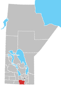
Rosenort, Manitoba, is an unincorporated community recognized as a local urban district [1] within the Rural Municipality of Morris about 17 kilometres from the town of Morris and about 47 kilometres south of Winnipeg.

Contents

Rosenort is named after a Mennonite village in Imperial Russia, meaning 'Rose Garden' in German. A post office was located on 32-5-1E and was opened in 1899. Rosenort has a K-12 school that is a part of the Red River Valley School Division.

Rosenort was established in 1874 after David Klassen, a Kleine Gemeinde Mennonite delegate and signer of the Privilegium decided to establish a settlement along what is now called the Morris River rather than settle in the nearby East Reserve. The area became known the Scratching River Settlement. The community was settled by 31 Plautdietsch-speaking families of Mennonites of Dutch descent, who came from the Molotschna colony in the Russian Empire, whose descendants continue to have a significant presence in the community.
Demographics

In the 2021 Census of Population conducted by Statistics Canada, Rosenort had a population of 798 living in 275 of its 283 total private dwellings, a change of

Notable people

Related Research Articles

Grunthal is a local urban district in the Rural Municipality of Hanover, Manitoba, located 24 kilometers southwest of Steinbach, and about 50 minutes south of Winnipeg. It had a population of 1,680 in 2016.

Austin is an unincorporated community recognized as a local urban district in western Manitoba on the Trans-Canada Highway about 110 km (68 mi) west of Winnipeg. It is part of the Municipality of North Norfolk. It sits at the western edge of the table-flat Portage Plains, but to the south and west is surrounded by miles of low wooded hills known as the Carberry sandhills. The biggest attraction is the annual rodeo and Threshermen's Reunion held at the Manitoba Agricultural Museum the last four business days of July.

<span class="mw-page-title-main">Rural Municipality of Hanover</span> Rural municipality in Manitoba, Canada

The Rural Municipality of Hanover is a rural municipality (RM) in southeastern Manitoba, Canada, located southeast of Winnipeg in Division No. 2.

Plum Coulee is an unincorporated urban community in the Municipality of Rhineland within the Canadian province of Manitoba that held town status prior to January 1, 2015. It is west of Altona, one hour southwest of Winnipeg and 22 kilometres from the United States border. It is also the former home to the Plum Coulee Xpress hockey club. It has an artificial beach located in town called Sunset Beach.

<span class="mw-page-title-main">Morris, Manitoba</span> Town in Manitoba, Canada

Morris is a small town in the Pembina Valley region of Manitoba, Canada, located 51 km south of Winnipeg and 42 km north of Emerson. Morris is home to 1,885 people (2016). Named after Alexander Morris, the second Lieutenant Governor of Manitoba.

Grandview is an unincorporated urban community in the Grandview Municipality within the Canadian province of Manitoba that held town status prior to January 1, 2015. It is located 45 kilometres west of the City of Dauphin along the Valley River.

<span class="mw-page-title-main">Gretna, Manitoba</span>

Gretna is an unincorporated urban community in the Municipality of Rhineland within the Canadian province of Manitoba that held town status prior to January 1, 2015. Just north of the Canada - United States border on PTH 30, Gretna had a population of 541 in 2016. It is bordered by Pembina County, North Dakota. The nearest American community to Gretna is Neche, North Dakota.

Birch River is a local urban district in the northern portion of the Rural Municipality of Mountain, Manitoba, Canada. It is around 40 kilometers from Swan River, Manitoba.

Mitchell is a local urban district and population centre located in the Rural Municipality of Hanover, Manitoba, Canada. It is located three kilometers west of Steinbach, Manitoba along Provincial Highway 52. The community has a population of 3,136 as of 2016, making Mitchell the 19th largest population centre in Manitoba.

<span class="mw-page-title-main">Landmark, Manitoba</span> Unincorporated community

Landmark, originally called Prairie Rose, is a local urban district in the Rural Municipality of Taché, Manitoba, Canada, located about 30 km (18.6 mi) southeast of the provincial capital, Winnipeg. Landmark's population as of the 2021 census was 1,326. The community lies on the longitudinal centre of Canada.

Arran is a special service area in the Canadian province of Saskatchewan within the Rural Municipality of Livingston No. 331 and Census Division No. 9. It held village status between 1916 and 2022.

Waldeck is a village in the Canadian province of Saskatchewan within the Rural Municipality of Excelsior No. 166 and Census Division No. 7. Waldeck is 18 kilometres (11 mi) northeast of the city of Swift Current on the Trans-Canada Highway. Waldeck is situated in the Swift Current River Valley.

Oakville, Manitoba is an unincorporated community recognized as a local urban district in Manitoba. It is located in the Rural Municipality of Portage la Prairie. Oakville is 56 km (35 mi) west of Winnipeg at the intersection of PTH 13 and PR 331.

La Rivière is an unincorporated community recognized as a local urban district in Manitoba, Canada. It is located 11 km west of the town of Manitou on Highway 3. It is located in the Municipality of Pembina. La Riviere was founded 1886 by Metis Franco-Manitobans, however it is predominantly English speaking. It has a post office, credit union, a five-lift ski hill, a construction company, and a seasonal drive-in restaurant. It has a full service campground at the edge of the community that backs onto the Pembina River. La Riviere was previously home to Hamm-tone Guitars and Mandolins and the Pembina Valley Guitar Building Course.

<span class="mw-page-title-main">Waldheim, Saskatchewan</span> Town in Saskatchewan, Canada

Waldheim is a town of 1,035 residents in the Rural Municipality of Laird No. 404, in the Canadian province of Saskatchewan, 57 kilometres (35 mi) north of Saskatoon. Waldheim is located on Highway 312 in central Saskatchewan, the "Heart of the Old North-Wes". Fort Carlton, Batoche, Battle of Fish Creek, and Seager Wheeler's Maple Grove Farm are all near Waldheim.

Richer is a local urban district in southeast Manitoba, almost 60 kilometres (37 mi) east south-east of Winnipeg. It is located in the Rural Municipality of Ste. Anne, at the junction of the Trans-Canada Highway and Provincial Road 302.

<span class="mw-page-title-main">Rural Municipality of Mountain</span> Rural municipality in Manitoba, Canada

The Rural Municipality of Mountain is a rural municipality (RM) in the Parkland Region of Manitoba, western Canada.

<span class="mw-page-title-main">Ninette, Manitoba</span> Local urban district in Manitoba, Canada

Ninette is an unincorporated community recognized as a local urban district located in Manitoba, Canada at the north end of Pelican Lake. It is located in the Rural Municipality of Prairie Lakes. Ninette has many small businesses, and is known locally for its wide range of sports facilities. In the summer, activities such as boating, fishing, and hunting are offered, while snowmobiling and ice fishing are offered during the wintertime.

<span class="mw-page-title-main">Blumenort, Manitoba</span> Local urban district in Manitoba, Canada

Blumenort is a local urban district in the Canadian province of Manitoba. It is located in the Rural Municipality of Hanover, 4.1 kilometres north of the city of Steinbach. It was founded in 1874 by Plautdietsch-speaking Mennonite farmers from the Russian Empire. Today, its economy is based on agriculture and the service industry.

<span class="mw-page-title-main">Rural Municipality of La Broquerie</span> Rural municipality in Manitoba, Canada

La Broquerie is a rural municipality in the province of Manitoba in Western Canada, located in the southeastern part of the province, just south and east of the city of Steinbach.

References

  1. "Local Urban Districts Regulation". Government of. April 23, 2016. Retrieved April 24, 2016.
  2. "Population and dwelling counts: Canada and designated places". Statistics Canada. February 9, 2022. Retrieved September 3, 2022.

49°27′31″N97°26′03″W / 49.45861°N 97.43417°W / 49.45861; -97.43417