Reinfeld, Manitoba

Last updated

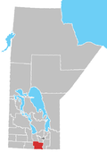
Reinfeld is an Unincorporated Urban Community (UUC) in the Rural Municipality of Stanley in the Pembina Valley region of Manitoba, Canada, about one km east of Winkler. Mainly a Mennonite community, its relative vicinity to Winkler makes it a possible candidate to become a suburb in the future.
History

In the 1880 Village Census of the West Reserve, Reinfeld was populated by 12 males and 1 female. [1] By the 1890s it was a well developed village. [2] Because of its proximity to Winkler, Manitoba it has seen rapid growth of late.

Related Research Articles

<span class="mw-page-title-main">Emerson (electoral district)</span> Defunct provincial electoral district in Manitoba, Canada

Emerson is a former provincial electoral division in the Canadian province of Manitoba. It was created by redistribution in 1879 and eliminated prior the 2019 general election. Most of its territory was redistributed to the newly created Borderland riding. The eastern part of the former riding was transferred to the La Verendrye riding.

<span class="mw-page-title-main">Winkler, Manitoba</span> City in Manitoba, Canada

Winkler is a city in Manitoba, Canada with a population of 13,745, making it the 4th largest city in Manitoba, as of the 2021 Canadian census. It is located in southern Manitoba, surrounded by the Rural Municipality of Stanley, about one hundred kilometres southwest of Winnipeg and thirteen kilometres east of its "twin city" Morden. As the largest city in the Pembina Valley, it serves as a regional hub for commerce, agriculture and industry. Winkler is the third-fastest growing city in the province after Morden and Steinbach.

<span class="mw-page-title-main">Pembina Valley Region</span> District in Manitoba, Canada

The Pembina Valley is an informal geographic region of the Canadian province of Manitoba. It is named for its major geographical feature, the Pembina Valley, which runs through the southwestern part of the region.

<span class="mw-page-title-main">Canadian Mennonite University</span> Private university in Manitoba, Canada

Canadian Mennonite University (CMU) is a private Mennonite university located in Winnipeg, Manitoba, Canada, with an enrolment of 1,607 students. The university was chartered in 1999 with a Shaftesbury campus in southwest Winnipeg, as well as Menno Simons College and a campus at the University of Winnipeg.

<span class="mw-page-title-main">Altona, Manitoba</span> Place in Manitoba, Canada

Altona is a town in southern Manitoba, Canada, about 100 km south-west of Winnipeg and 158 km north of Grand Forks, North Dakota. The population at the 2011 Census was 4,123 residents. Old Altona was founded in 1880 by Plautdietsch-speaking Mennonites from the Russian Empire. It is surrounded by the Municipality of Rhineland. Much of the surrounding area is devoted to farming and agriculture-based business.

Roseau River Anishinabe First Nation is a First Nation in southern Manitoba, Canada, situated around the Roseau River.

Schanzenfeld is a small hanlet community in the Rural Municipality of Stanley, Manitoba, Canada, located about 2 miles south of the City of Winkler. Largely a Mennonite community.

<span class="mw-page-title-main">Gretna, Manitoba</span>

Gretna is an unincorporated urban community in the Municipality of Rhineland within the Canadian province of Manitoba that held town status prior to January 1, 2015. Just north of the Canada - United States border on PTH 30, Gretna had a population of 541 in 2016.

<span class="mw-page-title-main">Block settlement</span> Type of land distribution to settlers with the same ethnicity

A block settlement is a particular type of land distribution which allows settlers with the same ethnicity to form small colonies. This settlement type was used throughout western Canada between the late 19th and early 20th centuries. Some were planned and others were spontaneously created by the settlers themselves. As a legacy of the block settlements, the three Prairie Provinces have several regions where ancestries other than British are the largest, unlike the norm in surrounding regions.

Hochfeld is a community in the Canadian province of Manitoba. It is located in the Rural Municipality of Stanley. The community was founded by Mennonites in 1875. The village is the birthplace of Canadian jazz guitarist Ed Bickert.

The Rural Municipality of Rhineland is a former rural municipality (RM) in the Canadian province of Manitoba. Since 1876, the area made up part of the Mennonite West Reserve. The R.M. of Rhineland was originally incorporated as a rural municipality on February 14, 1880 and later absorbed the neighbouring RM of Douglas in January 1891. It ceased on January 1, 2015 as a result of its provincially mandated amalgamation with the towns of Gretna and Plum Coulee to form the Municipality of Rhineland.

Stanley is a rural municipality (RM) in the province of Manitoba in Western Canada. It is located in the southern part of the province, along its border with the state of North Dakota in the United States. Since 1876, the area made up part of the Mennonite West Reserve. The municipality has a population of 8,969 as of the 2016 Canada Census. The cities of Winkler and Morden lie geographically within the municipality but are separate urban municipalities.

Reinland is a Mennonite village in Manitoba located in the Rural Municipality of Stanley, about ten minutes south of Winkler and about five minutes north of U.S. border. Its population numbers about five hundred, with an agrarian economy.

<span class="mw-page-title-main">Blumenort, Manitoba</span> Local urban district in Manitoba, Canada

Blumenort is a local urban district in the Canadian province of Manitoba. It is located in the Rural Municipality of Hanover, 4.1 kilometres north of the city of Steinbach. It was founded in 1874 by Plautdietsch-speaking Mennonite farmers from the Russian Empire. Today, its economy is based on agriculture and the service industry.

<span class="mw-page-title-main">Friedensfeld West</span>

Friedensfeld West, locally known as Friedensfeld, is a small hamlet in the Rural Municipality of Stanley, Manitoba, Canada. It is located south of Winkler along Manitoba Highway 32, about 8 kilometers north of the Canada–United States border.

<span class="mw-page-title-main">Randolph, Manitoba</span> Place in Manitoba, Canada

Randolph, originally known as Chortitz, is a small community in the Rural Municipality of Hanover, Manitoba, Canada. The community has an estimated population of 70 and is located 1.6 kilometres north of Highway 52 on Provincial Road 206 about 11 kilometres west of Steinbach. Randolph is located within a half kilometre of the longitudinal centre of Canada.

<span class="mw-page-title-main">Neubergthal</span> Unincorporated rural community in Manitoba, Canada

Neubergthal is an unincorporated rural community and a National Historic Site of Canada in the Municipality of Rhineland, Manitoba, Canada. Neubergthal was founded in 1876 as a Mennonite community with Russian Mennonite settlers who came from the Bergthal Colony in Russia. The historic site encompassed six sections of land and the village was laid out in traditional long narrow farmsteads. The village is famous for its traditional Mennonite housebarns and other historic buildings.

<span class="mw-page-title-main">East Reserve</span>

The East Reserve was a block settlement in Manitoba set aside by the Government of Canada exclusively for settlement by Russian Mennonite settlers in 1873. Most of the East Reserve's earliest settlers were from the Kleine Gemeinde or Bergthaler Mennonite churches.

Nehrungisch is a dialect (Mundart) of Low Prussian, belonging to the Low German language variety. It was spoken in East Prussia and West Prussia, in the region around the Vistula Spit near Gdansk. The easternmost locality where this variety was spoken was Narmeln, and it was spoken from Narmeln to Krakau (Krakowiec). The dialect survives in Chortitza-Plautdietsch, a dialect of Low Prussian brought to Ukraine by migrants from the Vistula region. Nehrungisch shares features with Eastern Low Prussian.

References

  1. 1880 Village Census Of The West Reserve, 1998, Dyck, John & Harms, William
  2. "Reinfeld".

Coordinates: 49°10′40″N97°53′08″W / 49.17778°N 97.88556°W / 49.17778; -97.88556