Graysville, Manitoba

Last updated

Graysville
Canada Manitoba location map 2.svg
Red pog.svg
Graysville
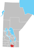
Location of Graysville in Manitoba
Coordinates: 49°30′33″N98°9′27″W / 49.50917°N 98.15750°W / 49.50917; -98.15750
Country Flag of Canada (Pantone).svg  Canada
Province Flag of Manitoba.svg  Manitoba
Region Pembina Valley
Census Division No. 3
Government
  Governing BodyRural Municipality of Dufferin Council
   MP Branden Leslie
   MLA Lauren Stone
Time zone UTC−6 (CST)
  Summer (DST) UTC−5 (CDT)
Postal Code
R0G 0T0
Area code(s) 204, 431
NTS Map062G09
GNBC CodeGAJUV

Graysville is an unincorporated community in south central Manitoba, Canada. It is located approximately 11 kilometers (7 miles) west of Carman, Manitoba [1] in the Rural Municipality of Dufferin.

The Post Office was opened in 1904 on the farm of George Gray where a town site had developed. There was a Gray, Saskatchewan so the name Graysville became the mail name. The community had been known as Grays. The railway point and the school district also assumed the name.

Related Research Articles

<span class="mw-page-title-main">Gilbert Plains</span> Place in Manitoba, Canada

Gilbert Plains is an unincorporated urban community in the Gilbert Plains Municipality, Manitoba, Canada, that was classified as a town prior to January 1, 2015.

<span class="mw-page-title-main">Graysville, Alabama</span> City in Alabama, United States

Graysville is a city in northwestern Jefferson County, Alabama, United States, located north of Adamsville. At the 2020 census, the population was 1,950.

<span class="mw-page-title-main">Graysville, Tennessee</span> Town in Tennessee, United States

Graysville is a town in Rhea County, Tennessee, United States. The population was 1,471 at the 2020 census and 1,502 at the 2010 census.

Lynn Lake is a town in the northwest region of Manitoba, Canada, approximately 1,071 km (665 mi) from Winnipeg. The town is the fourth-largest town in Manitoba in terms of land area. It is centred on the original urban community of Lynn Lake. The town was named after Lynn Smith, chief engineer of Sherritt Gordon Mines Ltd. There are many outfitters in the Lynn Lake area, offering services for most wilderness experiences, including sport fishing and bear and moose hunting.

Roblin is an unincorporated urban community in the Municipality of Roblin, Manitoba, Canada. It is located approximately 400 km (250 mi) northwest of Winnipeg.

Graysville is the name of several places:

<span class="mw-page-title-main">Pembina Valley Region</span> Region of Manitoba, Canada

The Pembina Valley is an informal geographic region of the Canadian province of Manitoba. It is named for its major geographical feature, the Pembina Valley, which runs through the southwestern part of the region.

<span class="mw-page-title-main">Northern Manitoba</span> Region of Manitoba, Canada

Northern Manitoba is a geographic and cultural region of the Canadian province of Manitoba. Originally encompassing a small square around the Red River Colony, the province was extended north to the 60th parallel in 1912. The region's specific boundaries vary, as "northern" communities are considered to share certain social and geographic characteristics, regardless of latitude.

St. Claude is an unincorporated community recognized as a local urban district in the Rural Municipality of Grey within the Canadian province of Manitoba that held village status prior to January 1, 2015.

<span class="mw-page-title-main">Rivers, Manitoba</span> Unincorporated community in Manitoba, Canada

Rivers is an unincorporated urban community in the Riverdale Municipality within the Canadian province of Manitoba. It is located 40 kilometres (25 mi) northwest of Brandon, 473 metres (1,552 ft) above sea level. It is within the Westman Region. Agriculture, health and related businesses provide income for the community and area. Rivers has a population of 1,257 people in the 2016 census.

Bowsman is an unincorporated urban community in the Municipality of Minitonas – Bowsman, Manitoba, Canada.

<span class="mw-page-title-main">Rural Municipality of Springfield</span> Rural municipality in Manitoba, Canada

Springfield is a rural municipality (RM) in Manitoba, Canada. It stretches from urban industrial development on the eastern boundary of the city of Winnipeg, through urban, rural residential, agricultural and natural landscapes, to the Agassiz Provincial Forest on the municipality's eastern boundary. Birds Hill Provincial Park nestles into the north-western corner of Springfield.

Reston is an unincorporated community recognized as a local urban district in southwestern Manitoba, located near the border of Saskatchewan on the west and North Dakota on the south. It is the largest community in the Rural Municipality of Pipestone, which also includes Sinclair, Cromer and Pipestone.

<span class="mw-page-title-main">Rural Municipality of Sifton</span> Rural municipality in Manitoba, Canada

The Rural Municipality of Sifton is a rural municipality (RM) in the south-west portion of the Canadian province of Manitoba.

<span class="mw-page-title-main">Graysville, Indiana</span> Unincorporated community in Indiana, United States

Graysville is an unincorporated community in Turman Township, Sullivan County, in the U.S. state of Indiana.

<span class="mw-page-title-main">Rural Municipality of Dufferin</span> Rural municipality in Manitoba, Canada

Dufferin is a rural municipality in the province of Manitoba in Western Canada. The separately administered town of Carman lies near its centre.

Graysville is an unincorporated community in Accomack County, Virginia.

Graysville is an unincorporated community in Catoosa County, in the U.S. state of Georgia. It is part of the Chattanooga, Tennessee–GA Metropolitan Statistical Area. The ZIP Code for Graysville is 30726.

Graysville is an unincorporated community in eastern Putnam County, in the U.S. state of Missouri.

<span class="mw-page-title-main">Graysville, Pennsylvania</span> Unincorporated community in Pennsylvania, United States

Graysville is an unincorporated community in Gray Township in Greene County, Pennsylvania, United States. The community is located along Pennsylvania Route 21, 11.2 miles (18.0 km) west-northwest of Waynesburg. Graysville has a post office with ZIP code 15337.

References

Notes
  1. "Geographical Names of Canada - Querying Distances". nrcan.gc.ca. October 24, 2011. Archived from the original on April 16, 2014. Retrieved October 5, 2012.
Sources