
Gilbert Plains is an unincorporated urban community in the Gilbert Plains Municipality, Manitoba, Canada, that was classified as a town prior to January 1, 2015.
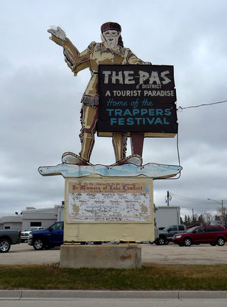
The Pas is a town in Manitoba, Canada, at the confluence of the Pasquia River and the Saskatchewan River and surrounded by the unorganized Northern Region of the province. It is approximately 520 kilometres (320 mi) northwest of the provincial capital, Winnipeg, and 35 kilometres (22 mi) from the border of Saskatchewan. It is sometimes still called Paskoyac by locals after the first trading post, called Fort Paskoya, constructed in the 1740s by French and Canadian traders. The Pasquia River begins in the Pasquia Hills in east central Saskatchewan. The French in 1795 knew the river as Basquiau.
Flin Flon is a mining city, located on a correction line on the border of the Canadian provinces of Manitoba and Saskatchewan, with the majority of the city located within Manitoba. Residents thus travel southwest into Saskatchewan, and northeast into Manitoba. The city is incorporated in and is jointly administered by both provinces.
Churchill is an Arctic port town in northern Manitoba, Canada, on the west shore of Hudson Bay, roughly 140 km (87 mi) from the Manitoba–Nunavut border. It is most famous for the many polar bears that move toward the shore from inland in the autumn, leading to the nickname "Polar Bear Capital of the World" and to the benefit of its burgeoning tourism industry.
Lynn Lake is a town in the northwest region of Manitoba, Canada, approximately 1,071 km (665 mi) from Winnipeg. The town is the fourth-largest town in Manitoba in terms of land area. It is centred on the original urban community of Lynn Lake. The town was named after Lynn Smith, chief engineer of Sherritt Gordon Mines Ltd. There are many outfitters in the Lynn Lake area, offering services for most wilderness experiences, including sport fishing and bear and moose hunting.

Arviat is a predominantly Inuit hamlet located on the western shore of Hudson Bay in the Kivalliq Region of Nunavut, Canada. Arviat is derived from the Inuktitut word arviq meaning "Bowhead whale". Earlier in history, its name was Tikirajualaaq, and Ittaliurvik,.

Morden is a city located in the Pembina Valley region of southern Manitoba, Canada near the United States border. It is about 11 km (6.8 mi) west of the neighbouring city of Winkler; together Morden and Winkler are often referred to as Manitoba's Twin Cities. Morden, which is surrounded by the Rural Municipality of Stanley, is the eighth largest and fastest-growing city in Manitoba. According to Statistics Canada, the city had a population of 9,929 in 2021, an increase of 14.5% from 2016, making it Manitoba's fastest growing city.

Northern Manitoba is a geographic and cultural region of the Canadian province of Manitoba. Originally encompassing a small square around the Red River Colony, the province was extended north to the 60th parallel in 1912. The region's specific boundaries vary, as "northern" communities are considered to share certain social and geographic characteristics, regardless of latitude.

Gillam is a town on the Nelson River in northern Manitoba, Canada. It is situated between Thompson and Churchill on the Hudson Bay Railway line.

The Rural Municipality of Alexander is a rural municipality in the Eastman Region of Manitoba, Canada. The town of Powerview-Pine Falls lies adjacent to the municipality, as does the Sagkeeng First Nation Indian reserve.
Beausejour is a town in the Canadian province of Manitoba. It is 46 kilometres northeast of Winnipeg, just west of the Canadian Shield and Whiteshell Provincial Park. The French name Beauséjour [beau + séjour] means "beautiful stay". The town is surrounded by the Rural Municipality of Brokenhead.
Powerview-Pine Falls is a town in the Canadian province of Manitoba, with a population of 1,314 at the 2011 census, up 1.54% from 1,294 at the 2006 census and down 7.57% from 1,400 during the 2001 census.

The Rural Municipality of Coldwell is a rural municipality in the Interlake Region of the province of Manitoba in Western Canada. The principal community within the boundaries is Lundar.
Woodlands is a rural municipality (RM) in the province of Manitoba in Western Canada. It lies in the southern part of the Interlake and is named for the community of Woodlands, which itself is named for the wooded lands of the area.
Thompson is a rural municipality (RM) in the Pembina Valley Region of Manitoba, Canada. It had a population of 1,259 according to the Canada 2006 Census.
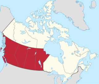
Western Canada, also referred to as the Western provinces, Canadian West or the Western provinces of Canada, and commonly known within Canada as the West, is a Canadian region that includes the four western provinces just north of the Canada–United States border namely British Columbia, Alberta, Saskatchewan and Manitoba. The people of the region are often referred to as "Western Canadians" or "Westerners", and though diverse from province to province are largely seen as being collectively distinct from other Canadians along cultural, linguistic, socioeconomic, geographic and political lines. They account for approximately 32% of Canada's total population.
McAuley is a community northwest of Virden, Manitoba located in the Rural Municipality of Ellice – Archie.

Snowflake is a small community in the Municipality of Pembina in Manitoba, Canada near the Canada–United States border. It is the birthplace of ice hockey player Justin Falk, and was the first ecclesiastical posting for the sixth Bishop of Calgary, George Reginald Calvert.
Arrow River is an unincorporated community in southwestern Manitoba, Canada. It is located approximately 10 kilometers east of Miniota, Manitoba in the Prairie View Municipality.

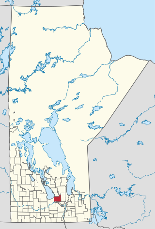
The Municipality of Souris-Glenwood is a rural municipality (RM) in the Canadian province of Manitoba.


