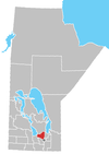
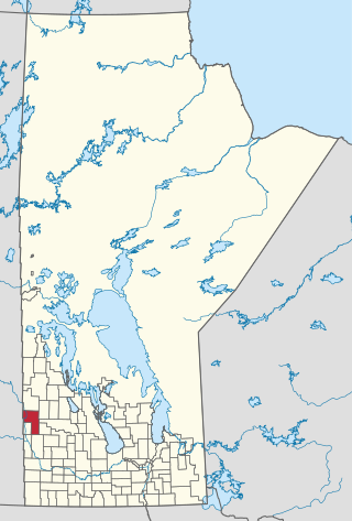
Rural Municipality of Woodlands

Last updated

Rural Municipality of Woodlands
CAN MB Woodlands.svg
Location of the RM of Woodlands in Manitoba
Coordinates: 50°14′27″N97°44′09″W / 50.24083°N 97.73583°W / 50.24083; -97.73583
CountryCanada
Province Manitoba
IncorporatedFebruary 14, 1884
Government
  ReeveLori Schellekens
   MP (Selkirk—Interlake—Eastman) James Bezan
   MLA (Lakeside) Trevor King
Area
  Total1,197.59 km2 (462.39 sq mi)
Population
 (2021) [1]
  Total3,797
Time zone UTC-6 (CST)
  Summer (DST) UTC-5 (CDT)
Website www.rmwoodlands.info

Woodlands is a rural municipality (RM) in the province of Manitoba in Western Canada. It lies in the southern part of the Interlake and is named for the community of Woodlands, which itself is named for the wooded lands of the area. [2]

Contents

History

The Rural Municipality of Woodlands was incorporated on February 14, 1884. [3]

Geography

Communities

Climate

Climate data for Marquette
MonthJanFebMarAprMayJunJulAugSepOctNovDecYear
Record high °C (°F)8
(46)
9.4
(48.9)
17.2
(63.0)
36.1
(97.0)
37.8
(100.0)
38
(100)
35
(95)
38.5
(101.3)
37.5
(99.5)
31
(88)
23.9
(75.0)
10.6
(51.1)
38.5
(101.3)
Mean daily maximum °C (°F)−12.6
(9.3)
−8.1
(17.4)
−0.9
(30.4)
10.1
(50.2)
19.3
(66.7)
23.3
(73.9)
25.6
(78.1)
24.9
(76.8)
18.5
(65.3)
10.8
(51.4)
−0.9
(30.4)
−9.8
(14.4)
8.4
(47.1)
Daily mean °C (°F)−17.5
(0.5)
−13.2
(8.2)
−5.8
(21.6)
4.1
(39.4)
12.4
(54.3)
17.1
(62.8)
19.6
(67.3)
18.6
(65.5)
12.6
(54.7)
5.6
(42.1)
−4.9
(23.2)
−14.3
(6.3)
2.9
(37.2)
Mean daily minimum °C (°F)−22.3
(−8.1)
−18.2
(−0.8)
−10.7
(12.7)
−1.9
(28.6)
5.5
(41.9)
10.9
(51.6)
13.5
(56.3)
12.1
(53.8)
6.7
(44.1)
0.4
(32.7)
−8.9
(16.0)
−18.8
(−1.8)
−2.6
(27.3)
Record low °C (°F)−39.5
(−39.1)
−41
(−42)
−33.3
(−27.9)
−27.8
(−18.0)
−9
(16)
−0.5
(31.1)
2.8
(37.0)
1.1
(34.0)
−5
(23)
−19
(−2)
−35
(−31)
−39.5
(−39.1)
−41
(−42)
Average precipitation mm (inches)23.3
(0.92)
18.3
(0.72)
26.6
(1.05)
32.7
(1.29)
57.8
(2.28)
87.3
(3.44)
73.1
(2.88)
70.5
(2.78)
57
(2.2)
39.1
(1.54)
29.6
(1.17)
23.5
(0.93)
538.8
(21.21)
Source: Environment Canada [4]

Demographics

In the 2021 Census of Population conducted by Statistics Canada, Woodlands had a population of 3,797 living in 1,376 of its 1,483 total private dwellings, a change of

Government

Woodlands federal election results [6]
Year Liberal Conservative New Democratic Green
2021 8%15669%1,27813%2412%41
2019 7%13775%1,40311%2096%108
Woodlands provincial election results [7]
Year PC New Democratic Liberal
2019 74%1,11317%2559%128
2016 85%1,12615%2010%0

The Rural Municipality of Woodlands is municipal style government with one head of council and six councillors, one of which is the deputy reeve. The councillors are elected at large. The municipal offices are located in Woodlands. The municipalities lies within the federal riding of Selkirk—Interlake—Eastman, represented by Conservative James Bezan, and the provincial riding of Lakeside represented by Progressive Conservative Trevor King.

2022 Members of Council

The representatives from the local urban district of Warren are Judy Olson, Diana Friesen, and Cal Martin.

Transportation

The first rail line, the Air Line, connected Warren to Stonewall and Winnipeg, and later to Portage la Prairie, but was taken out of service in 1882. The Hudson Bay CPR line was built to Shoal Lake, but construction stopped after 1886 due to lack of funds. In the 1880s, multiple rail lines were built through the municipality to transport gravel from the ridges and pits, but were later abandoned once supply diminished. The Canadian Northern Railroad was built through the area from 1903 to 1904. [3] The section north of Warren was abandoned beginning in 1996, but the section south remains in operation. [8]

See also

Twin Lakes Beach, Manitoba

Related Research Articles

<span class="mw-page-title-main">Rural Municipality of Gimli</span> Rural municipality in Manitoba, Canada

The Rural Municipality of Gimli is a rural municipality located in the Interlake Region of south-central Manitoba, Canada, on the western shore of Lake Winnipeg. It is about 75 kilometres (47 mi) north of the provincial capital Winnipeg. The rural municipality's population in the 2016 Canadian Census was 6,181, making it the 12th largest rural municipality by population. The RM of Gimli has an area of 318.75 km2 (123.07 sq mi), making it the sixth smallest rural municipality by area.

<span class="mw-page-title-main">Flin Flon</span> City in Manitoba and Saskatchewan, Canada

Flin Flon is a mining city, located on a correction line on the border of the Canadian provinces of Manitoba and Saskatchewan, with the majority of the city located within Manitoba. Residents thus travel southwest into Saskatchewan, and northeast into Manitoba. The city is incorporated in and is jointly administered by both provinces.

Ashern is a local urban district located in the Municipality of West Interlake in Manitoba's Interlake Region.

Lundar is a local urban district in the Rural Municipality of Coldwell, Manitoba, Canada. Located in Manitoba's Interlake Region, it is situated 99 km (62 mi) north of Winnipeg on Highway 6.

The Rural Municipality of Lakeview was a rural municipality (RM) in the Canadian province of Manitoba.

McCreary is an unincorporated urban community in the Municipality of McCreary, Manitoba, Canada.

Bowsman is an unincorporated urban community in the Municipality of Minitonas – Bowsman, Manitoba, Canada.

<span class="mw-page-title-main">Winnipeg Beach</span> Town in Manitoba, Canada

Winnipeg Beach is a town in the Interlake Region, in the Canadian province of Manitoba. The town was founded in 1900 by Sir William Whyte and is located at the junction of Highway 9 and Highway 229 on the southwestern shore of Lake Winnipeg, about 56 kilometres (35 mi) north of Winnipeg. It is bordered by the Rural Municipality of Gimli, the Rural Municipality of St. Andrews, and Dunnottar as well as Lake Winnipeg. Nearby towns are Ponemah, Whytewold, and Matlock, Gimli, and Sandy Hook,, as well as Teulon, and Selkirk. Its permanent population is 1,439

<span class="mw-page-title-main">Gladstone, Manitoba</span> Unincorporated community in Manitoba, Canada

Gladstone is an unincorporated urban community in the Municipality of WestLake – Gladstone within the Canadian province of Manitoba that held town status prior to January 1, 2015. It is located on the Yellowhead Highway at the intersection with Highway 34. The Gladstone railway station receives Via Rail service.

<span class="mw-page-title-main">Stonewall, Manitoba</span> Town in Manitoba, Canada

Stonewall is a town in the Canadian province of Manitoba with a population of 5,046 as of the 2021 census. The town is situated approximately 25 kilometres (16 mi) north of Winnipeg on PTH 67. It is known for its limestone quarries. The local festival is the Quarry Days which is usually held over three days in August on Main Street. The town is surrounded by the R.M. of Rockwood.

<span class="mw-page-title-main">Rural Municipality of Springfield</span> Rural municipality in Manitoba, Canada

Springfield is a rural municipality (RM) in Manitoba, Canada. It stretches from urban industrial development on the eastern boundary of the city of Winnipeg, through urban, rural residential, agricultural and natural landscapes, to the Agassiz Provincial Forest on the municipality's eastern boundary. Birds Hill Provincial Park nestles into the north-western corner of Springfield.

<span class="mw-page-title-main">Teulon</span> Town in Manitoba, Canada

Teulon is a town located approximately 59 kilometres north of Winnipeg, Manitoba, Canada, on Provincial Trunk Highway 7. Located between Stonewall and Gimli, Teulon is commonly referred to as "The Gateway to the Interlake". Teulon is surrounded by the Rural Municipality of Rockwood.

<span class="mw-page-title-main">Warren, Manitoba</span> Unincorporated Community in Manitoba, Canada

Warren is an unincorporated community recognized as a local urban district 26.3 kilometres north-west of Winnipeg, Manitoba. It is located in the Rural Municipality of Woodlands.

Gypsumville is a community in Manitoba, Canada. It is 242 kilometres north-northwest of Winnipeg in the Interlake Region of Manitoba on the north bank of Lake St. Martin in the Rural Municipality of Grahamdale.

<span class="mw-page-title-main">Rural Municipality of Armstrong</span> Rural municipality in Manitoba, Canada

Armstrong is a rural municipality in the province of Manitoba in Western Canada. It lies in the southern area of the Interlake and was named after James William Armstrong, a Manitoba politician.

<span class="mw-page-title-main">Rural Municipality of Coldwell</span> Rural municipality in Manitoba, Canada

The Rural Municipality of Coldwell is a rural municipality in the Interlake Region of the province of Manitoba in Western Canada. The principal community within the boundaries is Lundar.

Woodlands is an unincorporated community in the Rural Municipality of Woodlands in the Interlake Region of Manitoba, Canada. It is located approximately 40 kilometres north-west of Winnipeg.

<span class="mw-page-title-main">Rural Municipality of Lakeshore</span> Rural municipality in Manitoba, Canada

The Rural Municipality of Lakeshore is a rural municipality (RM) in the Parkland Region of Manitoba, Canada.

<span class="mw-page-title-main">Rural Municipality of Riding Mountain West</span> Rural municipality in Manitoba, Canada

The Rural Municipality of Riding Mountain West is a rural municipality (RM) in the Canadian province of Manitoba. It is located in Manitoba's Parkland region, between Riding Mountain National Park near the province's western border with Saskatchewan.

References

  1. 1 2 3 "Population and dwelling counts: Canada, provinces and territories, and census subdivisions (municipalities), Manitoba". Statistics Canada. February 9, 2022. Retrieved February 20, 2022.
  2. Geographical Names of Manitoba (PDF). Winnipeg, Manitoba: Manitoba Conservation. 2000.
  3. 1 2 "Rural Municipality of Woodlands: History". www.rmwoodlands.info. Retrieved December 30, 2020.
  4. Environment Canada Canadian Climate Normals 1971–2000, accessed 18 February 2014
  5. "Manitoba Communities: Woodlands (Rural Municipality)". www.mhs.mb.ca. Retrieved December 31, 2020.
  6. "Official Voting Results Raw Data (poll by poll results in Woodlands)". Elections Canada. Retrieved March 2, 2023.
  7. "Official Voting Results by polling station (poll by poll results in Woodlands)". Elections Manitoba. Retrieved March 2, 2023.
  8. "Manitoba Business: Canadian Northern Railway / Canadian National Railway". www.mhs.mb.ca. Retrieved December 31, 2020.