Rural Municipality of Grahamdale

Last updated

Rural Municipality of Grahamdale
CAN MB Grahamdale.svg
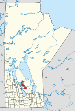
Location in Manitoba
Coordinates: 51°25′12″N98°22′24″W / 51.42000°N 98.37333°W / 51.42000; -98.37333 Coordinates: 51°25′12″N98°22′24″W / 51.42000°N 98.37333°W / 51.42000; -98.37333
CountryCanada
Province Manitoba
Area
[1]
  Land2,385.42 km2 (921.02 sq mi)
Population
 (2016) [1]
  Total1,359
Time zone UTC-6 (CST)
  Summer (DST) UTC-5 (CDT)
Area codes 204 and 431

Grahamdale is a rural municipality (RM) in the province of Manitoba in Western Canada. It lies in the Interlake Region. It was incorporated as a Local Government District (LGD) on 1 January 1945, and became a Rural Municipality in 1997.

Contents

The municipality exists in two sections that are separated by a part of the Fairford 50 Indian reserve. It extends from Gypsumville to Mulvihill and incorporates the former RM of Woodlea within its present boundaries. [2]

Communities

Demographics

In the 2021 Census of Population conducted by Statistics Canada, Grahamdale had a population of 1,278 living in 579 of its 886 total private dwellings, a change of

Related Research Articles

<span class="mw-page-title-main">Rural Municipality of Aberdeen No. 373</span> Rural municipality in Saskatchewan, Canada

The Rural Municipality of Aberdeen No. 373 is a Rural Municipality (RM) in the Canadian province of Saskatchewan within Census Division No. 15 and SARM Division No. 5. It is located on the South Saskatchewan River.

<span class="mw-page-title-main">Rural Municipality of St. Clements</span> Rural municipality in Manitoba, Canada

St. Clements is a rural municipality in Manitoba, Canada. It is located to the north-east of Winnipeg, stretching from East St. Paul and Birds Hill Provincial Park in the south to Lake Winnipeg and Grand Beach Provincial Park to the north. The Red River demarcates the western boundary of the municipality. St. Clements contains the communities of East Selkirk, and Lockport east of the Red River. It almost completely surrounds the Brokenhead 4 Indian reserve, with the exception of a small lakefront on Lake Winnipeg.

<span class="mw-page-title-main">Rural Municipality of Cartier</span> Rural municipality in Manitoba, Canada

Rural Municipality of Cartier is a rural municipality in the Central Plains and Metro Regions of Manitoba, Canada. The municipality is bordered on the west by the RM of Portage la Prairie, to the east by the RM of Headingley, and to the north by the Assiniboine River. It is mainly flat rich farmland. Its main town is Elie.

<span class="mw-page-title-main">Rural Municipality of Argyle No. 1</span> Rural Municipality in Saskatchewan, Canada

The Rural Municipality of Argyle No. 1 is a rural municipality (RM) in the Canadian province of Saskatchewan within Census Division No. 1 and SARM Division No. 1. It is located in the southeast corner of the province along Highway 18.

<span class="mw-page-title-main">Rural Municipality of Antler No. 61</span> Rural Municipality in Saskatchewan, Canada

The Rural Municipality of Antler No. 61 is a rural municipality (RM) in the Canadian province of Saskatchewan within Census Division No. 1 and SARM Division No. 1.

<span class="mw-page-title-main">Rural Municipality of Victoria</span> Rural municipality in Manitoba, Canada

The Rural Municipality of Victoria is located in south-central Manitoba, north-east of Glenboro. The RM was established in 1902 and named for Queen Victoria. In its westernmost part, the RM contains parts of Manitoba's Spruce Woods Provincial Forest and Spruce Woods Provincial Park.

<span class="mw-page-title-main">Rural Municipality of Martin No. 122</span> Rural Municipality in Saskatchewan, Canada

The Rural Municipality of Martin No. 122 is a rural municipality (RM) in the Canadian province of Saskatchewan within Census Division No. 5 and SARM Division No. 1. It is approximately 200 km (120 mi) east of Regina and bisected by the Trans-Canada Highway.

<span class="mw-page-title-main">Rural Municipality of Coldwell</span> Rural municipality in Manitoba, Canada

The Rural Municipality of Coldwell is a rural municipality in the Interlake Region of the province of Manitoba in Western Canada. The principal community within the boundaries is Lundar.

<span class="mw-page-title-main">Rural Municipality of Montcalm</span> Rural municipality in Manitoba, Canada

Montcalm is a rural municipality (RM) in the province of Manitoba in Western Canada. The Canada 2016 Census reported a population of 1,260 persons, a decrease from the 1,309 reported in the 2011 Census.

<span class="mw-page-title-main">Rural Municipality of Stanley</span> Rural municipality in Manitoba, Canada

Stanley is a rural municipality (RM) in the province of Manitoba in Western Canada. It is located in the southern part of the province, along its border with the state of North Dakota in the United States. Since 1876, the area made up part of the Mennonite West Reserve. The municipality has a population of 8,969 as of the 2016 Canada Census. The cities of Winkler and Morden lie geographically within the municipality but are separate urban municipalities.

<span class="mw-page-title-main">Rural Municipality of Alonsa</span> Rural municipality in Manitoba, Canada

Alonsa is a rural municipality (RM) in the province of Manitoba, western Canada. It lies on the west side of Lake Manitoba.

<span class="mw-page-title-main">Rural Municipality of Morris</span> Rural municipality in Manitoba, Canada

Morris is a rural municipality (RM) in the province of Manitoba in Western Canada. The Town of Morris, a separate urban municipality, is located in the southeastern corner of the RM.

<span class="mw-page-title-main">Rural Municipality of Roland</span> Rural municipality in Manitoba, Canada

Roland is a rural municipality located in the Pembina Valley Region of Manitoba, Canada. According to the Canada 2016 Census, it has a population of 1,129.

<span class="mw-page-title-main">Municipality of Killarney-Turtle Mountain</span> Rural municipality in Manitoba, Canada

Killarney-Turtle Mountain is a rural municipality (RM) located in the Westman Region of Manitoba, Canada. It is located to the immediate north of the Canada–United States border opposite Rollete and Towner Counties, North Dakota.

<span class="mw-page-title-main">Rural Municipality of Cana No. 214</span> Rural Municipality in Saskatchewan, Canada

The Rural Municipality of Cana No. 214 is a rural municipality (RM) in the Canadian province of Saskatchewan within Census Division No. 5 and SARM Division No. 1. It is located in the southeast portion of the province.

<span class="mw-page-title-main">Rural Municipality of Lipton No. 217</span> Rural Municipality in Saskatchewan, Canada

The Rural Municipality of Lipton No. 217 is a rural municipality (RM) in the Canadian province of Saskatchewan within Census Division No. 6 and SARM Division No. 1.

<span class="mw-page-title-main">Rural Municipality of Brokenhead</span> Rural municipality in Manitoba, Canada

The Rural Municipality of Brokenhead is a rural municipality (RM) in the Canadian province of Manitoba.

<span class="mw-page-title-main">Rural Municipality of St. Laurent</span> Rural municipality in Manitoba, Canada

The Rural Municipality of St. Laurent is located in the Interlake Region of Manitoba and has Lake Manitoba as its western boundary and is serviced by Manitoba Highway 6. The community of St. Laurent lies within its boundaries.

<span class="mw-page-title-main">Municipality of Bifrost – Riverton</span> Rural municipality in Manitoba, Canada

The Municipality of Bifrost – Riverton is a rural municipality (RM) in the Canadian province of Manitoba.

References

  1. 1 2 "Population and dwelling counts, for Canada, provinces and territories, and census subdivisions (municipalities), 2016 and 2011 censuses – 100% data (Manitoba)". Statistics Canada. 7 February 2018. Retrieved 15 January 2022.
  2. Manitoba Historical Society
  3. "Population and dwelling counts: Canada, provinces and territories, and census subdivisions (municipalities), Manitoba". Statistics Canada. 9 February 2022. Retrieved 20 February 2022.