
Lake Winnipeg is a very large, relatively shallow 24,514-square-kilometre (9,465 sq mi) lake in North America, in the province of Manitoba, Canada. Its southern end is about 55 kilometres (34 mi) north of the city of Winnipeg. Lake Winnipeg is Canada's sixth-largest freshwater lake and the third-largest freshwater lake contained entirely within Canada, but it is relatively shallow excluding a narrow 36 m (118 ft) deep channel between the northern and southern basins. It is the eleventh-largest freshwater lake on Earth. The lake's east side has pristine boreal forests and rivers that were in 2018 inscribed as Pimachiowin Aki, a UNESCO World Heritage Site. The lake is 416 km (258 mi) from north to south, with remote sandy beaches, large limestone cliffs, and many bat caves in some areas. Manitoba Hydro uses the lake as one of the largest reservoirs in the world. There are many islands, most of them undeveloped.

The Rural Municipality of Gimli is a rural municipality located in the Interlake Region of south-central Manitoba, Canada, on the western shore of Lake Winnipeg. It is about 75 kilometres (47 mi) north of the provincial capital Winnipeg. The rural municipality's population in the 2016 Canadian Census was 6,181, making it the 12th largest rural municipality by population. The RM of Gimli has an area of 318.75 square kilometres (123.07 sq mi), making it the sixth smallest rural municipality by area.
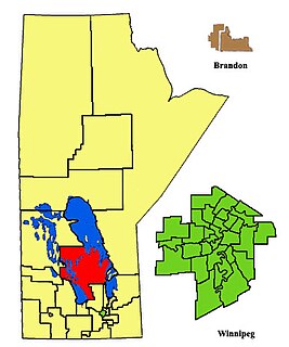
Interlake was a provincial electoral division in the Canadian province of Manitoba. It was created by redistribution in 1979, and has formally existed since the 1981 provincial election. Previously, much of the Interlake region was included in the constituency of St. George. As its name implies, Interlake was located between Lake Winnipeg and Lake Manitoba, in the mid-northern section of the province.

Gimli was a provincial electoral division in the Canadian province of Manitoba. It was created by redistribution in 1899, and existed continuously until the 2019 election.

Selkirk—Interlake—Eastman is a federal electoral district in Manitoba, Canada, that has been represented in the House of Commons of Canada from 1976 to 1987, and since 1997.

The Winnipeg Metropolitan Region is a metropolitan area in the Canadian province of Manitoba located in the Red River Valley in the southeast portion of the province of Manitoba, Canada. It contains the provincial capital of Winnipeg and 17 surrounding rural municipalities, cities, and towns.
Icelandic Canadians are Canadian citizens of Icelandic ancestry or Iceland-born people who reside in Canada.
The Rural Municipality of Bifrost is a former rural municipality (RM) in the Canadian province of Manitoba. It was originally incorporated as a rural municipality on December 1, 1907. It ceased on January 1, 2015 as a result of its provincially mandated amalgamation with the Village of Riverton to form the Municipality of Bifrost – Riverton.

The Interlake Region is an informal geographic region of the Canadian province of Manitoba that lies roughly between Lake Winnipeg and Lake Manitoba in the Canadian province of Manitoba. The region comprises 14 rural municipalities, one city, six towns and one village, Dunnottar. The largest population centre in the region is Selkirk. The second largest is the town of Stonewall.
Treaty 2 was entered in to on 21 August 1871 at Manitoba House, Rupertsland, with representatives of the Queen of Great Britain and Ireland. The original Anishinaabe, who were present, constitute Treaty 2 today. It is known that many of the chiefs and leaders within the territory were at the early gathering and after the treaty was agreed to. Those who were not present were represented through Metis until they indicated where they wished their farming reserves to be established. The treaty reaffirmed the inherent rights that the Anishinaabe had prior to European contact, located where southwestern Manitoba is today and a small part of southeastern Saskatchewan.

Teulon is a town located approximately 59 kilometres north of Winnipeg, Manitoba, Canada, on Provincial Trunk Highway 7. Located between Stonewall and Gimli, Teulon is commonly referred to as "The Gateway to the Interlake". Teulon is surrounded by the Rural Municipality of Rockwood.
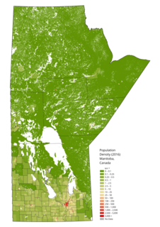
Manitoba is one of Canada's 10 provinces. It is the easternmost of the three Prairie provinces.

Division No. 19, also informally known as North East Manitoba, is a census division within the Province of Manitoba, Canada. Unlike in some other provinces, census divisions do not reflect the organization of local government in Manitoba. These areas exist solely for the purposes of statistical analysis and presentation; they have no government of their own.
Riverton Collegiate Institute is a high school located in Riverton, Manitoba in the Rural Municipality of Bifrost in the Interlake Region, Manitoba.

Eriksdale is an unincorporated community located in the Interlake Region of central Manitoba, Canada, near the eastern shore of Lake Manitoba. The community is located on the crossroads of Highway 6 and Highway 68, approximately 118 km (73 mi) north of Winnipeg. It is part of the Municipality of West Interlake.

Gimli is an unincorporated community in the Rural Municipality of Gimli on the west side of Lake Winnipeg in Manitoba, Canada. The community's first European settlers were Icelanders who were part of the New Iceland settlement in Manitoba. The community maintains a strong connection to Iceland and Icelandic culture today, including the annual Icelandic Festival. It was incorporated as a village on March 6, 1908, and held town status between December 31, 1946, and January 1, 2003, when it amalgamated with the RM of Gimli. Census Canada now recognizes the community as a population centre for census purposes. The 2016 Canadian census recorded a population of 2,246 in the population centre of Gimli.
Pinaymootang First Nation is a First Nations people whose home location is on Fairford 50 Reserve at Fairford, Manitoba, Canada. They are situated on Hwy #6 in the Interlake Region of Manitoba about 220 kilometres from Winnipeg. The Rural Municipality of Grahamdale forms most of the reserve's land boundary, although it also has a short border with the Little Saskatchewan First Nation as well as significant lakeshore on Lake St. Martin, which is considered as being outside the reserve. The main settlement on the reserve is located at 51°35′55″N98°41′32″W.
Interlake-Eastern Regional Health Authority is the governing body responsible for healthcare delivery and regulation for the Interlake and eastern regions of Manitoba.
Hnausa Beach Provincial Park is a Manitoba provincial park on the west shore of Lake Winnipeg north of Gimli, Manitoba. The beach within the park is named after the nearby community of Hnausa. Hnausa is an Old Icelandic word for a piece of turf. This part of Manitoba is known as New Iceland due to the significant Icelandic settlement of the area that began in 1875.


