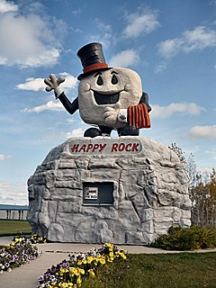
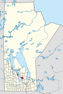
Lynn Lake is a town in the northwest region of Manitoba, Canada, approximately 1,071 km (665 mi) from Winnipeg. The town is the fourth-largest town in Manitoba in terms of land area. It is centred on the original urban community of Lynn Lake. The town was named after Lynn Smith, chief engineer of Sherritt Gordon Mines Ltd. There are many outfitters in the Lynn Lake area, offering services for most wilderness experiences, including sport fishing and bear and moose hunting.
St. Lazare is an unincorporated community recognised as a local urban district in the Rural Municipality of Ellice – Archie within the Canadian province of Manitoba that held village status prior to January 1, 2015.

Elm Creek is an unincorporated community recognized as a local urban district in Manitoba, Canada. It is about 50 km west of Winnipeg and about 35 km southeast of Portage la Prairie. It is located in the Rural Municipality of Grey. It is home to the second largest fire hydrant in the world which was unveiled on Canada Day, 2001. It is also the home of the second largest H4 chondrite ever found in Canada. The 8.2-kg mass was found by a local grader driver on a rural road in 1997. Elm Creek has a Kindergarten to Grade 12 school.
Ashern is an unincorporated community recognized as a local urban district located in the Municipality of West Interlake in Manitoba's Interlake Region. The RM of Siglunes was incorporated in 1917. Ashern was named after A. S. Hern, a timekeeper of the firm that constructed the railway that served the Western Interlake.
Lundar is an unincorporated community recognized as a local urban district situated in Manitoba, Canada. It is located in the Rural Municipality of Coldwell, in Manitoba's Interlake Region, 99 km north of Winnipeg on Hwy 6. Nearby attractions are Lake Manitoba and its beaches, and the Lundar Provincial Park. Lundar is home to a Canada goose refuge, and a large statue of a Canada goose is located in the community. Lundar was founded by Icelandic settlers.

Baldur is an unincorporated community recognized as a local urban district in the Canadian province of Manitoba, located in the Rural Municipality of Argyle. Baldur is the largest community of the municipality, which is in southwestern Manitoba between Brandon and Portage la Prairie. The community is named after the Norse god Baldur.
Binscarth is an unincorporated urban community in the Municipality of Russell – Binscarth, Manitoba. It is located approximately 167 km (104 mi) northwest of Brandon, 16 km (9.9 mi) south from Russell, and 16 km (10 mi) east of the Saskatchewan border.
Birch River is a local urban district in the northern portion of the Rural Municipality of Mountain, Manitoba, Canada. It is around 40 kilometers from Swan River, Manitoba.

Gladstone is an unincorporated urban community in the Municipality of WestLake – Gladstone within the Canadian province of Manitoba that held town status prior to January 1, 2015. It is located on the Yellowhead Highway at the intersection with Highway 34. The Gladstone railway station receives Via Rail service.
Pilger is a village in the Canadian province of Saskatchewan within the Rural Municipality of Three Lakes No. 400 and Census Division No. 15. It is approximately 100 km (62 mi) northeast of the City of Saskatoon. The village offers a bar and restaurant, the Pilger Public Library, an autobody shop, and Pilger General Store offering groceries, fuel and more.
Arran is a village in the Canadian province of Saskatchewan within the Rural Municipality of Livingston No. 331 and Census Division No. 9. The village is approximately 90 km northeast of the City of Yorkton and 10 km west of the Manitoba border. Arran is located on Highway 49.

Somerset is an unincorporated community recognized as a local urban district in the Municipality of Lorne within the Canadian province of Manitoba that held village status prior to January 1, 2015.
Semans is a village in the Canadian province of Saskatchewan within the Rural Municipality of Mount Hope No. 279 and Census Division No. 10. The village is located approximately 125 km north of the City of Regina and 195 km southeast of the City of Saskatoon.

Maryfield is a village in the Canadian province of Saskatchewan within the Rural Municipality of Maryfield No. 91 and Census Division No. 1. The village lies south of the intersection of Highway 48 and Highway 600 and is about 8 km west of the Manitoba border. It is a junction point on the Canadian National Railway between the main line heading northwest towards Regina and a branch line heading southwest toward Carlyle and Lampman.

Paynton is a village in the Canadian province of Saskatchewan within the Rural Municipality of Paynton No. 470 and Census Division No. 17. It is the administrative centre of the Little Pine Cree First Nation band government.
Pennant is a village in the Canadian province of Saskatchewan within the Rural Municipality of Riverside No. 168 and Census Division No. 8.

The Rural Municipality of Coldwell is located in the Interlake Region of the province of Manitoba in Western Canada. The principal community within the boundaries is Lundar.
Pierson is an unincorporated community recognized as a local urban district located in the Municipality of Two Borders in southwestern Manitoba, Canada. The Antler–Lyleton Border Crossing is located south of Pierson.
Shamrock is a village in the Canadian province of Saskatchewan within the Rural Municipality of Shamrock No. 134 and Census Division No. 7.
Tugaske is a village in the Canadian province of Saskatchewan within the Rural Municipality of Huron No. 223 and Census Division No. 7. It is nicknamed Gateway to Lake Diefenbaker. It is near Eyebrow Lake, a prairie lake in the Qu'Appelle Valley. It was named after an eyebrow-shaped hill also in the Qu'Appelle Valley above Eyebrow Lake. The lake, which is 9 km long and 1 km wide, is a bird sanctuary and is near Highway 627.


