
Flin Flon is a mining city, located on a correction line on the border of the Canadian provinces of Manitoba and Saskatchewan, with the majority of the city located within Manitoba. Residents thus travel southwest into Saskatchewan, and northeast into Manitoba. The city is incorporated in and is jointly administered by both provinces.

The City of Kawartha Lakes is a unitary municipality in Central Ontario, Canada. It is a municipality legally structured as a single-tier city; however, Kawartha Lakes is the size of a typical Ontario county and is mostly rural. It is the second largest single-tier municipality in Ontario by land area.

Hinton is a town in west-central Alberta, Canada.

Oro-Medonte is a township in south-central Ontario, Canada, on the northwestern shores of Lake Simcoe in Simcoe County.

West Nipissing is a municipality in Northeastern Ontario, Canada, on Lake Nipissing in the Nipissing District. It was formed on January 1, 1999, with the amalgamation of seventeen and a half former town, villages, townships and unorganized communities.

Gillam is a town on the Nelson River in northern Manitoba, Canada. It is situated between Thompson and Churchill on the Hudson Bay Railway line.

Wabamun is a hamlet in central Alberta, Canada within Parkland County. It is approximately 67 kilometres (42 mi) west of Edmonton on Highway 16. It held village status prior to 2021.

Morris is a small town in the Pembina Valley region of Manitoba, Canada, located 51 km south of Winnipeg and 42 km north of Emerson. Morris is home to 1,885 people (2016). Named after Alexander Morris, the second Lieutenant Governor of Manitoba.

Blaine Lake is a town in central Saskatchewan, Canada. It is located 85 km north of Saskatoon, 104 km southwest of Prince Albert and 104 km east of North Battleford at the junction of Highway 12 and Highway 40. Nearby are the urban centres of Shellbrook and Rosthern. Blaine Lake is considered to be the "Gateway to the Northern Lakes" due to its proximity to fishing, hunting and camping sites, as well as its convenient location at a junction of two highways.

St. George is an incorporated town in Charlotte County, New Brunswick, Canada. The population was 1,517 in 2016. It is located where the Magaguadavic River flows into the Bay of Fundy, between Passamaquoddy Bay and Lake Utopia.
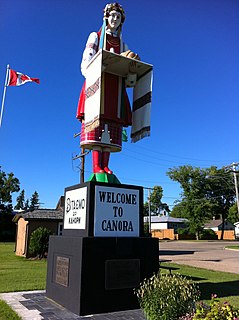
Canora is a town, located at the junction of highways No. 5 and 9 in east central Saskatchewan, about 50 km north of Yorkton. It is centrally located on the corners of four adjacent rural municipalities, including the RM of Good Lake. The community is home to approximately 3,500 residents and is part of the Canora-Pelly electoral district. The community was founded along the Canadian Northern Railway tracks - one of the companies that evolved into the Canadian National Railway (CN), and two CN freight lines still run through Canora. The Canora railway station, downtown on the CN east-west line before the switch to the northbound line, is served by Via Rail on its passenger service from Winnipeg to Churchill, Manitoba.
Hornepayne is a township of 980 people in the Algoma District of Ontario, Canada. The town was established in 1915 as Fitzback when the Canadian Northern Railway's transcontinental line was built through the area. It was renamed Hornepayne in 1920 after British financier Robert Horne-Payne. The municipality was originally named Wicksteed Township after the geographic township in which it is located. It was renamed Hornepayne, after its primary community, in 1986.

Schreiber is a municipal township in the Canadian province of Ontario, located on the northernmost point of Lake Superior along Highway 17. The town, with a population of approximately 1100 people, is almost completely located inside the geographic township of Priske, with a small western portion of the town in the southeast of Killraine Township.

Carberry is a town in southwestern Manitoba, Canada. It is situated 3 kilometres south of the Trans-Canada Highway on Highway 5 in the Municipality of North Cypress – Langford, and has a population of 1,738 people.

Cromer, Manitoba is a village located in the Rural Municipality of Pipestone, in south-western Manitoba, Canada in a region called Westman.

Watson is a town of 777 residents in the rural municipality of Lakeside, in the Canadian province of Saskatchewan. Watson is located on the intersection of Highway 5 and Highway 6, the Canam Highway. Watson is approximately the same distance from Saskatoon which is to the west, and Regina to the south, which gives rise to its town motto, Industrial Crossroads of Saskatchewan.
Grahamdale is a rural municipality in the province of Manitoba in Western Canada. It was incorporated as a Local Government District (LGD) on 1 January 1945, and became a Rural Municipality in 1997.
Woodlands is a rural municipality in the province of Manitoba in Western Canada. It lies in the southern part of the Interlake and is named for the community of Woodlands, which itself is named for the wooded lands of the area.

The Rural Municipality of Moose Mountain No. 63 is a rural municipality (RM) in the Canadian province of Saskatchewan within Census Division No. 1 and SARM Division No. 1. It is located in the south-east portion of the province.
Shoal Lake is a locality in the southwest of Manitoba, Canada. Originally incorporated as a town, Shoal Lake amalgamated with the Rural Municipality of Shoal Lake on January 1, 2011 to form the Municipality of Shoal Lake, which became the Rural Municipality of Yellowhead on January 1, 2015.

