Division No. 17, Manitoba

Last updated

1
2
3
4
5
6
7
8
9
10
11
12
13
14
15
16
17
18
19
19
20
21
22
23
Manitoba-census areas.png

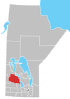
Census Division No. 17 (Dauphin) is a census division located within the Parklands Region of the province of Manitoba, Canada. Unlike in some other provinces, census divisions do not reflect the organization of local government in Manitoba. These areas exist solely for the purposes of statistical analysis and presentation; they have no government of their own.

Contents

The economic base of the area is primarily agriculture with some manufacturing and food processing. The population of the division at the 2006 census was 22,358. The division is geographically centred on the city of Dauphin and Dauphin Lake, and contains most of Riding Mountain National Park. Also included in the division is the Ebb and Flow First Nation.This region in located in central Manitoba.

Demographics

In the 2021 Census of Population conducted by Statistics Canada, Division No. 17 had a population of 21,996 living in 9,468 of its 11,521 total private dwellings, a change of

City

Main Street in Dauphin Main Street P5270039.jpg
Main Street in Dauphin

Unincorporated communities

Municipalities

Reserve

Unorganized Area

Related Research Articles

<span class="mw-page-title-main">Gilbert Plains</span> Place in Manitoba, Canada

Gilbert Plains is an unincorporated urban community in the Gilbert Plains Municipality, Manitoba, Canada, that was classified as a town prior to January 1, 2015.

<span class="mw-page-title-main">Sainte Rose du Lac</span> Place in Manitoba, Canada

Sainte Rose du Lac is an unincorporated urban community in the Municipality of Ste. Rose, Manitoba, Canada.

Grandview is an unincorporated urban community in the Grandview Municipality within the Canadian province of Manitoba that held town status prior to January 1, 2015. It is located 45 kilometres west of the City of Dauphin along the Valley River.

McCreary is an unincorporated urban community in the Municipality of McCreary, Manitoba, Canada.

<span class="mw-page-title-main">Parkland Region</span> Region of Manitoba in Canada

Parkland is an informal geographic region of the Canadian province of Manitoba, located between Lakes Manitoba and Winnipegosis on the east and the Manitoba–Saskatchewan border on the west.

Ethelbert is an unincorporated urban community in the Municipality of Ethelbert, Manitoba, Canada.

Pine Dock is a small fishing community by Lake Winnipeg in Manitoba, Canada. It had a population that was largest in the 1970s. Since this time its population has decreased. There is a small public beach and community town hall that continues to operate. During the 1970s to 1980s there was a small general store and a gas station, and an elementary school run by the Frontier School Division, however these are no longer operating. There is still a government dock and fishing station that continues to be used by local fishing industry. The next closest community is located on Matheson Island, Manitoba, that is 15 miles north of Pine Dock on Provincial Road 234, and accessed by a cable Ferry. South of Pine Dock are several recreational cottage developments including Beaver Creek Provincial Park (Manitoba), Mill Creek and Little Deer.

Provincial Trunk Highway 5 is a provincial primary highway located in the Canadian province of Manitoba.

<span class="mw-page-title-main">Division No. 19, Manitoba</span> Census division in Manitoba, Canada

Division No. 19, also informally known as North East Manitoba, is a census division within the Province of Manitoba, Canada. Unlike in some other provinces, census divisions do not reflect the organization of local government in Manitoba. These areas exist solely for the purposes of statistical analysis and presentation; they have no government of their own.

The Duck Mountain Provincial Forest is located on the Saskatchewan / Manitoba border. The forest sits atop the Duck Mountains, which rise 200-500m above the surrounding prairie, and are part of the larger Manitoba Escarpment.

<span class="mw-page-title-main">Division No. 2, Manitoba</span> Census division in Manitoba, Canada

Census Division No. 2 is a census division located within the Eastman Region in the Canadian province of Manitoba. Unlike in some other provinces, census divisions do not reflect the organization of local government in Manitoba. These areas exist solely for the purposes of statistical analysis and presentation; they have no government of their own.

The Manitoba Watershed District Program is a provincial-municipal partnership directed to the conservation and management of water and soil resources. There are 14 watershed districts including more than 130 municipalities covering almost all of the agricultural areas of Manitoba, Canada. The Province provides substantial funding and general guidance but the programs are developed and administered locally. The districts spend more than $8 million each year on a wide variety of conservation programs.

Laurier is an unincorporated urban community in the Rural Municipality of Ste. Rose, Manitoba, Canada. It is located on Highway 480, 3.2 km (2.0 mi) west of Highway 5, between the community of McCreary to the south and the community of Ste. Rose du Lac to the north.

The Prairie Mountain Health is the governing body responsible for healthcare delivery and regulation for the eponymous health region in southwest Manitoba.

<span class="mw-page-title-main">Municipality of Ethelbert</span> Rural municipality in Manitoba, Canada

The Municipality of Ethelbert is a rural municipality (RM) in the Canadian province of Manitoba.

<span class="mw-page-title-main">Grandview Municipality</span> Rural municipality in Manitoba, Canada

Grandview Municipality is a rural municipality (RM) in the Parkland Region of Manitoba, Canada. It is located in a valley between Duck Mountain Provincial Forest & Park and Riding Mountain National Park, which both lie partially within the RM's territory.

<span class="mw-page-title-main">Rural Municipality of Lakeshore</span> Rural municipality in Manitoba, Canada

The Rural Municipality of Lakeshore is a rural municipality (RM) in the Parkland Region of Manitoba, Canada.

<span class="mw-page-title-main">Municipality of Ste. Rose</span> Rural municipality in Manitoba, Canada

The Municipality of Ste. Rose is a rural municipality (RM) in the Canadian province of Manitoba.

The D Division is the division of the Royal Canadian Mounted Police responsible for federal policing in Manitoba and, at times, northwestern Ontario. Headquartered in Winnipeg, the division is commanded by Assistant Commissioner Rob Hill and consists of 1089 police officers and 438 support staff.

References

  1. "Population and dwelling counts: Canada and census divisions". Statistics Canada. February 9, 2022. Retrieved April 2, 2022.

51°16′45″N99°48′20″W / 51.27917°N 99.80556°W / 51.27917; -99.80556