
The Saulteaux, otherwise known as the Plains Ojibwe, are a First Nations band government in Ontario, Manitoba, Saskatchewan, Alberta and British Columbia, Canada. They are a branch of the Ojibwe who pushed west. They formed a mixed culture of woodlands and plains Indigenous customs and traditions.

The Westman Region is an informal geographic region of the Canadian province of Manitoba located in the southwestern corner of the province.
First Nations in Manitoba constitute of over 160,000 registered persons as of 2021, about 57% of whom live on reserve. Manitoba is second to Ontario in total on-reserve population and in total First Nation population.
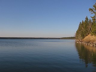
Riding Mountain National Park is a national park in Manitoba, Canada. The park is located within Treaty 2 Territory and sits atop the Manitoba Escarpment. Consisting of a protected area 2,969 km2 (1,146 sq mi), the forested parkland stands in sharp contrast to the surrounding prairie farmland. It was designated a national park because it protects three different ecosystems that converge in the area; grasslands, upland boreal and eastern deciduous forests. It is most easily reached by Highway 10 which passes through the park. The south entrance is at the townsite of Wasagaming, which is the only commercial centre within the park boundaries.
The Waywayseecappo First Nation is a First Nations band government whose reserve is located twenty miles east of Russell, Manitoba, Canada. The First Nation's reserve is 10,059 hectare and is located near the southwestern corner of the Riding Mountain National Park. It is bordered by the Rural Municipality of Rossburn and the Rural Municipality of Riding Mountain West. The First Nation also hold interest together with 32 other First Nations on the 37.1 hectare Treaty Four Reserve Grounds , located adjacent to Fort Qu'Appelle. Its population was 1,219 in 2011. They are home of the MJHL team Waywayseecappo Wolverines. There are several businesses located in the Birdtail valley near PTH 45, such as a gas station, food mart, gaming centre, health centre, daycare, and community arena complex. As of April 1, 2014, the RCMP is no longer in the community, being replaced by the Manitoba First Nations Police Service.
The Anisininew or Oji-Cree are a First Nation in the Canadian provinces of Ontario and Manitoba, residing in a band extending from the Missinaibi River region in Northeastern Ontario at the east to Lake Winnipeg at the west.
Mishkeegogamang First Nation is an Ojibway band government in the Canadian province of Ontario. Until 1993, the band was called the Osnaburgh First Nation, with various settlements at times being called New Osnaburgh, Osnaburgh House, or Osnaburgh.
Treaty 2 was entered in to on 21 August 1872 at Manitoba House, Rupertsland, with representatives of the Queen of Great Britain and Ireland. The original Anishinaabe, who were present, constitute Treaty 2 today. It is known that many of the chiefs and leaders within the territory were at the early gathering and after the treaty was agreed to. Those who were not present were represented through Metis until they indicated where they wished their farming reserves to be established. The treaty reaffirmed the inherent rights that the Anishinaabe had prior to European contact, located where southwestern Manitoba is today and a small part of southeastern Saskatchewan.

Sandy Lake is a small farming community in the Canadian province of Manitoba. It is located in the Rural Municipality of Harrison Park along PTH 45 approximately 10 miles (16 km) west of PTH 10.

The Long Plain First Nation is an Ojibway and Dakota First Nations band government in Manitoba, Canada.

Census Division No. 15 is a census division located within the Westman Region of the province of Manitoba, Canada. Unlike in some other provinces, census divisions do not reflect the organization of local government in Manitoba. These areas exist solely for the purposes of statistical analysis and presentation; they have no government of their own.
Shoal Lake 40 First Nation is an Ojibway or Ontario First Nation reserve located in the Eastman Region of Manitoba and the Kenora District of Ontario. The total registered population in December 2022 was 683, of which the on-reserve population was 306. The First Nation is a member of the Bimose Tribal Council, a Regional Chiefs' Council that is a member of the Grand Council of Treaty 3.
Sandy Bay Ojibway First Nation is an Ojibwa First Nation in Manitoba, Canada. As of the 2016 Canadian Census, it had a population of 2,515; while the First Nation's website reported a membership of 6,905 individuals as of December 2019.
The Mathias Colomb Cree Nation (MCCN) —also known as Mathias Colomb First Nation, Mathias Colomb (Cree) First Nation, and Pukatawagan/Mathias Colomb Cree Nation—is a remote First Nations community in northern Manitoba, located 210 km (130 mi) north of The Pas and 819 km (509 mi) northwest of Winnipeg, Manitoba.
Keeseekoowenin was a First Nations leader during the period when Canada was expanding into the prairie provinces of Manitoba, Saskatchewan and Alberta.
Riding Mountain House was a Hudson's Bay Company trading post set up to the south of what is now the Riding Mountain National Park, on the Little Saskatchewan River. It was built in 1860 and maintained until 1895, by which time there was little remaining trade in furs. It was near modern-day Elphinstone, Manitoba.
The Rural Municipality of Strathclair is a former rural municipality (RM) in the Canadian province of Manitoba. It was originally incorporated as a rural municipality on December 22, 1883. It ceased on January 1, 2015, as a result of its provincially mandated amalgamation with the RM of Shoal Lake to form the Rural Municipality of Yellowhead.
The Swan Lake First Nation is a Saulteaux band government located along Swan Lake in the Pembina Valley Region of Manitoba, Canada.
Ebb and Flow First Nation is an Anishinaabe First Nations community in Manitoba. It is located on the eponymous Ebb and Flow Lake, northeast of Riding Mountain National Park. It is about 180 km from Winnipeg, and lies on the west side of Lake Manitoba, on Manitoba Provincial Road 278.

Riding Mountain Biosphere Reserve (RMBR) is a UNESCO World Biosphere Reserve designated by the United Nations Educational, Scientific and Cultural Organization (UNESCO) in 1986 as part of its Man and the Biosphere Programme. The RMBR, which encompasses Riding Mountain National Park and twelve surrounding municipalities in the province of Manitoba, is one of 16 Biosphere Reserves in Canada. Ecologically sensitive ecosystems include the grasslands, deciduous forest and boreal forest. Although grasslands occupy only 7,400 of the total 1,331,800 hectares, they are considered of national importance since they exist as discrete units and the rare climax rough fescue community represents the eastern extent of its range. The Biosphere Reserve extends the protection of these ecosystems outside of park boundaries. Municipalities in the Riding Mountain Biosphere Reserve include Clanwilliam – Erickson, Dauphin, Gilbert Plains, Grandview, Harrison Park, Lakeshore, McCreary, Rosedale, St. Rose, Riding Mountain West, Rossburn, and Yellowhead. First Nations in the Biosphere Reserve include Rolling River First Nation, Keeseekoowenin First Nation, Waywayseecappo First Nation, and Tootinaowaziibeeng First Nation. Asessippi Provincial Park and Duck Mountain Provincial Forest also border the Biosphere Reserve.

