Related Research Articles

The Cree or nehinaw are a North American Indigenous people. They live primarily in Canada, where they form one of the country's largest First Nations. More than 350,000 Canadians are Cree or have Cree ancestry. The major proportion of Cree in Canada live north and west of Lake Superior, in Ontario, Manitoba, Saskatchewan, Alberta, and the Northwest Territories. About 27,000 live in Quebec.

Northern Manitoba is a geographic and cultural region of the Canadian province of Manitoba. Originally encompassing a small square around the Red River Colony, the province was extended north to the 60th parallel in 1912. The region's specific boundaries vary, as "northern" communities are considered to share certain social and geographic characteristics, regardless of latitude.
The Opaskwayak Cree Nation is a First Nations band government located in Manitoba, Canada. The main OCN reserve is regarded as one of three distinct communities that comprise "The Pas area" in northern Manitoba, with the two others being the Town of The Pas and the Rural Municipality of Kelsey.
Tkʼemlúps te Secwépemc, abbreviated TteS and previously known as the Kamloops Indian Band, is a First Nations government within the Shuswap Nation Tribal Council, which represents ten of the seventeen Secwepemc band governments, all in the southern Central Interior region, spanning the Thompson and Shuswap districts. It is one of the largest of the 17 groups into which the Secwepemc (Shuswap) nation was divided when the Colony of British Columbia established an Indian reserve system in the 1860s.
The Waywayseecappo First Nation is a First Nations band government whose reserve is located twenty miles east of Russell, Manitoba, Canada. The First Nation's reserve is 10,059 hectare and is located near the southwestern corner of the Riding Mountain National Park. It is bordered by the Rural Municipality of Rossburn and the Rural Municipality of Riding Mountain West. The First Nation also hold interest together with 32 other First Nations on the 37.1 hectare Treaty Four Reserve Grounds , located adjacent to Fort Qu'Appelle. Its population was 1,219 in 2011. They are home of the MJHL team Waywayseecappo Wolverines. There are several businesses located in the Birdtail valley near PTH 45, such as a gas station, food mart, gaming centre, health centre, daycare, and community arena complex. As of April 1, 2014, the RCMP is no longer in the community, being replaced by the Manitoba First Nations Police Service.
The Pine Creek First Nation is a Saulteaux First Nation in Manitoba, Canada. The First Nation's homeland is the Pine Creek 66A reserve, located approximately 110 kilometres north of Dauphin along the southwestern shore of Lake Winnipegosis between the communities of Camperville and Duck Bay. The Rural Municipality of Mountain (South) borders it on the southwest.

St. Theresa Point First Nation is a First Nations community in northern Manitoba. It has 3 reserves in total, the largest and most populated of which is St. Theresa Point, which is bordered by the unorganized portion of Division No. 22, Manitoba, and by the Wasagamack First Nation.
York Factory First Nation —sometimes referred to as York Landing First Nation or York Factory Cree Nation—is a First Nations community in northern Manitoba, Canada.
Buffalo Point First Nation is an Ojibwa or Saulteaux First Nations located in the southeastern corner of Manitoba, along the shores of Lake of the Woods. It is bordered largely by the unorganized portion of Division No. 1, Manitoba, and also has smaller borders with the Rural Municipality of Piney, as well as the northeast corner of Roseau County, Minnesota.
Fox Lake Cree Nation is a First Nations band government whose reserve is located in Fox Lake, Bird, Manitoba, Canada.
The O'Chiese First Nation is a Saulteaux First Nation in Alberta, Canada. The First Nation's homeland is the 14,131.9 ha O'Chiese 203 Indian reserve, located approximately 52 km northwest of Rocky Mountain House. Also reserved is the O'Chiese Cemetery 203A. As of November 2013, the First Nation had the population of 1,250 registered people, of which the on-reserve population was 831 people. The primary language spoken on the reserve is Western Ojibwa. Though the ancestors of O'Chiese First Nation made the area about the Baptiste River their winter camp site where they hunted moose and deer, and trapped small game for the fur trade, they also migrated in the summer as far south as the Milk River in what is now Montana.
The Lyackson First Nation is a First Nations band government located at Chemainus, British Columbia, Canada, on Vancouver Island.
The Leq'á:mel First Nation, formerly known as Lakahahmen First Nation, is a First Nations band government whose community and offices are located in the area near Deroche, British Columbia in the Fraser Valley region in Canada, about 12 kilometres east of the District of Mission. They are a member government of the Sto:lo Nation Chiefs Council, which is one of two tribal councils of the Sto:lo.
Barren Lands First Nation is a First Nation located on the north shore of Reindeer Lake in northern Manitoba close to the Saskatchewan border. It has one reserve land called Brochet 197, which is 4,339.40 ha in size and adjoins the village of Brochet, Manitoba.
Marcel Colomb First Nation (MCFN), Band #328, is a First Nations Band of approximately 449 Registered Swampy Cree and Rocky Cree (Asinīskāwiyiniwak) located in the area of Lynn Lake, Manitoba, Canada.
The Rolling River First Nation is an Ojibwe First Nations community in Manitoba, located south of Riding Mountain National Park.
Ebb and Flow First Nation is an Anishinaabe First Nations community in Manitoba. It is located on the eponymous Ebb and Flow Lake, northeast of Riding Mountain National Park. It is about 180 km from Winnipeg, and lies on the west side of Lake Manitoba, on Manitoba Provincial Road 278.

Ɂejëre Kʼelnı Kuę́ 196I, also known as Hay Camp, is an Indian reserve in northern Alberta, Canada. The reserve is one of ten reserves under the governance of the Smith's Landing First Nation, known in their language as the Dene Ch'anie. The reserve is located on the west bank of Slave River within Wood Buffalo National Park, and comprises 213 ha.

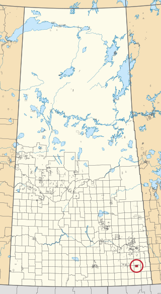
Cote 64 is an Indian reserve of the Cote First Nation in Saskatchewan. It is 16 kilometres (9.9 mi) west of the Manitoba border. In the 2016 Canadian Census, it recorded a population of 748 living in 220 of its 269 total private dwellings. In the same year, its Community Well-Being index was calculated at 51 of 100, compared to 58.4 for the average First Nations community and 77.5 for the average non-Indigenous community.
White Bear 70 is an Indian reserve of the White Bear First Nations in Saskatchewan. It is about 13 kilometres (8.1 mi) north of Carlyle, is adjacent to Moose Mountain Provincial Park, and surrounds White Bear (Carlyle) Lake. It encompasses a total of 12,038.4 ha. In the 2016 Canadian Census, it recorded a population of 691 living in 237 of its 972 total private dwellings. In the same year, its Community Well-Being index was calculated at 60 of 100, compared to 58.4 for the average First Nations community and 77.5 for the average non-Indigenous community.
References
- 1 2 3 4 5 "Home". Crown–Indigenous Relations and Northern Affairs Canada . Government of Canada. 3 November 2008.
- ↑ Paynter., Florence; Thomas, Andy Thomas. "The Significance of Creating First Nation Traditional Names Maps" (PDF). Manitoba First Nations Education Resource Centre Inc. Archived from the original (PDF) on 9 August 2017.
- 1 2 Gambler First Nation website
- ↑ "Indian and Northern Affairs Canada, Registered Population Detail". Crown–Indigenous Relations and Northern Affairs Canada . Government of Canada. Retrieved 2014-05-01.
- ↑ Indigenous and Northern Affairs Canada (2019-04-09). "Gambler First Nation | Reserves/Settlements/Villages". Crown–Indigenous Relations and Northern Affairs Canada . Government of Canada. Retrieved 2021-08-18.
- ↑ "Indian and Northern Affairs Canada, Reserves/Settlements/Villages Detail". Crown–Indigenous Relations and Northern Affairs Canada . Government of Canada. Retrieved 2014-05-01.
- ↑ Government of Canada, Natural Resources Canada. "Place names - Gambler First Nation 63B". www4.nrcan.gc.ca. Retrieved 2021-08-18.
- ↑ "Indian and Northern Affairs Canada Reserve/Settlement/Village Detail". Crown–Indigenous Relations and Northern Affairs Canada . Government of Canada. Retrieved 2014-05-01.
Division No. 15, Manitoba (Western Manitoba) | ||||
|---|---|---|---|---|
| Towns |
|  | ||
| Villages |
| |||
| Rural municipalities |
| |||
| First Nations | ||||
| Indian reserves | ||||
| Unincorporated communities | ||||
| Towns |
|  | ||
|---|---|---|---|---|
| Villages |
| |||
| Rural municipalities |
| |||
| First Nations | ||||
| Indian reserves | ||||
| Unincorporated communities | ||||