
The Hudson's Bay Company is a Canadian, now American-owned, retail business group. A fur trading business for much of its existence, HBC now owns and operates retail stores in Canada and the United States. It had been a member of the International Association of Department Stores from 2001 to 2005.

Northern Canada, colloquially the North or the Territories, is the vast northernmost region of Canada variously defined by geography and politics. Politically, the term refers to the three territories of Canada: Yukon, Northwest Territories and Nunavut. This area covers about 48 per cent of Canada's total land area, but has less than 1 per cent of Canada's population.

York Factory was a settlement and Hudson's Bay Company (HBC) factory located on the southwestern shore of Hudson Bay in northeastern Manitoba, Canada, at the mouth of the Hayes River, approximately 200 kilometres (120 mi) south-southeast of Churchill. York Factory was one of the first fur-trading posts established by the HBC, built in 1684 and used in that business for more than 270 years. The settlement was headquarters of the HBC's Northern Department from 1821 to 1873. The complex was designated a National Historic Site of Canada in 1936.
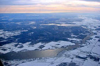
The Winnipeg River is a Canadian river that flows roughly northwest from Lake of the Woods in the province of Ontario to Lake Winnipeg in Manitoba. This river is 235 kilometres (146 mi) long from the Norman Dam in Kenora to its mouth at Lake Winnipeg. Its watershed is 106,500 square kilometres (41,100 sq mi) in area, mainly in Canada. About 29,000 square kilometres (11,000 sq mi) of the watershed is in northern Minnesota, United States.

Marie-Anne Lagimodière was a French-Canadian woman noted as both the grandmother of Louis Riel, and as the first woman of European descent to travel to and settle in what is now Western Canada.

Henry Kelsey was an English fur trader, explorer, and sailor who played an important role in establishing the Hudson's Bay Company in Canada. Kelsey was born and married in East Greenwich, south-east of central London.

Fort Carlton was a Hudson's Bay Company fur trade post from 1795 until 1885. It was located along the North Saskatchewan River not far from Duck Lake, Saskatchewan. It was rebuilt by the government of Saskatchewan as a feature of a provincial historic park and can be visited today. It is about 65 kilometres north of Saskatoon.

The North Saskatchewan River is a glacier-fed river that flows from the Canadian Rockies continental divide east to central Saskatchewan, where it joins with the South Saskatchewan River to make up the Saskatchewan River. Its water flows eventually into the Hudson Bay.
Russell is an unincorporated urban community in the Municipality of Russell – Binscarth, Manitoba.
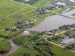
Rapid City is an unincorporated community recognized as a local urban district that also once held town status in southwest Manitoba, Canada within the Rural Municipality of Oakview. It is located about 30 km north of Brandon. Rapid City is a farming community that is developed on the banks of the Little Saskatchewan River. The dam and reservoir in Rapid City were built by the province in 1961, the reservoir stores 200 acre-feet (250,000 m3) and provides a water supply and recreational facility for the community.
Fort Ellice was a Hudson's Bay Company trading post operated from 1794 to 1892. First established on the Qu'Appelle River, the post was rebuilt in 1817 on the south bank of the Assiniboine. Another iteration of the post was built near the first in 1862 and, in 1873, replaced Fort Pelly as the headquarters for the Swan River District. The fort was located in what is now west-central Manitoba, Canada, just east of that province's border with Saskatchewan.

The Selkirk Concession was a land grant issued by the Hudson's Bay Company (HBC) to Thomas Douglas, 5th Earl of Selkirk, in 1812. The Hudson's Bay Company held a commercial monopoly in Rupert's Land, consisting of the entire Hudson Bay drainage basin. The Selkirk Concession, also known as Selkirk's Grant, included a large section of the southwest area of Rupert's Land, bounded: on the north by the line of 52° N latitude roughly from the Assiniboine River east to Lake Winnipegosis, then by the line of 52° 30′ N latitude from Lake Winnipegosis to Lake Winnipeg; on the east by the Winnipeg River, Lake of the Woods and Rainy River; on the west roughly by the current boundary between modern Saskatchewan and Manitoba; and on the south by the rise of land marking the extent of the Hudson Bay watershed. This covered portions of present-day southern Manitoba, northern Minnesota and eastern North Dakota, in addition to small parts of eastern Saskatchewan, northwestern Ontario and northeastern South Dakota.

Peter Fidler was a British surveyor, map-maker, fur trader and explorer who had a long career in the employ of the Hudson's Bay Company (HBC) in what later became Canada. He was born in Bolsover, Derbyshire, England and died at Fort Dauphin in present-day Manitoba. He married Mary (Methwewin) Mackagonne, a Cree woman, and together they had 14 children.

William Kennedy was a Canadian fur trader, politician, and historian.

Fisher River is a Cree First Nations reserve located approximately 193 km north of Manitoba's capital city, Winnipeg. The Fisher River Cree Nation is composed of two reserves; Fisher River 44 and Fisher River 44A. The reserve population is 1945, the off reserve population is 1934 for a total of 3879 band members as of June 2017. Fisher River is 15,614 acres.

George Flett was a Presbyterian missionary in what is now Manitoba, Canada. Flett was of Orkney and Cree descent. As a young man he farmed on the White Horse Plains, led a gold exploration party to Edmonton and then became the first post master for the Hudson's Bay Company at Fort Victoria, Alberta. Flett was an interpreter to the first Presbyterian mission to the northwest between 1866 and 1867. After serving as a delegate in the provisional government of Louis Riel during the Red River Rebellion, he became a missionary among the Ojibwa of Okanese Reserve, serving from 1873 to 1895.
Keeseekoowenin was a First Nations leader during the period when Canada was expanding into the prairie provinces of Manitoba, Saskatchewan and Alberta.
Louis Primeau or Primo was one of the first European fur traders on the Churchill River. Primeau Lake in northern Saskatchewan, Canada is named after him. Little is known of his youth. Morton says that he was born in Quebec of an English father and French mother, but the DCB does not repeat this.
Fur trading on the Assiniboine River and the general area west of Lake Winnipeg began as early as 1731.
The Iron Confederacy or Iron Confederation was a political and military alliance of Plains Indians of what is now Western Canada and the northern United States. This confederacy included various individual bands that formed political, hunting and military alliances in defense against common enemies. The ethnic groups that made up the Confederacy were the branches of the Cree that moved onto the Great Plains around 1740, the Saulteaux, the Nakoda or Stoney people also called Pwat or Assiniboine, and the Métis and Haudenosaunee. The Confederacy rose to predominance on the northern Plains during the height of the North American fur trade when they operated as middlemen controlling the flow of European goods, particularly guns and ammunition, to other Indigenous nations, and the flow of furs to the Hudson's Bay Company (HBC) and North West Company (NWC) trading posts. Its peoples later also played a major part in the bison (buffalo) hunt, and the pemmican trade. The decline of the fur trade and the collapse of the bison herds sapped the power of the Confederacy after the 1860s, and it could no longer act as a barrier to U.S. and Canadian expansion.

