Whitemouth | |
|---|---|
| Rural Municipality of Whitemouth | |
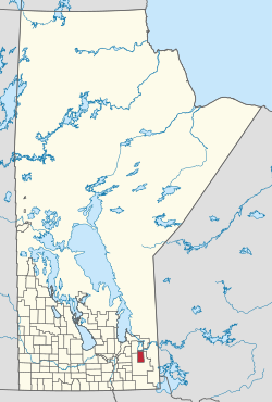 Location of the Rural Municipality of Whitemouth in Manitoba | |
| Coordinates: 49°58′01″N95°57′30″W / 49.96694°N 95.95833°W | |
| Country | Canada |
| Province | Manitoba |
| Region | Eastman Region |
| First incorporated | March 1, 1905 |
| Incorporated (amalgamated) | January 1, 2015 |
| Area | |
• Total | 697.35 km2 (269.25 sq mi) |
| Population | |
• Total | 1,630 |
| • Density | 2.3/km2 (6.1/sq mi) |
| Time zone | UTC-6 (CST) |
| • Summer (DST) | UTC-5 (CDT) |
| Website | rmwhitemouth |
The Rural Municipality of Whitemouth is a rural municipality (RM) located in southeastern Manitoba.
Contents
The community of Whitemouth is located in the municipality, which also contains the Whitemouth Bog Ecological Reserve , and small parts of Manitoba's Agassiz Provincial Forest (in its southwest quadrant) and Whiteshell Provincial Forest (in its northeast corner).
