Shoal Lake 40 First Nation

Last updated

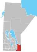
Shoal Lake 40 First Nation (Ojibwe : Iskatewi-zaaga'iganiing 40) [1] is an Ojibway or Ontario First Nation reserve located in the Eastman Region of Manitoba and the Kenora District of Ontario. The total registered population in December 2022 was 683, of which the on-reserve population was 306. [2] The First Nation is a member of the Bimose Tribal Council, a Regional Chiefs' Council that is a member of the Grand Council of Treaty 3.

Contents

The community inhabits a man-made island. It is accessible via barge traffic from Iskatewizaagegan 39 First Nation's dock, located in the community of Kejick, Ontario, and in winter by ice roads. The construction of a new all-season road to link the community with the Trans-Canada Highway was secured after an agreement was reached between three levels of government on how the cost would be covered. [3] The road, aptly named Freedom Road, was eventually built between 2017 and 2019. [4]

The First Nation possesses basic infrastructure, limited retail outlets, and indoor and outdoor recreational facilities and provides local elementary schooling to grade 8.

History

Indian Bay and drinking water

In 1915 the City of Winnipeg expropriated over 3,000 acres of Shoal Lake 40 ancestral land, relocating a longstanding village site and over 100 residents. By 1919 this area became the intake facility for the Winnipeg-Shoal Lake Aqueduct, pumping approximately 85 million gallons per day to the city. The construction project involved the excavation of indigenous burial grounds and disinterment of human remains. [5] [6]

In 1980, both First Nation bands in the area (#39 and #40) planned to develop 350 cottage lots on Indian Bay, Shoal Lake. This project was opposed by the City of Winnipeg because of concerns about the safety of its drinking water, which is drawn from Indian Bay. [7] The dispute was settled in 1989 when the Greater Winnipeg Water District placed $6 million in trust for Shoal Lake 40, with the interest to be used to fund alternative development projects. The agreement was conditional on a contribution of $3 million from the federal government. [8] A tripartite agreement was finalized when a parallel agreement was signed between the federal government and Shoal Lake 40 in 1990. [9] [10] In the meantime, Shoal Lake began importing water by barge or truck at a substantial cost. [9] A formal drinking water advisory was only announced in 1997. [11]

In 2011, when the proposal for a new water treatment plant showed that the cost would be more than anticipated, the federal government refused to contribute the difference and the plan was abandoned. Instead, Shoal Lake proposed the construction of an all-weather road to guarantee safe year-round access to the reserve and for the importation of water. [9]

Freedom Road and treatment facility

Shoal Lake 40 joined forces with the neighbouring Manitoba municipality of Reynolds to encourage the building of an all-weather road by two levels of government, in order to connect with the Trans-Canada Highway. [9] In earlier years, the community obtained many necessary supplies and goods via the Greater Winnipeg Water District Railway as they were shipped to the aqueduct water intake site. This terminus site for the railway was also known as Waugh Station.

In 2015, the government agreed to pay for a design project for the study, but would not promise to pay for the construction of "Freedom Road" itself. [12] [13] Earlier in the year, the community's barge ferry failed to pass inspection and the local leadership declared a state of emergency. [12] Funding was later approved and construction of the new road started in Spring 2017. [14] Completion of the road in June 2019 has reconnected the community to the rest of Canada, allowing emergency services to enter easily, waste to be transported out, and residents to access health services outside of the community. [15] The Freedom Road project intersects the eastbound lanes of the Trans-Canada Highway (Hwy #1) at a point 3.7 km west of Route 301 in Falcon Beach, MB.

On September 15, 2021, a 33 million CAD water treatment facility was opened in the reserve, giving the reserve access to clean drinking water. [11] The completion of the facility was due, in part, to a lower price tag thanks to the construction of the Freedom Road. [11]

Reserves

This First Nation occupies three reserves:

Governance

Shoal Lake 40 First Nation elects their leadership through the Act Electoral System for two year terms.

Chief and Council

Media

Shoal Lake 40 was featured the 360° documentary experience film, Cut-Off VR [21] which places the viewer in the middle of Prime Minister Justin Trudeau's historic visit to Shoal Lake 40. Viewers also visit Cross Lake, where a state of emergency was declared after a wave of youth suicides. The film was created by Vice and Occupied VR. The documentary nominated for a Canadian Screen Award for Best Immersive Experience.

Related Research Articles

<span class="mw-page-title-main">Lake of the Woods</span> Lake on the United States–Canada border

Lake of the Woods is a lake occupying parts of the Canadian provinces of Ontario and Manitoba and the U.S. state of Minnesota. Lake of the Woods is over 70 miles (110 km) long and wide, containing more than 14,552 islands and 65,000 miles (105,000 km) of shoreline. It is fed by the Rainy River, Shoal Lake, Kakagi Lake and other smaller rivers. The lake drains into the Winnipeg River and then into Lake Winnipeg. Ultimately, its outflow goes north through the Nelson River to Hudson Bay.

Shoal Lake is a lake that straddles the boundary between Ontario and Manitoba, Canada, northwest of the Lake of the Woods. Depending on the water level of Lake of the Woods, Shoal Lake runs both a tributary and distributary of Lake of the Woods and, for many practical purposes, is part of that lake.

<span class="mw-page-title-main">Nisichawayasihk Cree Nation</span>

The Nisichawayasihk Cree Nation is a Cree First Nations community centered in Nelson House, Manitoba, Canada. Its main reserve is Nelson House 170.

Roseau River Anishinabe First Nation is an Ojibway First Nation in southern Manitoba, Canada, situated around the Roseau River.

<span class="mw-page-title-main">Misipawistik Cree Nation</span> Place in Manitoba, Canada

Misipawistik Cree Nation is a Cree community in northern Manitoba. Misipawistik in the local Cree language means 'Rushing Rapids', which was once a historical Canadian landmark before the construction of the Manitoba Hydro-electric Dam in the late 1950s.

Kitchenuhmaykoosib Inninuwug, also known as Big Trout Lake First Nation or KI for short, is an Oji-Cree First Nation reserve in Northwestern Ontario and is a part of Treaty 9. The community is about 580 km (360 mi) north of Thunder Bay, Ontario.

Webequie First Nation is located on the northern peninsula of Eastwood Island on Winisk Lake, 540 km (336 mi) north of Thunder Bay in Ontario, Canada. Webequie is a fly-in community with no summer road access. The primary way into the community is by air to Webequie Airport or winter road, which connects to the Northern Ontario Resource Trail. The First Nation have the 34,279 ha Webequie Indian reserve. The Webequie or Webiqui Indian Settlement also have reserve status. Webequie First Nation is a member of the Matawa First Nations, a Regional Chiefs' Council and a member of the Nishnawbe Aski Nation.

The Berens River is a river in the provinces of Manitoba and Ontario, Canada. It flows west from an unnamed lake in Kenora District, Ontario, and discharges its waters into Lake Winnipeg near the community and First Nation of Berens River, Manitoba. The river has a number of lakes along its course, and many rapids.

Lac Seul First Nation is an Ojibwe First Nation band government located on the southeastern shores of Lac Seul, 56 kilometres (35 mi) northeast of the city of Dryden, Ontario. Though Lac Seul First Nation is a treaty signatory to Treaty 3, the First Nation is a member of the Independent First Nations Alliance, a regional tribal council and a member of the Nishnawbe Aski Nation.

Cross Lake First Nation is a band of Cree First Nations people in Canada governed under the Indian Act. Its members occupy several reserves within the town of Cross Lake situated on the east shore of Cross Lake in the province of Manitoba. In October 2008, its recorded registered membership was 6,969, of which 4,953 people of this First Nation lived on their reserve. Cross Lake is the principal community of the Pimicikamak indigenous people that made treaty with the British Crown in 1875. Its indigenous language is Woods Cree. Cross Lake was the site of a residential school operated under Canada's assimilation policy. In 2008, Prime Minister Stephen Harper apologized for the damage caused by this policy.

Wabaseemoong Independent Nations or more fully as the Wabaseemoong Independent Nations of One Man Lake, Swan Lake and Whitedog, is an Ojibway First Nation band government who reside 120 km northwest of Kenora, Ontario and 13 kilometres (8.1 mi) east of the Ontario-Manitoba border of northwestern Ontario, Canada. As of December 2018, the First Nation had a population of 2,000 registered people, of which their on-Reserve population was 1200 registered members and approximately 100 non-Band members.

Hollow Water First Nation is an Anishinaabe (Ojibwa) First Nation located on the east side of Lake Winnipeg, Canada, 75 km (47 mi) north of Pine Falls, Manitoba, and 217 km (135 mi) north of Winnipeg.

The Mathias Colomb Cree Nation (MCCN) —also known as Mathias Colomb First Nation, Mathias Colomb (Cree) First Nation, and Pukatawagan/Mathias Colomb Cree Nation—is a remote First Nations community in northern Manitoba, located 210 km (130 mi) north of The Pas and 819 km (509 mi) northwest of Winnipeg, Manitoba.

<span class="mw-page-title-main">Sapotaweyak Cree Nation</span>

The Sapotaweyak Cree Nation is a First Nations band government whose reserves are located in northern Manitoba, north-east of Swan River, approximately 400 kilometres northwest of Winnipeg.

Shoal Lake may refer to:

<span class="mw-page-title-main">Greater Winnipeg Water District Aqueduct</span> Bridge in Shoal Lake First Nation

The Greater Winnipeg Water District Aqueduct (GWWDA) is an aqueduct that supplies the city of Winnipeg, Manitoba, with water from Shoal Lake, Kenora District, Ontario. Winnipeg has relied on the lake as its source for safe drinking water since the aqueduct was put in service in 1919 at a cost of nearly CDN $16 million.

Shoal Lake 34B2 is a First Nations reserve on the shores of Shoal Lake in northwestern Ontario. It is shared between the Iskatewizaagegan 39 Independent First Nation and Shoal Lake 40 First Nation.

References

  1. https://211north.ca/first-nations/
  2. "Registered Population (Shoal Lake No.40)". Crown–Indigenous Relations and Northern Affairs Canada . Government of Canada. December 2022. Retrieved 2021-09-16.
  3. Feds give more for Freedom Road. Winnipeg Free Press, 12 December 2016. Retrieved 16 December 2016.
  4. Government of Canada. "Shoal Lake 40 welcomes the opening of Freedom Road" . Retrieved November 27, 2022.
  5. Prodan, Cornelius S. (1979). "The Building of the Winnipeg Aqueduct". Manitoba Pageant. Manitoba Historical Society. 24 (2). ISSN   0025-2263. OCLC   1756630 . Retrieved 2017-03-03.
  6. Sarain Carson-Fox, Daryl Redsky (2016). CUT-OFF S1 Ep.1. VICELAND. Event occurs at 09:30. Retrieved 2023-02-09.
  7. Shoal Lake Aqueduct, Winnipeg, Manitoba. The National History Committee of the Canadian Society for Civil Engineering, 1994. Retrieved 7 September 2011.
  8. Agreements and Licenses - Urban Water Quality: Shoal Lake. Winnipeg Green Map - Source and Supply. Retrieved 14 September 2011.
  9. 1 2 3 4 At the mouth of the aqueduct, there's no water to drink. Winnipeg Free Press, 8 January 2011. Retrieved 7 September 2011.
  10. "List of Selected Treaties, Intergovernmental Agreements, Memoranda of Understanding, Orders, Draft Documents, etc. of Specific Relevance to the Shoal Lake Watershed." Government of Manitoba, Dept. of Water Stewardship. Retrieved 14 September 2011.
  11. 1 2 3 Cecco, Leyland (2021-09-16). "'About damn time': First Nation gets clean water after 24-year wait". The Guardian . Archived from the original on 2021-09-16. Retrieved 2021-09-16.
  12. 1 2 Puxley, Chinta (25 Jun 2015). "Shoal Lake reserve residents weep as Ottawa balks at funding road construction". CBC News. Retrieved 27 June 2015.
  13. Road to isolated Shoal Lake First Nation a long-awaited step in tangled history. CBC News, 17 December 2015. Retrieved 20 November 2016.
  14. Shoal Lake 40 celebrates start of on-reserve construction of Freedom Road. CTV News, 30 June 2017. Retrieved 15 October 2017.
  15. A century of water: As Winnipeg aqueduct turns 100, Shoal Lake finds freedom. CBC News, 2 June 2019. Retrieved 3 June 2019.
  16. Aboriginal Canada Portal - Shoal Lake No.40 Archived 2012-01-14 at the Wayback Machine . Retrieved 7 September 2011.
  17. Aboriginal Canada Portal - Shoal Lake 34B2 Archived 2012-01-14 at the Wayback Machine . Retrieved 7 September 2011.
  18. Aboriginal Canada Portal - Agency 30 Archived 2011-05-16 at the Wayback Machine . Retrieved 7 September 2011.
  19. 1 2 Hale, Alan S. (7 March 2014). "Erwin Redsky wins another term as chief of Shoal Lake 40, half of band council replaced". Kenora Daily Miner and News. Retrieved 27 June 2015.
  20. Thompson, Jon (March 1, 2012). "Redsky returns as Shoal Lake 40 chief". Kenora Daily Miner and News. Retrieved 27 June 2015.
  21. "VICELAND PRESENTS: CUT-OFF".

49°36′45″N95°08′41″W / 49.61250°N 95.14472°W / 49.61250; -95.14472