This article needs additional citations for verification .(April 2012) |
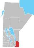
Caliento is a small, unorganized community in southeastern Manitoba in the Rural Municipality of Stuartburn, situated between the communities of Vita, Zhoda, and Sundown.
It is approximately 100 kilometres (62 mi) from Winnipeg and is around 45 kilometres (28 mi) from Emerson, Manitoba, at the Canada–US border. A post office was opened there c. 1912 on section 14-2-8E; Safron Stefiuk was the first postmaster. The origin of the name is not certain.
Caliento was founded in 1907 by a group of 27 families and a few single men that had come from Ukraine in 1896. [1] They came on the steamship "Sicilia" that landed in Winnipeg in July 1896. The original colony was named Stuartburn which was the name of the post office and railway station in the area. Caliento was one of 15 original church communities that developed from the Stuartburn colony in the early 1900s. It is claimed that the name of the town came from the Spanish word "caliente" meaning warm.
The Canadian Northern Railway (CNR) built a railway in 1904 that stretched from Emerson to Ridgeville. Caliento was a station halt along this line along with others that were established every six or seven miles. Toll offices for telephone access were created along the railway in 1918 by the Bell telephone company. These services were only accessible during the day and by 1959 these toll offices were closed. This railway had a significant impact on the geography and economy of the Stuartburn colony. That being said, Stuartburn was a relatively poor area with only 9% of the 276,480 acres being cultivated. 1,285 farmers lived on this land and the average farm had one horse, five cattle, a pig, and only twenty acres cultivated. It seems they were stuck in the pioneer stage while other communities developed faster and generated wealth four times as quick. [2]
Emerson is an unincorporated community recognized as a local urban district (LUD) in south central Manitoba, Canada, located within the Municipality of Emerson – Franklin. It has a population of 678 as of the 2016 Canada census.
Roseau River Anishinabe First Nation is an Ojibway First Nation in southern Manitoba, Canada, situated around the Roseau River.
Carberry is a town in southwestern Manitoba, Canada. It is situated 3 kilometres (1.9 mi) south of the Trans-Canada Highway on Highway 5 in the Municipality of North Cypress – Langford, and has a population of 1,818 people.
A block settlement is a particular type of land distribution which allows settlers with the same ethnicity to form small colonies. This settlement type was used throughout western Canada between the late 19th and early 20th centuries. Some were planned and others were spontaneously created by the settlers themselves. As a legacy of the block settlements, the three Prairie Provinces have several regions where ancestries other than British are the largest, unlike the norm in surrounding regions.
Tolstoi is a hamlet in the Municipality of Emerson – Franklin, Manitoba, Canada. It is located along Manitoba Highway 59 at the junction with Provincial Road 209, approximately 90 kilometres (56 mi) south of Winnipeg and 10 kilometres (6.2 mi) north of the Tolstoi Port of Entry at the Canada–United States border.
Île-des-Chênes is an unincorporated community in Manitoba, Canada, within the Rural Municipality of Ritchot. The community is located 13 kilometres south-east of the provincial capital Winnipeg, just east of Highway 59. Île-des-Chênes is a French name, translating to Island of the Oaks, coming from a nearby stand of oaks on higher ground, where early settlers sought refuge from the annual spring floodwaters.
Vita is a local urban district in southeast Manitoba settled by Ukrainian immigrants in the late 1890s. It is roughly 50 km (31 mi) by road from Steinbach in the Rural Municipality of Stuartburn.
Zhoda is a community in southeastern Manitoba, Canada, approximately 20 kilometres (12 mi) north of the town of Vita. Although "Zhoda Corner" is situated at the intersection of PTH 12 and Manitoba Provincial Road 302, in the Rural Municipality of La Broquerie, the "heart" of Zhoda is the area located near the Zhoda Community Hall and the Ukrainian Catholic Church in the centre of the community, which is also part of the Rural Municipality of Stuartburn.
Stuartburn is a small, primarily Ukrainian community in southeastern Manitoba, Canada and situated in the Rural Municipality of Stuartburn. Stuartburn is considered to be the first Ukrainian community in western Canada.
The history of Manitoba covers the period from the arrival of Paleo-Indians thousands of years ago to the present day. When European fur traders first travelled to the area present-day Manitoba, they developed trade networks with several First Nations. European fur traders in the area during the late-17th century, with the French under Pierre Gaultier de Varennes, sieur de La Vérendrye set up several trading post forts. In 1670, Britain declared sovereignty over the watershed of Hudson's Bay, known as Rupert's Land; with the Hudson's Bay Company granted a commercial monopoly over the territory.
Provincial Trunk Highway 12 is a provincial primary highway located in the Canadian province of Manitoba. Lying entirely in the Eastman Region, it runs from the U.S. border to a dead end in Grand Beach. PTH 12 forms the Manitoba section of MOM's Way, a tourist route from Thunder Bay to Winnipeg. PTH 12 is primarily a two-lane highway except for two four-lane stretch between Steinbach and PTH 1 and a ten-kilometre concurrency with PTH 44.
Gardenton is a community in the Canadian province of Manitoba. It is located in the Rural Municipality of Stuartburn, approximately 9 kilometres north of the Canada–United States border.
Armstrong is a rural municipality in the province of Manitoba in Western Canada. It lies in the southern area of the Interlake and was named after James William Armstrong, a Manitoba politician.
Stuartburn is a rural municipality (RM) located in the Eastman Region of Manitoba, Canada. It had a population of 1,629 according to the Canada 2006 Census.
Arbakka is an unincorporated community in the Rural Municipality of Stuartburn, Manitoba, lying south of Vita, Manitoba. This region is sparsely populated, and its major exports are farmed goods and hogs.
Brokenhead Ojibway Nation is an Anishinaabe (Saulteaux/Ojibwa) First Nation located approximately 64 kilometres (40 mi) northeast of Winnipeg, Manitoba.
The Rat River is a tributary of the Red River of the North in southern Manitoba, Canada. It is part of the watershed of Hudson Bay.
The Rural Municipality of Franklin is a former rural municipality (RM) in the Canadian province of Manitoba. It was incorporated on December 22, 1883. It ceased on January 1, 2015 as a result of a provincially mandated amalgamation with the Town of Emerson to form the Municipality of Emerson – Franklin.
The Hudson Bay Railway (HBR) is a historic rail line in Manitoba, Canada, to the shore of Hudson Bay. The venture began as a line between Winnipeg in the south and Churchill, and/or Port Nelson, in the north. However, HBR came to describe the final section between The Pas and Churchill.
Provincial Road 209 is a short 14.1-kilometre-long (8.8 mi) east-west provincial road in the Eastman Region of Manitoba, Canada. It connects the community of Gardenton with PTH 59, as well as PR 201, along with the communities of Tolstoi, Vita, Stuartburn.
49°08′01″N96°24′54″W / 49.13361°N 96.41500°W