Shoal Lake 37A

Last updated
Shoal Lake 37A
Shoal Lake Indian Reserve No. 37A
Canada location map 2.svg
Red pog.svg
Shoal Lake 37A
Coordinates: 49°28′N95°10′W / 49.467°N 95.167°W / 49.467; -95.167 Coordinates: 49°28′N95°10′W / 49.467°N 95.167°W / 49.467; -95.167
Country Flag of Canada (Pantone).svg  Canada
Provinces Flag of Manitoba.svg  Manitoba, Flag of Ontario.svg  Ontario
Division / District Division 1 / Kenora
First Nation Animakee Wa Zhing 37
Area
[1]
  Land7.77 km2 (3.00 sq mi)

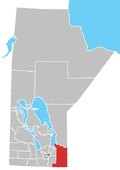
Shoal Lake 37A is a First Nations reserve [1] on Shoal Lake straddling the border between Manitoba and Ontario. It is one of the reserves of the Animakee Wa Zhing 37 First Nation.

Related Research Articles

The Cree are a North American Indigenous people. They live primarily in Canada, where they form one of that country's largest First Nations.

Treaty 3 was an agreement entered into on October 3, 1873, by Chief Mikiseesis on behalf of the Ojibwe First Nations and Queen Victoria. The treaty involved a vast tract of Ojibwe territory, including large parts of what is now northwestern Ontario and a small part of eastern Manitoba, to the Government of Canada. Treaty 3 also provided for rights for the Waasaakode Anishinaabe and other Ojibwe, through a series of agreements signed over the next year. The treaty was modified in 1875 when Nicolas Chatelain negotiated an adhesion that created a reserve, surveyed as reserve 16A, for Metis families connected to Mikiseesis' Rainy Lake Band. Reserve 16A and the Rainy Lake Band reserve were unified in 1967.

Eastman Region

Eastern Manitoba, or the Eastman Region, is an informal geographic region of the Canadian province of Manitoba. It is bounded on the north by the Winnipeg River and Lake Winnipeg, on the east by the Manitoba-Ontario border, on the south by the Canada–US border, and on the west by the Red River.

Division No. 1, Manitoba Census division in Manitoba, Canada

Division No. 1 is a census division located within the Eastman Region of the Canadian province of Manitoba. Unlike in some other provinces, census divisions do not reflect the organization of local government in Manitoba. These areas exist solely for the purposes of statistical analysis and presentation; they have no government of their own.

Shoal Lake 40 First Nation is an Ojibway or Ontario First Nation reserve located in the Eastman Region of Manitoba and the Kenora District of Ontario. The total registered population in August 2021 was 667, of which the on-reserve population was 295. The First Nation is a member of the Bimose Tribal Council, a Regional Chief's Council that is a member of the Grand Council of Treaty 3.

Division No. 1, Unorganized, or Whiteshell Unorganized, is a Statistics Canada census subdivision of its Division No. 1, Manitoba that consists of a part of the division that is not organized into either incorporated municipalities or Indian reserves. Unlike in some other provinces, census divisions do not reflect the organization of local government in Manitoba.

Sapotaweyak Cree Nation

The Sapotaweyak Cree Nation (SCN) is a First Nations band government whose reserves are located in northern Manitoba, north-east of Swan River, approximately 400 kilometres northwest of Winnipeg.

Shoal Lake 39 First Nation is an Ojibwa or Anishinaabe First Nation, located along the northwestern shores of Shoal Lake, Ontario. It is officially known as Iskatewizaagegan #39 Independent First Nation. The total registered population of this First Nation is 585, of which 297 live on its own reserves. They are governed by a chief and council, with their current Chief Gerald Lewis having been elected in March 2016 for a two-year term.

The Shoal Lake Cree Nation is a Swampy Cree First Nations band government in Saskatchewan, Canada located 98 kilometres (61 mi) east of Nipawin. The Cree First Nation is on the Carrot River and can be accessed by Highway 55. Nearby to the west is the Red Earth First Nation.

Red Earth First Nation

Red Earth First Nation is a Swampy Cree First Nations band government in Saskatchewan, Canada. It is located 225 kilometres (140 mi) northeast of Prince Albert. The main settlement of Red Earth is located on the Carrot River and accessed by Highway 55. Nearby to the east is the Shoal Lake First Nation.

The Anishnaabeg of Naongashiing is a First Nation band government in Ontario. They are a member of the Anishinabeg of Kabapikotawangag Resource Council, which is a part of the Grand Council of Treaty 3. Their reserves include:

Shoal Lake 39A Indian reserve in Canada

Shoal Lake 39A is a First Nations reserve straddling the border of Manitoba and Ontario on the shores of Shoal Lake. It is one of the reserves of the Iskatewizaagegan 39 Independent First Nation.

Shoal Lake 40 Indian reserve in Canada

Shoal Lake 40 is a First Nations reserve straddling the border of Manitoba and Ontario on the shores of Shoal Lake. It is one of the reserves of the Shoal Lake 40 First Nation.

Shoal Lake 34B2 Indian reserve in Ontario, Canada

Shoal Lake 34B2 is a First Nations reserve on the shores of Shoal Lake in northwestern Ontario. It is shared between the Iskatewizaagegan 39 Independent First Nation and Shoal Lake 40 First Nation.

Agency 30 Indian reserve in Ontario, Canada

Agency 30 is a First Nations reserve on the Aulneau Peninsula of Lake of the Woods in northwestern Ontario. It is shared by 13 First Nations:

Shoal Lake 31J Indian reserve in Ontario, Canada

Shoal Lake 31J is a First Nations reserve on Shoal Lake, northwestern Ontario. It is one of the reserves of the Anishnaabeg of Naongashiing.

Shoal Lake 34B1 Indian reserve in Ontario, Canada

Shoal Lake 34B1 is a First Nations reserve at the southwestern end of Shoal Lake in Kenora District, Ontario. It is one of the reserves of the Animakee Wa Zhing 37 First Nation.
Shoal Lake 39 Indian reserve in Canada

Shoal Lake 39 is a First Nations reserve on Shoal Lake straddling the border between Manitoba and Ontario. It is one of the reserves of the Iskatewizaagegan 39 Independent First Nation.

Shoal Lake 28A Indian reserve in Canada, Shoal Lake

Shoal Lake 28A is an Indian reserve of the Shoal Lake Cree Nation in Saskatchewan. It is 92 kilometres east of Nipawin. In the 2016 Canadian Census, it recorded a population of 424 living in 115 of its 118 total private dwellings. In the same year, its Community Well-Being index was calculated at 46 of 100, compared to 58.4 for the average First Nations community and 77.5 for the average non-Indigenous community.

References