Unorganized Kenora District | |
|---|---|
| Kenora, Unorganized | |
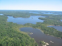 Scenery near Minaki | |
 | |
| Coordinates: 53°00′N89°00′W / 53.000°N 89.000°W | |
| Country | Canada |
| Province | Ontario |
| District | Kenora |
| Government | |
| • Fed. riding | Kapuskasing—Timmins—Mushkegowuk, Kenora—Kiiwetinoong, Thunder Bay—Superior North |
| • Prov. riding | Kenora—Rainy River, Kiiwetinoong, Mushkegowuk—James Bay |
| Area | |
| • Land | 388,982.20 km2 (150,186.87 sq mi) |
| Population (2021) | |
• Total | 7,475 |
| • Density | 0/km2 (0/sq mi) |
| Time zones | UTC-5 (EST) |
| • Summer (DST) | UTC-4 (EDT) |
| UTC-6 (CST) | |
| • Summer (DST) | UTC-5 (CDT) |
| Postal code FSA | P |
| Area codes | 705, 807 |
Unorganized Kenora District is an unorganized area in northwestern Ontario, Canada, in Kenora District. Constituting 98.39 percent of the district's land area, yet only 10.93 percent of its population, it is essentially the remainder of the district's territory after all incorporated cities, municipalities, townships, Indian reserves, and Indian settlements have been excluded. It is by far the largest municipal-equivalent level census division in Ontario, covering over 35 percent of the entire provincial land area, yet only about 0.05 percent of the population of Ontario.
Contents
The unorganized area is gradually being reduced in size when adjacent municipalities annex portions of the unorganized area or new municipalities are formed. Balmertown, Barclay (now part of Dryden) and Ear Falls Improvement Districts were incorporated in 1950, 1963, and 1970 respectively, and in 1969, Sioux Lookout (formed in 1944 as an Improvement District) annexed portions of unorganized territory. [2] [3] Between the 2001 and 2021 censuses, its area shrunk from 401,003.37 square kilometres (154,828.27 sq mi) to 388,982.2 square kilometres (150,186.9 sq mi), [4] [5]
