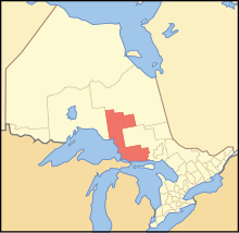
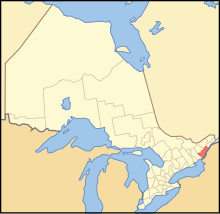
The Regional Municipality of York, also called York Region, is a regional municipality in Southern Ontario, Canada, between Lake Simcoe and Toronto. The region was established after the passing of then Bill 102, An Act to Establish The Regional Municipality of York, in 1970. It replaced the former York County in 1971, and is part of the Greater Toronto Area and the inner ring of the Golden Horseshoe. The regional government is headquartered in Newmarket.
Nickel Belt is one of two federal electoral districts serving the city of Greater Sudbury, Ontario, Canada. It has been represented in the House of Commons of Canada since 1953.

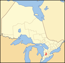
Bradford West Gwillimbury is a town in south-central Ontario, in the County of Simcoe in the Toronto Census Metropolitan Area on the Holland River. West Gwillimbury takes its name from the family of Elizabeth Simcoe, née Gwillim.

The Sudbury District is a district in Northeastern Ontario in the Canadian province of Ontario. It was created in 1894 from townships of eastern Algoma District and west Nipissing District.

Manitoulin District is a district in Northeastern Ontario within the Canadian province of Ontario. It was created in 1888 from part of the Algoma District. The district seat is in Gore Bay.

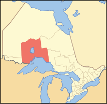
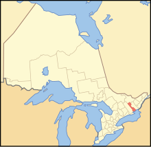
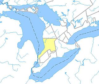
Simcoe County is located in the central portion of Southern Ontario, Canada. The county is just north of the Greater Toronto Area, stretching from the shores of Lake Simcoe in the east to Georgian Bay in the west. Simcoe County forms part of the Greater Golden Horseshoe area, a densely populated and industrialized region, centred on the Greater Toronto Area.

The Indian River is a river in Renfrew County and Nipissing District in Eastern and Northeastern Ontario, Canada. It is in the Saint Lawrence River drainage basin, and is a left tributary of the Muskrat River.
Unorganized Centre Parry Sound District is an unorganized area in central Ontario, Canada, between Georgian Bay and Lake Nipissing in the District of Parry Sound. It is made up of geographic townships which have no governing bodies and which are not incorporated as municipalities. The territory consists of two non-contiguous areas, with the main part located directly south of the French River and Lake Nipissing, and east of Georgian Bay. Shawanaga Township is a small exclave south of it along Highway 69.

West Nipissing is a municipality in Northeastern Ontario, Canada, on Lake Nipissing in the Nipissing District. It was formed on January 1, 1999, with the amalgamation of seventeen and a half former towns, villages, townships and unorganized communities.
French River, also known as Rivière-des-Français, is a municipality in the Canadian province of Ontario, in the Sudbury District. The municipality had a population of 2,662 in the Canada 2016 Census. It was formed in 1999 through the merger of the Township of Cosby, Mason and Martland and surrounding unincorporated portions of the Unorganized North Sudbury District. It was named after the French River, which flows through the municipality.

The Barron River is a river in the Saint Lawrence River drainage basin in Nipissing District and Renfrew County, Ontario, Canada. It flows from Clemow Lake in northern Algonquin Provincial Park and joins the Petawawa River, whose southern branch it forms, in the municipality of Laurentian Hills, near the municipality of Petawawa.
An unorganized area or unorganized territory is any geographic region in Canada that does not form part of a municipality or Indian reserve. In these areas, the lowest level of government is provincial or territorial. In some of these areas, local service agencies may have some of the responsibilities that would otherwise be covered by municipalities.
Zorra is a township in Oxford County, situated in south-western Ontario, Canada. A predominantly rural municipality, Zorra was formed in 1975 through the amalgamation of East Nissouri, West Zorra and North Oxford townships. It is best known for the Highland Games weekend held each summer in Embro, celebrating the heritage of the Scottish pioneer families which grew from the 1830s to form nearly a quarter of the county's population.
Nipissing First Nation is a long-standing community of Nishnaabeg peoples located along the shorelines of Lake Nipissing in northern Ontario. They are referred to by many names in European historical records, since the colonists often adopted names given to them by other nations.

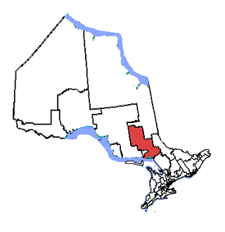
The Almaguin Highlands Region in Ontario, Canada, covers approximately 5,200 km2 (2,000 sq mi) comprising the eastern half of Parry Sound District. It is bounded by Muskoka in the south, and by Lake Nipissing and Nipissing District in the north. The eastern edge abuts the western boundary of Algonquin Provincial Park, whereas the western boundary of the Almaguin Highlands is generally regarded to be the mid east-west point of Parry Sound District. Originally derived from the words Algonquin, Magnetawan, and Seguin. the name Almaguin is now used to describe the marketing region of East Parry Sound.
The Huron Tract Purchase also known as the Huron Block, registered as Crown Treaty Number 29, is a large area of land in southwestern Ontario bordering on Lake Huron to the west and Lake Erie to the east. The area spans the counties of Huron, Perth, Middlesex and present day Lambton County, Ontario in the province of Ontario.