
The Bay of Quinte is a long, narrow bay shaped like the letter "Z" on the northern shore of Lake Ontario in the province of Ontario, Canada. It is just west of the head of the Saint Lawrence River that drains the Great Lakes into the Gulf of Saint Lawrence. It is located about 200 kilometres (120 mi) east of Toronto and 350 kilometres (220 mi) west of Montreal.

Prince Edward County (PEC) is a municipality in southern Ontario, Canada. Its coastline on Lake Ontario’s northeastern shore is known for Sandbanks Provincial Park, and sandy beaches and towering limestone cliffs. The Regent Theatre, a restored Edwardian opera house, sits at the heart of the town of Picton on the Bay of Quinte. Nearby Macaulay Heritage Park highlights local history through its 19th-century buildings. In 2016, Prince Edward County had a census population of 24,735. Prince Edward County is a city, single-tier municipality and a census division of the Canadian province of Ontario.
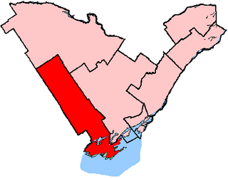
Prince Edward—Hastings was a federal electoral district in Ontario, Canada, that existed in the House of Commons of Canada from 1968 to 2015. Its population in 2006 was 113,227. It was redistributed between Bay of Quinte electoral district and Hastings—Lennox and Addington electoral district as a result of the Canadian federal electoral redistribution, 2012.

Russell Island is an uninhabited island of the Arctic Archipelago in the Qikiqtaaluk Region of Nunavut, Canada. It is located in the Parry Channel, separated from the northern tip of Prince of Wales Island by the narrow Baring Channel. The western third of the island is separated from the other two thirds by a narrow lake and its outlet. At the northern end of the lake there is an isthmus just 1.1 km (0.68 mi) wide and this joins the two parts of the island. With a total area of 940 km2 (360 sq mi), it is the largest island offshore of Prince of Wales Island.
Ansnorveldt is a hamlet located at the northeastern extent of King Township, in Ontario, Canada. It is located in the Holland Marsh, north of Highway 9. Whereas most of King township is in the Oak Ridges—Markham electoral district, Ansnorveldt and all other portions of King north of Highway 9 are part of the York—Simcoe electoral district, represented federally by Scot Davidson of the Conservative Party of Canada and provincially by Caroline Mulroney of the Progressive Conservative Party of Ontario.

Midland District was one of four districts of the Province of Quebec created in 1788 in the western reaches of the Montreal District and partitioned in 1791 to create the new colony of Upper Canada.
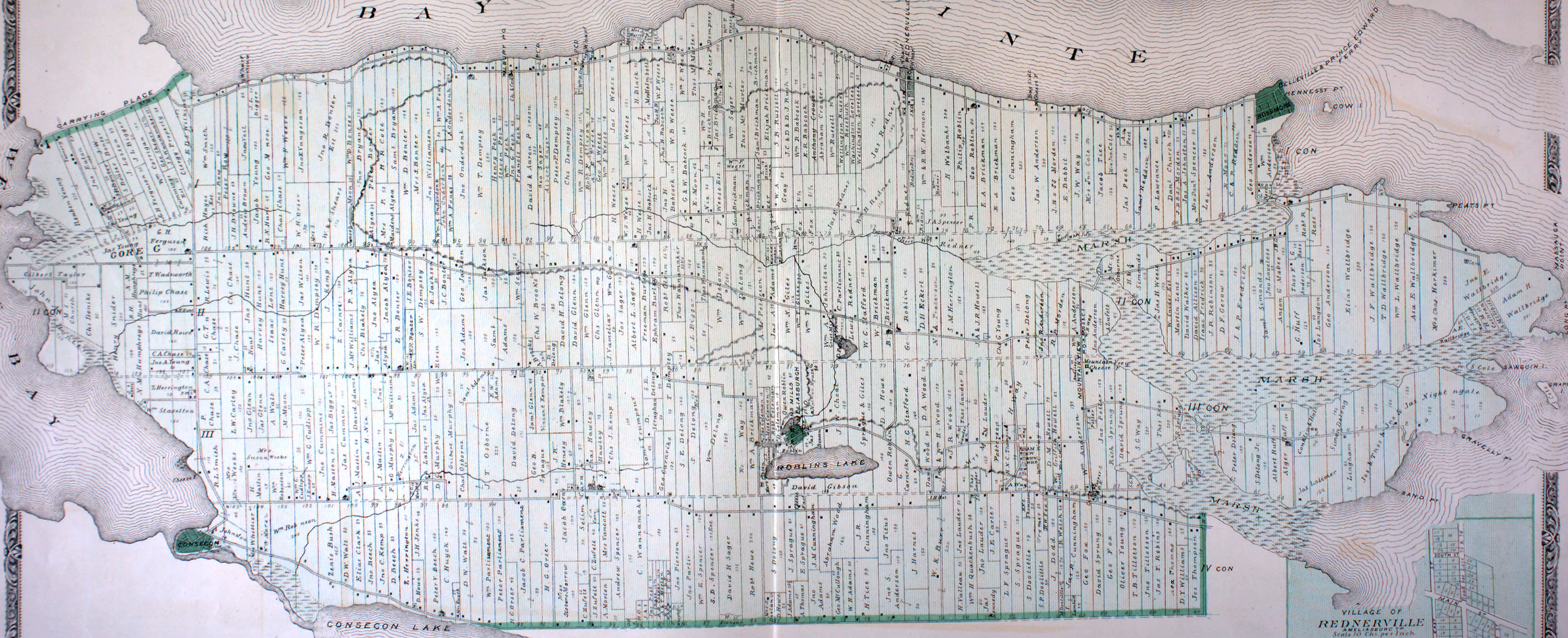
Sophiasburgh is an historic township in southern Ontario, Canada, one of the three original townships that formed Prince Edward County. The other two townships were Ameliasburgh and Marysburgh. It was named in 1798 after Princess Sophia, the fifth daughter of George III. The township was amalgamated into the Corporation of the County of Prince Edward, a single tier municipality, on January 1, 1998.
Marysburgh is a former incorporated and now geographic township in southern Ontario, Canada. It is one of the three original townships that formed Prince Edward County. The other two townships were Ameliasburgh and Sophiasburgh. Originally known as Fifth Township, it was renamed in 1786 after Princess Mary, the fourth daughter of George III. In 1871, the township was split into North and South Marysburgh townships. These two townships were amalgamated into the Corporation of the County of Prince Edward, a single tier municipality, on January 1, 1998.
Seymour is a former incorporated township and now a geographic township located in Northumberland County, Ontario, Canada. It is currently part of the Municipality of Trent Hills.
Percy, Ontario was a former incorporated township and now a geographic township located in Northumberland County, Ontario, Canada. It is currently part of the Municipality of Trent Hills.
The Township of Dalton was a municipality located in the northwest corner of the former Victoria County, now a geographic township in the city of Kawartha Lakes, in the Canadian province of Ontario. It was named after John Dalton (1766–1844), an English scientist who contributed to the foundations of atomic theory.
Ancona Point, Ontario is located in the former Township of Verulam, Ontario within the city of Kawartha Lakes, Ontario, Canada, and lies on Sturgeon Lake, 8 kilometres (5 mi) along County Road 24 south-west of Bobcaygeon. This stop on the former Canadian Pacific Railway was to have been called Scotch Line, but, after a disagreement between local residents, the completely unrelated Ancona Point was chosen as the station name. Scotch Line Road, which travels south from Ancona Point to Ontario Highway 36, retains the originally mooted name.

Algonquin Highlands is a township located in Haliburton County, Ontario, Canada. It has a population of 2,351. The northeastern section of the township is included in Algonquin Provincial Park.

Ameliasburgh is a village in the Township of Ameliasburgh in Prince Edward County, Ontario, Canada.
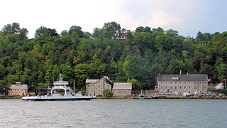
Glenora is a community in the Canadian province of Ontario, on the southern shore of the Bay of Quinte at 44°02′N77°03′W. The Bay of Quinte is a long narrow inlet on the northern shore of Lake Ontario.
Otter Creek is the name of a settlement in the municipality of Tweed, Hastings County, Ontario, Canada. It lies 3 kilometres (1.9 mi) east of the community of Sulphide and 10 kilometres (6 mi) northeast of the village of Tweed. Otter Creek, a tributary of the Clare River in the Moira River drainage basin, flows through the community.
Hungerford is a settlement in the municipality of Tweed, Hastings County, Ontario, Canada, about 4.5 kilometres (2.8 mi) east of the community of Sulphide and 11.6 kilometres (7.2 mi) northeast of the village of Tweed. Sulphide Creek, a tributary of the Moira River, flows northwest the community.
Cosy Cove is a settlement on Stoco Lake in the municipality of Tweed, Hastings County, Ontario, Canada, about 4 kilometres (2.5 mi) southwest of the community of Sulphide and 2.5 kilometres (1.6 mi) east of the village of Tweed. Sulphide Creek, a tributary of the Moira River, reaches its mouth at Stoco Lake in the community.
Bogart is a settlement in the municipality of Tweed, Hastings County, Ontario, Canada, about 2.3 kilometres (1.4 mi) south of the community of Sulphide and 5.3 kilometres (3.3 mi) east of the village of Tweed. The Clare River, a tributary of the Moira River, flows through the community.
Big Island is an island in Prince Edward County, Ontario, Canada. Approximately 9.5 kilometres in length and with a maximal width of three kilometres, it is located in the Bay of Quinte in Lake Ontario, between Belleville and Demorestville. It is accessed by a fixed causeway of 600 m length which connects Big Island to the remainder of Prince Edward County. The island is within the former Township of Sophiasburgh and is the largest of all off-shore islands in Prince Edward County.
