The town's southern boundary is formed by the Welland River, a meandering waterway that flows into the Niagara River. To the west is the township of West Lincoln, to the east the city of Welland and the city of Thorold, and to the north the city of St. Catharines and the town of Lincoln. North Pelham contains the picturesque Short Hills (see attractions). Two important creeks have their headwaters within Pelham; Coyle Creek, which flows south into the Welland River, and Twelve Mile creek, a spring-fed stream that flows north into Lake Ontario.
History
Pelham Township was part of the original Welland County since the late 1780s. The Town of Pelham derives its name from Pelham Township, which John Graves Simcoe named in the 1790s. In the beginning, the townships were only numbered and not named. The policy of Simcoe was to adopt township names from England. Pelham was named after the Pelham family though it is uncertain which particular Pelham family member it is attributed to - either Henry Fiennes Pelham-Clinton (nephew to 2 Prime Ministers and considered powerful and influential) or Charles Anderson Pelham (a quiet MP who spoke only once in 26 years in the House of Commons). But in fact, it turns out that it was named after early landowner Joshua Pell's family manor in Westchester County, New York—Pelham Manor—lost by the Loyalist Pells during the American Revolution (Pell went first in exile to Nova Scotia in 1783, before later being granted lands in the Niagara area after a direct appeal to George III.).[2]
In 1922, the Village of Fonthill became a separate municipality[3] by petitioning for land from the Township of Pelham and the Township of Thorold.
The current Town of Pelham was created in 1970 as part of area municipal restructuring through the amalgamation of the Township of Pelham, Village of Fonthill and a small portion of the Township of Thorold immediately adjacent to Fonthill.[4]
Steve Bauer grew up in Fenwick winning a silver medal at the 1984 Olympics in cycling and later became a professional cyclist.
World Golf Hall of Fame inductee Marlene Streit also grew up in Pelham, belonged to the Lookout Point Golf and Country Club, and has a park in the Town's core named after her.
CTV's morning show Canada AM's weather and sportsman, Jeff Hutcheson currently lives in Fenwick.
Former NHL enforcer Matt Johnson was raised and lived in Fenwick, although his birthplace is listed as Welland as this is where the local hospital is located.
The Town is divided into three wards, each of which elects two councillors to sit on Town Council for a period of four years. The Mayor is elected separately, serves on the Council of the Niagara Region, and (since 2006) also serves four years.
Mayors of the Town of Pelham
1970-1976: Harold Black
1976-1978: John Weldon
1978-1988: Eric Bergenstein
1988-1994: Marty Collins
1994-2003: Ralph Beamer
2003-2006: Ron Leavens
2006-2018: Dave Augustyn
2018–present: Marvin Junkin
Regional Councillors of the Town of Pelham
Regional councillors represent Pelham on Regional Municipality of Niagara Council.
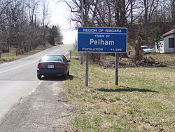
In the 2021 Census of Population conducted by Statistics Canada, Pelham had a population of 18,192 living in 6,959 of its 7,123 total private dwellings, a change of 6.3% from its 2016 population of 17,110. With a land area of 126.35km2 (48.78sqmi), it had a population density of 144.0/km2 (372.9/sqmi) in 2021.[6]
This page is based on this Wikipedia article Text is available under the CC BY-SA 4.0 license; additional terms may apply. Images, videos and audio are available under their respective licenses.