Regional Municipality of Niagara

Last updated

Niagara Region
Regional Municipality of Niagara
Niagara Falls, Ontario - 2.jpg
Port Colborne, Welland Canal.jpg
St. Catharines James Street.jpg
Flag of the Regional Municipality of Niagara.svg
Logo of the Regional Municipality of Niagara.svg
Motto(s): 
Unity, Responsibility, Loyalty
Map of Ontario NIAGARA.svg
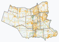
Location of Niagara within Ontario
Coordinates: 43°02′33″N79°18′02″W / 43.04250°N 79.30056°W / 43.04250; -79.30056 (St. Catharines – Niagara (Regional Municipality of Niagara)) [1]
CountryCanada
Province Ontario
Formed1970 (from Welland and Lincoln Counties)
Seat Thorold
Government
  Chair Jim Bradley
  Governing body Niagara Regional Council
   MPs Dean Allison, Chris Bittle, Vance Badawey, Tony Baldinelli
   MPPs Jeff Burch, Wayne Gates, Sam Oosterhoff, Jennie Stevens
Area
[2]
  Land1,854.23 km2 (715.92 sq mi)
Population
 (2016) [2]
  Total447,888
  Density241.5/km2 (625/sq mi)
Gross Metropolitan Product
  St. Catharines – Niagara CMA CA$17.4 billion (2020) [3]
Time zone UTC−05:00 (EST)
  Summer (DST) UTC−04:00 (EDT)
Website www.niagararegion.ca

The Regional Municipality of Niagara, also colloquially known as the Niagara Region or Region of Niagara, is a regional municipality comprising twelve municipalities of Southern Ontario, Canada. The regional seat is in Thorold. It is the southern end of the Golden Horseshoe, the largest megalopolis in Canada.

Contents

The region occupies most of the Niagara Peninsula. Its eastern boundary is the Niagara River, which is also the border with the US state of New York. It is bounded on the north by Lake Ontario and on the south by Lake Erie.

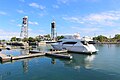
Unique natural landscapes make the Niagara Region an important centre for agriculture and tourism in Canada. The most important agricultural enterprise in Niagara is viticulture, or winemaking. The Niagara Wine Route, which connects visitors to dozens of wineries, is a growing tourism draw while the internationally renowned Niagara Falls is one of Canada's major tourist attractions. Along with Shaw Festival, held annually in Niagara-on-the-Lake, and the Welland Canal, the Regional Municipality of Niagara receives up to 12 million visitors each year.

Niagara Region is situated on treaty land. This land has a rich history of First Nations such as the Neutral, the Haudenosaunee, and the Anishinaabe, including the Mississaugas of the Credit First Nation. [4] There are many First Nations, Métis, and Inuit people from across Turtle Island that continue to live and work in Niagara today.

Administrative divisions

Map of the Regional Municipality of Niagara, showing its component municipalities. NiagaraONMunicipalities.png
Map of the Regional Municipality of Niagara, showing its component municipalities.
NameTypeSub-regionPopulation
Niagara Falls CityWelland94,415
Port Colborne CityWelland20,033
St. Catharines CityLincoln136,803
Thorold CityWelland23,816
Welland CityWelland55,750
Fort Erie TownWelland32,901
Grimsby TownLincoln28,883
Lincoln TownLincoln25,719
Niagara-on-the-Lake TownLincoln19,088
Pelham TownWelland18,192
Wainfleet TownshipWelland6,887
West Lincoln TownshipLincoln15,454

Demographics

As a census division in the 2021 Census of Population conducted by Statistics Canada, the Regional Municipality of Niagara had a population of 477,941 living in 195,914 of its 207,926 total private dwellings, a change of 6.7% from its 2016 population of 447,888. With a land area of 1,852.82 km2 (715.38 sq mi), it had a population density of 258.0/km2 (668.1/sq mi) in 2021. [5]

Canada census – Regional Municipality of Niagara community profile
2021 2016 2011
Population477,941 (+6.7% from 2016)447,888 (+3.8% from 2011)431,346 (+0.9% from 2006)
Land area1,852.82 km2 (715.38 sq mi)1,854.23 km2 (715.92 sq mi)1,854.25 km2 (715.93 sq mi)
Population density258/km2 (670/sq mi)241.5/km2 (625/sq mi)232.6/km2 (602/sq mi)
Median age46 (M: 44, F: 47.2)45.7 (M: 44.4, F: 46.9)
Private dwellings195,915 (total) 196,241 (total) 188,877 (total) 
Median household income$65,086
References: 2021 [6] 2016 [7] 2011 [8] earlier [9] [10]

Historic populations: [10] [11]

Religion

Religious profile [9]

Ethnicity

Top ten largest ethnicities [9]

Panethnic groups in the Regional Municipality of Niagara (2001−2021)
Panethnic
group
2021 [12] 2016 [13] 2011 [14] 2006 [15] 2001 [16]
Pop. %Pop.%Pop.%Pop.%Pop.%
European [lower-alpha 1] 393,100387,095385,785388,415382,050
Indigenous 13,96012,2509,0556,9305,185
South Asian 13,8456,1703,4503,8052,585
African 13,3057,9706,4855,2103,960
Southeast Asian [lower-alpha 2] 9,7155,9504,5254,3102,580
East Asian [lower-alpha 3] 9,3658,2305,8355,5704,370
Latin American 6,9754,6203,8954,2601,570
Middle Eastern [lower-alpha 4] 4,6103,4302,2302,1201,485
Other [lower-alpha 5] 4,5752,4551,5501,130810
Total responses469,455438,160422,805421,750404,590
Total population477,941447,888431,346427,421410,574
Note: Totals greater than 100% due to multiple origin responses

Features

Education

Festivals and major events

Health care services

History and trails

Notable people

Other

Protected areas

Wineries

West Niagara

East Niagara

This list is not complete and changes every season, see also Niagara Peninsula wineries for more information.

Transportation

Airports

Niagara Region contains three airports used primarily for general aviation:

Aside from scheduled commuter flights between Niagara District Airport and Toronto City with FlyGTA, for commercial flights Niagara residents use Toronto Pearson International Airport, Billy Bishop Toronto City Airport, or John C. Munro Hamilton International Airport in the Greater Toronto and Hamilton Area; as well as crossing the border to use Buffalo Niagara International Airport or Niagara Falls International Airport in Upstate New York.

Public Transport

Public transit within Niagara Region is provided by Niagara Region Transit, including scheduled local bus service within Niagara Falls, St. Catharines, Thorold and Welland, on-demand transit service in other portions of the Region, and regional bus service between communities in the region.

WEGO is an additional local bus network within Niagara Falls, targeted at visitors rather than residents. The WEGO Green Line is operated by the Niagara Parks Commission and requires separate WEGO tickets, while the remainder of WEGO routes are operated by Niagara Region Transit and accept both Niagara Region Transit and WEGO tickets.

GO Transit provides regional train and bus services from Niagara Falls and St. Catharines to the Greater Toronto and Hamilton Area.

VIA Rail serves Grimsby, St. Catharines and Niagara Falls stations as part of the Maple Leaf intercity train between Toronto and New York City, jointly operated with Amtrak.

Many private bus operators operate intercity services to Niagara Region on routes connecting to cities such as Toronto, Buffalo and New York. As of 2023, private bus operators in Niagara Region include Flixbus, Megabus, Equinox, Greyhound, and Trailways.

Highways

400-series expressways:

Other highways:

See also

Notes

  1. Statistic includes all persons that did not make up part of a visible minority or an indigenous identity.
  2. Statistic includes total responses of "Filipino" and "Southeast Asian" under visible minority section on census.
  3. Statistic includes total responses of "Chinese", "Korean", and "Japanese" under visible minority section on census.
  4. Statistic includes total responses of "West Asian" and "Arab" under visible minority section on census.
  5. Statistic includes total responses of "Visible minority, n.i.e." and "Multiple visible minorities" under visible minority section on census.

Related Research Articles

<span class="mw-page-title-main">Oakville, Ontario</span> Town in Ontario, Canada

Oakville is a town in Halton Region, Ontario, Canada. It is located on Lake Ontario between Toronto and Hamilton. At its 2021 census population of 213,759, it is Ontario's largest town. Oakville is part of the Greater Toronto Area, one of the most densely populated areas of Canada.

<span class="mw-page-title-main">St. Catharines</span> City in Ontario, Canada

St. Catharines is the most populous city in Canada's Niagara Region, the eighth largest urban area in the province of Ontario. As of 2017, St. Catharines has an area of 96.13 square kilometres (37.12 sq mi) and 140,370 residents. It lies in Southern Ontario, 51 kilometres (32 mi) south of Toronto across Lake Ontario, and is 19 kilometres (12 mi) inland from the international boundary with the United States along the Niagara River. It is the northern entrance of the Welland Canal. Residents of St. Catharines are known as St. Catharinites. St. Catharines carries the official nickname "The Garden City" due to its 1,000 acres (4 km2) of parks, gardens, and trails.

<span class="mw-page-title-main">Welland</span> City in Ontario, Canada

Welland is a city in the Regional Municipality of Niagara in Southern Ontario, Canada. As of 2021, it had a population of 55,750.

<span class="mw-page-title-main">Regional Municipality of York</span> Regional municipality in Ontario, Canada

The Regional Municipality of York, also called York Region, is a regional municipality in Southern Ontario, Canada, between Lake Simcoe and Toronto. The region was established after the passing of then Bill 102, An Act to Establish The Regional Municipality of York, in 1970. It replaced the former York County in 1971, and is part of the Greater Toronto Area and the inner ring of the Golden Horseshoe. The regional government is headquartered in Newmarket.

<span class="mw-page-title-main">Niagara-on-the-Lake</span> Town in Ontario, Canada

Niagara-on-the-Lake is a town in Ontario, Canada. It is located on the Niagara Peninsula at the point where the Niagara River meets Lake Ontario, across the river from New York, United States. Niagara-on-the-Lake is in the Niagara Region of Ontario and is the only town in Canada that has a lord mayor. It has a population of 19,088.

<span class="mw-page-title-main">Regional Municipality of Durham</span> Regional municipality in Ontario, Canada

The Regional Municipality of Durham, informally referred to as Durham Region, is a regional municipality in Southern Ontario, Canada. Located east of Toronto and the Regional Municipality of York, Durham forms the east-end of the Greater Toronto Area and part of the Golden Horseshoe region. It has an area of approximately 2,500 km2 (970 sq mi). The regional government is headquartered in Whitby.

<span class="mw-page-title-main">Greater Toronto Area</span> Metropolitan area in Ontario, Canada

The Greater Toronto Area, commonly referred to as the GTA, includes the City of Toronto and the regional municipalities of Durham, Halton, Peel, and York. In total, the region contains 25 urban, suburban, and rural municipalities. The Greater Toronto Area begins in Burlington in Halton Region to the west, and extends along Lake Ontario past downtown Toronto eastward to Clarington in Durham Region.

<span class="mw-page-title-main">Golden Horseshoe</span> Secondary region in Ontario, Canada

The Golden Horseshoe is a secondary region of Southern Ontario, Canada, which lies at the western end of Lake Ontario, with outer boundaries stretching south to Lake Erie and north to Lake Scugog, Lake Simcoe and Georgian Bay of Lake Huron. The region is the most densely populated and industrialized in Canada. Based on the 2021 census, with a population of 7,759,635 people in its core and 9,765,188 in its greater area, the Golden Horseshoe accounts for over 20 percent of the population of Canada and more than 54 percent of Ontario's population. It is part of the Quebec City–Windsor Corridor, itself part of the Great Lakes megalopolis.

<span class="mw-page-title-main">Niagara Peninsula</span> Peninsula in Ontario, Canada

The Niagara Peninsula is an area of land lying between the southwestern shore of Lake Ontario and the northeastern shore of Lake Erie, in Ontario, Canada. Technically an isthmus rather than a peninsula, it stretches from the Niagara River in the east to Hamilton, Ontario, in the west. The peninsula is located in the Golden Horseshoe region of Southern Ontario, and has a population of roughly 1,000,000 residents. The region directly across the Niagara River and Lake Erie in New York State is known as the Niagara Frontier.

<span class="mw-page-title-main">Regional Municipality of Peel</span> Upper-tier regional municipality in Ontario, Canada

The Regional Municipality of Peel is a regional municipality in the Greater Toronto Area, Southern Ontario, Canada. It consists of three municipalities to the west and northwest of the city of Toronto: the cities of Mississauga and Brampton, and the town of Caledon, each of which spans its full east–west width. The regional seat is in Brampton.

<span class="mw-page-title-main">Norfolk County, Ontario</span> City in Ontario, Canada

Norfolk County is a rural single-tier municipality on the north shore of Lake Erie in Southwestern Ontario, Canada with a 2016 population of 67,490. Despite its name, it is no longer a county by definition, as all municipal services are handled by a single level of government. The largest community in Norfolk County is Simcoe, whose 2016 population was 13,922. The other population centres are Port Dover, Delhi, Waterford and Port Rowan, and there are many smaller communities. For several years in the late 20th century, the county was merged with Haldimand County but the merged entity was dissolved in 2000.

<span class="mw-page-title-main">Regional Municipality of Halton</span> Regional municipality in Ontario, Canada

The Regional Municipality of Halton, or Halton Region, is a regional municipality in Ontario, Canada, located in the Golden Horseshoe of Southern Ontario. It comprises the city of Burlington and the towns of Oakville, Milton, and Halton Hills. Policing in the Region is provided by the Halton Regional Police Service. The regional council's headquarters are located in Oakville. Burlington, Oakville, and Milton are largely urban and suburban, while Halton Hills is more rural.

<span class="mw-page-title-main">Niagara Falls (federal electoral district)</span> Federal electoral district in Ontario, Canada

Niagara Falls is a federal electoral district in Ontario, Canada, that has been represented in the House of Commons of Canada since 1953.

<span class="mw-page-title-main">St. Catharines (federal electoral district)</span> Federal electoral district in Ontario, Canada

St. Catharines is a federal electoral district in the Niagara Region of Ontario, Canada, that has been represented in the House of Commons of Canada since 1968.

<span class="mw-page-title-main">Niagara Centre</span> Federal electoral district in Ontario, Canada

Niagara Centre is a federal electoral district in the Niagara Region of Ontario that has been represented in the House of Commons of Canada from 1867 to 1988 and since 1997.

<span class="mw-page-title-main">Mackenzie, British Columbia</span> District municipality in British Columbia, Canada

Mackenzie is a district municipality within the Fraser-Fort George Regional District in central British Columbia, Canada. The community is located at the south end of Williston Lake. The townsite, established by Alexandra Forest Industries and Cattermole Timber, was named for Sir Alexander MacKenzie (1764–1820).

<span class="mw-page-title-main">Northern Rockies Regional Municipality</span> Regional district in British Columbia, Canada

The Northern Rockies Regional Municipality (NRRM), formerly the Northern Rockies Regional District (NRRD), and before that the Fort Nelson–Liard Regional District, is a municipality in northeastern British Columbia, Canada. Although portrayed as a regional municipality in its official name, and existing on the same administrative level as a regional district, it is actually classified as a district municipality. The NRRM's offices are located in Fort Nelson, formerly an incorporated town that amalgamated with the NRRD on February 6, 2009 to form the NRRM. With the Peace River Regional District as the southern part, it was the northern part of the Peace River-Liard Regional District, which was split into two on October 31, 1987.

<span class="mw-page-title-main">Niagara Falls Transit</span> Defunct public transportation authority in Ontario, Canada

Niagara Falls Transit was a public transit agency that operated the public transport bus services in Niagara Falls, Ontario, Canada between 1960 and 2022.

<span class="mw-page-title-main">Fort St. James</span> District municipality in British Columbia, Canada

Fort St. James is a district municipality and former fur trading post in northern central British Columbia, Canada. It is located on the south-eastern shore of Stuart Lake in the Omineca Country, at the northern terminus of Highway 27, which connects to Highway 16 at Vanderhoof.

<span class="mw-page-title-main">Niagara West</span> Federal electoral district in Ontario, Canada

Niagara West is a federal electoral district in Ontario. It encompasses a portion of Ontario formerly included in the electoral districts of Niagara West—Glanbrook, Welland and St. Catharines. It is currently represented by Dean Allison.

References

  1. "Regional Municipality of Niagara". Geographical Names Data Base . Natural Resources Canada.
  2. 1 2 "Census Profile, 2016 Census Niagara, Regional municipality". Statistics Canada. Retrieved July 2, 2019.
  3. "Gross domestic product (GDP) at basic prices, by census metropolitan area (CMA)". statcan.gc.ca.
  4. "Subject: Updated Land Acknowledgement Statements". Regional Municipality of Niagara publications. August 26, 2021. Retrieved May 8, 2023.
  5. "Population and dwelling counts: Canada and census divisions". Statistics Canada. February 9, 2022. Retrieved April 2, 2022.
  6. "2021 Community Profiles". 2021 Canadian Census . Statistics Canada. February 4, 2022. Retrieved April 27, 2022.
  7. "2016 Community Profiles". 2016 Canadian Census . Statistics Canada. August 12, 2021. Retrieved July 2, 2019.
  8. "2011 Community Profiles". 2011 Canadian Census . Statistics Canada. March 21, 2019. Retrieved March 27, 2012.
  9. 1 2 3 "2006 Community Profiles". 2006 Canadian Census . Statistics Canada. August 20, 2019.
  10. 1 2 "2001 Community Profiles". 2001 Canadian Census . Statistics Canada. July 18, 2021.
  11. "Niagara Regional Municipality census profile". 2011 Census of Population . Statistics Canada. Retrieved March 27, 2012.
  12. Government of Canada, Statistics Canada (October 26, 2022). "Census Profile, 2021 Census of Population". www12.statcan.gc.ca. Retrieved February 27, 2023.
  13. Government of Canada, Statistics Canada (October 27, 2021). "Census Profile, 2016 Census". www12.statcan.gc.ca. Retrieved February 27, 2023.
  14. Government of Canada, Statistics Canada (November 27, 2015). "NHS Profile". www12.statcan.gc.ca. Retrieved February 27, 2023.
  15. Government of Canada, Statistics Canada (August 20, 2019). "2006 Community Profiles". www12.statcan.gc.ca. Retrieved February 27, 2023.
  16. Government of Canada, Statistics Canada (July 2, 2019). "2001 Community Profiles". www12.statcan.gc.ca. Retrieved February 27, 2023.