Regional District of Central Okanagan

Last updated

Central Okanagan
Regional District of Central Okanagan
Kelowna Skyline.jpg
Downtown Kelowna from West Kelowna
Central Okanagan BC logo.png
CAN BC Central Okanagan Regional District locator.svg
Location in British Columbia
CountryCanada
Province British Columbia
Established1967
Administrative office location Kelowna
Government
[1]
  TypeRegional district
  BodyBoard of directors
  ChairLoyal Wooldridge (Kelowna)
  Vice chairGord Milsom (West Kelowna)
  Electoral areas
  • Central Okanagan East
  • Central Okanagan West
Area
  Land2,904.86 km2 (1,121.57 sq mi)
Population
 (2016) [2]
  Total194,882
  Density67.1/km2 (174/sq mi)
Time zone UTC-8 (PST)
Website www.rdco.com OOjs UI icon edit-ltr-progressive.svg

The Regional District of Central Okanagan (RDCO) is a regional district in the Canadian province of British Columbia, representing two unincorporated Electoral Areas of Central Okanagan East and Central Okanagan West, along with the member municipalities of the City of Kelowna, City of West Kelowna the District of Lake Country, the District of Peachland and Westbank First Nation. The RDCO office is located in Kelowna.

Contents

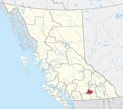
Statistics Canada defines the Kelowna CMA (Census Metropolitan Area) or Kelowna Metropolitan Area as being identical in area with the RDCO. The population in 2016 was 194,882, an increase from the official Canada 2006 Census total of 162,276 (these figures exclude the population of reserves belonging to the Westbank First Nation). The area is 2,904.86 square kilometres.

Communities

Incorporated municipalities

Communities and neighbourhoods

Regional district electoral areas

Central Okanagan West Electoral (Central Okanagan J)

Central Okanagan West Electoral Area used to be known as the Westside Electoral Area. It was created from the merger of Central Okanagan G and Central Okanagan H. The 2005 population exclusive of anyone living on an Indian Reserve, was 37,638 people. In 2007 most of the electoral area's population transferred to the jurisdiction of the newly incorporated District Municipality of West Kelowna.

Communities

Central Okanagan West

Central Okanagan East (Central Okanagan I)

Indigenous reserves

(within the boundaries of, but not part of, the RD)

Demographics

As a census division in the 2021 Census of Population conducted by Statistics Canada, the Regional District of Central Okanagan had a population of 222,162 living in 94,335 of its 102,097 total private dwellings, a change of

Panethnic groups in the Central Okanagan Regional District (2001−2021)
Panethnic
group
2021 [4] 2016 [5] 2011 [6] 2006 [7] 2001 [8]
Pop. %Pop.%Pop.%Pop.%Pop.%
European [lower-alpha 1] 180,675164,260157,625146,120136,310
Indigenous 13,42011,3708,2606,1203,950
South Asian 7,4253,9253,2302,3451,465
East Asian [lower-alpha 2] 5,8704,5453,4252,9652,510
Southeast Asian [lower-alpha 3] 4,2002,6551,4701,130545
African 2,3951,255780660455
Latin American 1,7901,065715530415
Middle Eastern [lower-alpha 4] 1,495695360255140
Other [lower-alpha 5] 1,250790560435155
Total responses218,530190,565176,435160,565145,950
Total population222,162194,882179,839162,276147,739

Notes

  1. Statistic includes all persons that did not make up part of a visible minority or an indigenous identity.
  2. Statistic includes total responses of "Chinese", "Korean", and "Japanese" under visible minority section on census.
  3. Statistic includes total responses of "Filipino" and "Southeast Asian" under visible minority section on census.
  4. Statistic includes total responses of "West Asian" and "Arab" under visible minority section on census.
  5. Statistic includes total responses of "Visible minority, n.i.e." and "Multiple visible minorities" under visible minority section on census.

Related Research Articles

<span class="mw-page-title-main">Kelowna</span> City in British Columbia, Canada

Kelowna is a city on Okanagan Lake in the Okanagan Valley in the southern interior of British Columbia, Canada. It serves as the head office of the Regional District of Central Okanagan. The name Kelowna derives from the Okanagan word kiʔláwnaʔ, referring to a grizzly bear.

<span class="mw-page-title-main">Alberni-Clayoquot Regional District</span> Regional district in British Columbia, Canada

The Alberni–Clayoquot Regional District of British Columbia is located on west central Vancouver Island. Adjacent regional districts it shares borders with are the Strathcona and Comox Valley Regional Districts to the north, and the Nanaimo and Cowichan Valley Regional Districts to the east. The regional district offices are located in Port Alberni.

<span class="mw-page-title-main">Oliver, British Columbia</span> Town in British Columbia, Canada

Oliver is a town near the south end of the Okanagan Valley in the Southern Interior of British Columbia, Canada, with a population of nearly 5,000 people. It is located along the Okanagan River by Tuc-el-nuit Lake between Osoyoos and Okanagan Falls, and is labelled as the Wine Capital of Canada by Tourism British Columbia. It was once "The Home of the Cantaloupe" as well as the "Home of the International Horseshow."

<span class="mw-page-title-main">Summerland, British Columbia</span> Town in British Columbia, Canada

Summerland is a town on the west side of Okanagan Lake in the interior of British Columbia, Canada. The district is between Peachland to the north and Penticton to the south. The largest centre in the region is Kelowna, approximately 50 km (31 mi) to the north, and Vancouver is approximately 425 km (264 mi) away to the west. The district is famous for "Bottleneck drive", a system of roads connecting various wineries.

<span class="mw-page-title-main">Peachland</span> District municipality in British Columbia, Canada

Peachland is a district municipality in the Okanagan Valley on the west side of Okanagan Lake in British Columbia, Canada. It was founded in 1899 by John Moore Robinson, although the region had long been home to the Okanagan people. Peachland is approximately half-an-hour's drive south of the city of Kelowna and about a 20-minute drive north of Summerland. The Okanagan Valley is very narrow in the area and there are few terraces that mark former lake levels and the former lake bottom. As a result, the city is largely located on a steep sidehill. Like many other areas in the Okanagan, Peachland is rapidly growing, with new residents coming from all across Canada. Across the lake from Peachland is Rattlesnake Island, home of the legendary Ogopogo. Peachland is approximately 370 km from Vancouver, British Columbia, on the British Columbia south coast.

<span class="mw-page-title-main">Sunshine Coast Regional District</span> Regional district in British Columbia, Canada

The Sunshine Coast Regional District is a regional district in British Columbia, Canada. It is located on the southern mainland coast, across Georgia Strait from Vancouver Island. It borders on the qathet Regional District to the north, the Squamish-Lillooet Regional District to the east, and, across Howe Sound, the Metro Vancouver District to the south. The regional district offices are located in the District Municipality of Sechelt.

<span class="mw-page-title-main">Regional District of Bulkley-Nechako</span> Regional district in British Columbia, Canada

The Regional District of Bulkley–Nechako (RDBN) is a regional district in the Canadian province of British Columbia, Canada. As of the 2021 census, the population was 37,737. The area is 73,419.01 square kilometres. The regional district offices are in Burns Lake.

<span class="mw-page-title-main">Fraser Valley Regional District</span> Regional district in British Columbia, Canada

The Fraser Valley Regional District (FVRD) is a regional district in British Columbia, Canada. Its headquarters are in the city of Chilliwack. The FVRD covers an area of 13,361.74 km² (5,159 sq mi). It was created in 1995 by an amalgamation of the Fraser-Cheam Regional District and Central Fraser Valley Regional District and the portion of the Dewdney-Alouette Regional District from and including the District of Mission eastwards.

<span class="mw-page-title-main">Columbia-Shuswap Regional District</span> Regional district in British Columbia, Canada

The Columbia–Shuswap Regional District is a regional district in the Canadian province of British Columbia, located in the Southern Interior region on the Trans-Canada Highway between Vancouver and Calgary, Alberta. The regional district borders the Province of Alberta across the Rocky Mountains.

<span class="mw-page-title-main">Cariboo Regional District</span> Regional district in British Columbia, Canada

The Cariboo Regional District spans the Cities and Districts of Quesnel, Williams Lake, 100 Mile House, and Wells in the Central Interior of British Columbia.

<span class="mw-page-title-main">Kelowna—Lake Country (federal electoral district)</span> Federal electoral district in British Columbia, Canada

Kelowna—Lake Country is a federal electoral district in the province of British Columbia, Canada, that has been represented in the House of Commons of Canada since 1997.

<span class="mw-page-title-main">Enderby, British Columbia</span> City in British Columbia, Canada

The City of Enderby is in the North Okanagan region of the Canadian province of British Columbia, between Armstrong and Salmon Arm. It is approximately 80 km north of Kelowna and 130 km east of Kamloops. Highway 97A passes through Enderby and the Shuswap River marks the eastern and northeastern limits of the City. There are two major schools in Enderby: M.V. Beattie Elementary School and A.L. Fortune Secondary School. M.V. Beattie Elementary School was rebuilt in 2012.

<span class="mw-page-title-main">Lake Country</span> District municipality in British Columbia, Canada

Lake Country is a district municipality with a population of approximately 15,000 in the Okanagan Valley region of British Columbia, Canada. It is a part of the Central Okanagan Regional District, and of the Kelowna metropolitan area. The city of Kelowna lies to the south, while the city of Vernon lies to the north. As its name suggests, there are a number of lakes in the vicinity of Lake Country, and outside the municipal boundaries in the hills to the east. Okanagan Lake defines the western boundary of the municipality, while the entirety of Wood Lake and the southernmost portion of Kalamalka Lake are encompassed by it.

<span class="mw-page-title-main">Regional District of North Okanagan</span> Regional district in British Columbia, Canada

The Regional District of North Okanagan (RDNO) is a regional district in the Canadian province of British Columbia, Canada. The Canada 2011 Census population was 81,237. The land area is 7,512.58 km². The regional district's head office is in the district municipality of Coldstream, although the largest population centre is its immediate neighbour, the city of Vernon.

<span class="mw-page-title-main">Regional District of Okanagan-Similkameen</span> Regional district in British Columbia, Canada

The Regional District of Okanagan-Similkameen (RDOS) is in southern British Columbia, adjacent to the U.S. state of Washington. It is bounded by Fraser Valley Regional District to the west, Thompson-Nicola Regional District and Regional District of Central Okanagan to the north, Regional District of Kootenay Boundary to the east, and by Okanogan County, Washington to the south. At the 2011 census the population was 80,742. The district covers a land area of 10,413.44 square kilometres (4,020.65 sq mi). The administrative offices are in the City of Penticton.

<span class="mw-page-title-main">Coldstream, British Columbia</span> District municipality in British Columbia, Canada

Coldstream is a district municipality in British Columbia, Canada, located at the northern end of Kalamalka Lake in the Okanagan Valley. Incorporated on December 21, 1906, Coldstream celebrated its centennial in 2006. The municipality is directly southeast of Vernon and is considered part of Greater Vernon. It is a member municipality of, and also the location of the head offices, of the Regional District of North Okanagan.

<span class="mw-page-title-main">West Kelowna</span> City in British Columbia, Canada

West Kelowna, formerly known as Westbank and colloquially known as Westside, is a city in British Columbia's Okanagan Valley. The city encompasses several distinct neighbourhoods, including Casa Loma, Gellatly, Glenrosa, Lakeview Heights, Shannon Lake, Smith Creek, Rose Valley, Westbank, and West Kelowna Estates. West Kelowna had an estimated population of 34,883 as of December 31, 2018.

<span class="mw-page-title-main">Strathcona Regional District</span> Regional district in British Columbia, Canada

The Strathcona Regional District is a regional district in British Columbia, Canada. It was created on February 15, 2008, encompassing the northern and western portions of the former Regional District of Comox-Strathcona. The partition left the new Strathcona Regional District with 91.6 percent of the former Comox-Strathcona's land area, but only 42.1 percent of its population. Its current territory has a land area of 18,329.948 km2 and a 2016 census population of 44,671 inhabitants. There are 21 named Indian reserves within its territory, with a combined 2016 census population of 1,579 and combined land area of 16.444 km2.

<span class="mw-page-title-main">Central Okanagan—Similkameen—Nicola</span> Federal electoral district in British Columbia, Canada

Central Okanagan—Similkameen—Nicola is a federal electoral district in British Columbia. It encompasses a portion of British Columbia formerly included in the electoral districts of Okanagan—Coquihalla (66%), Kelowna—Lake Country (25%) and British Columbia Southern Interior (10%).

<span class="mw-page-title-main">South Okanagan—West Kootenay</span> Federal electoral district in British Columbia, Canada

South Okanagan—West Kootenay is a federal electoral district in British Columbia. It encompasses a portion of British Columbia previously included in the electoral districts of British Columbia Southern Interior (58%), Kootenay—Columbia (3%), and Okanagan—Coquihalla (39%).

References

  1. "Regional District Board of Directors" . Retrieved July 9, 2019.
  2. "Population and dwelling counts: Canada and census divisions". Statistics Canada. February 9, 2022. Retrieved April 3, 2022.
  3. Government of Canada, Statistics Canada (October 26, 2022). "Census Profile, 2021 Census of Population". www12.statcan.gc.ca. Retrieved February 17, 2023.
  4. Government of Canada, Statistics Canada (October 27, 2021). "Census Profile, 2016 Census". www12.statcan.gc.ca. Retrieved February 17, 2023.
  5. Government of Canada, Statistics Canada (November 27, 2015). "NHS Profile". www12.statcan.gc.ca. Retrieved February 17, 2023.
  6. Government of Canada, Statistics Canada (August 20, 2019). "2006 Community Profiles". www12.statcan.gc.ca. Retrieved February 17, 2023.
  7. Government of Canada, Statistics Canada (July 2, 2019). "2001 Community Profiles". www12.statcan.gc.ca. Retrieved February 17, 2023.

49°53′17″N119°29′44″W / 49.888028°N 119.495417°W / 49.888028; -119.495417