Capital Regional District

Last updated

Capital
Capital Regional District
Capital Regional District logo 2017.png
Nickname: 
CRD
Motto: 
Making a difference...together
Major communities
CAN BC Capital Regional District locator.svg
Location in British Columbia
CountryCanada
Province British Columbia
Incorporated [1] 1966
Administrative office location Victoria
Government
[2]
  BodyBoard of directors
  ChairColin Plant (Saanich)
  Vice chairMaja Tait (Sooke)
  Electoral areas
  • Juan de Fuca
  • Salt Spring Island
  • Southern Gulf Islands
Area
[3]
  Total2,340.49 km2 (903.67 sq mi)
Population
 (2021) [3]
  Total415,451
  Density177.7/km2 (460/sq mi)
Time zone UTC-8 (PST)
  Summer (DST) UTC-7 (PDT)
Area code 250 / 778 / 236
Website www.crd.bc.ca OOjs UI icon edit-ltr-progressive.svg

The Capital Regional District (CRD) is a local government administrative district encompassing the southern tip of Vancouver Island and the southern Gulf Islands in the Canadian province of British Columbia. [4] The CRD is one of several regional districts in British Columbia and had an official population of 415,451 as of the Canada 2021 Census. [5]

Contents

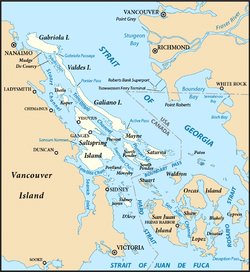
The CRD encompasses the thirteen municipalities of Greater Victoria and three unincorporated areas: Juan de Fuca Electoral Area on Vancouver Island, Salt Spring Island Electoral Area, and Southern Gulf Islands Electoral Area. The CRD also acts as the local government for most purposes in the Electoral Areas. CRD headquarters is in the City of Victoria, although there are many office and operational facilities throughout the region. The total land area is 2,341.11 km2 (903.91 sq mi).

The CRD was formed in 1966 as a federation of seven municipalities and five electoral areas to provide coordination of regional issues and local government in rural areas in the Greater Victoria region. [6]

Demographics

As a census division in the 2021 Census of Population conducted by Statistics Canada, the Capital Regional District had a population of 415,451 living in 185,206 of its 198,435 total private dwellings, a change of

Ethnicity

Panethnic groups in the Capital Regional District (2001−2021)
Panethnic
group
2021 [8] 2016 [9] 2011 [10] 2006 [11] 2001 [12]
Pop. %Pop.%Pop.%Pop.%Pop.%
European [lower-alpha 1] 320,205304,005297,865294,380284,025
East Asian [lower-alpha 2] 23,41521,20516,27016,01513,900
Indigenous 20,19517,88014,78011,3659,100
South Asian 13,82510,2807,6207,3005,805
Southeast Asian [lower-alpha 3] 12,4908,7006,2604,4103,085
African 5,1753,5352,9752,3802,235
Latin American 4,0152,6751,8851,8901,190
Middle Eastern [lower-alpha 4] 3,5352,5751,7251,095690
Other [lower-alpha 5] 3,2252,0101,6751,230685
Total responses406,080372,875351,060340,055320,710
Total population415,451383,360359,991345,164325,754

Political divisions

The CRD comprises the 13 municipalities of Greater Victoria, three electoral areas and 10 Indigenous reserves. The reserves have a relatively small portion of the population with 5,244 participating in the 2016 census. Some reserves did not participate; those that did are included in the population figures of the municipality or electoral area encompassing them, however the CRD regional government and local governments have no jurisdiction over reserves. Saanich and Victoria together have over 50 percent of the region's population.

Division [13] Census Subdivision type [14] Population
(2021) [15]
Population
(2016)
Change
(2016-2021)
Saanich District municipality117,735114,1483.1%
Victoria City91,86785,7927.1%
Langford City46,58435,34231.8%
Oak Bay District municipality17,99018,094-0.6%
Esquimalt Town17,53317,655-0.7%
Colwood City18,96116,85912.5%
Central Saanich District municipality17,38516,8143.4%
Sooke District municipality15,08613,00116.0%
Sidney Town12,31811,6725.5%
North Saanich District municipality12,23511,2498.8%
View Royal Town11,57510,40811.2%
Metchosin District municipality5,0674,7087.6%
Highlands District municipality2,4822,22511.6%
Salt Spring Island Regional district electoral area11,63510,55710.2%
Juan de FucaRegional district electoral area5,5314,86013.8%
Southern Gulf Islands Regional district electoral area6,1014,73228.9%
Total Capital Regional District [16] 415,451383,3608.4%

Electoral Areas

Salt Spring Island Electoral Area

The Salt Spring Island Electoral Area of the Capital Regional District (CRD) of British Columbia consists of unincorporated areas in the CRD located on Salt Spring Island. It is represented by one director on the CRD.

The major localities encompassed by the electoral area are:

According to the Canada 2021 Census:

Southern Gulf Islands Electoral Area

Southern Gulf Islands (British Columbia) in the Strait of Georgia Gulf Islands map 2.png
Southern Gulf Islands (British Columbia) in the Strait of Georgia

The Southern Gulf Islands Electoral Area of the Capital Regional District (CRD) of British Columbia consists of unincorporated districts in the CRD located on Galiano, Saturna, Mayne, and North and South Pender Islands, as well as many smaller islands located in the Gulf of Georgia north and east of Victoria. It is previously known as the Outer Gulf Islands Electoral Area. Its population of 6,101 is represented by one director on the CRD.

The major localities encompassed by the electoral area are:

Juan de Fuca Electoral Area

The Juan de Fuca Electoral Area is an Electoral Area of the CRD. It consists of the District's unincorporated land on Vancouver Island, including the neighbourhood of Willis Point (Greater Victoria) on the Saanich Inlet, Malahat, on the western shore of Saanich Inlet, and the Western Communities localities of East Sooke, Jordan River, Otter Point, Shirley, Port Renfrew, inclusive of the First Nations reserves of Gordon River 2 and Pacheena 1, which are within its territory. Its population of 5,531 is represented by a single director of the CRD. The total land area is 1,502.24 km² (580.0 sq mi). Population figures do not included residents of Indian Reserves, whether band members or non-indigenous persons.

Administrative role

The board of directors are either directly elected officials or are appointed from within the region's elected municipal councils. [6]

The CRD's responsibilities include recycling, operating the regional landfill, building and operating sewage treatment plants, a sewer source control program, regional water supply, funding for non-profit arts groups, regional planning, funding health facilities, and overseeing thirty regional parks, trails, and regional park reserves encompassing over 100 km². The CRD is the sole shareholder of the Capital Region Housing Corporation, which owns and operates over 1200 rental housing units. In certain areas, the CRD can pass bylaws that are binding on a portion of the geographical area or the entire geographical area. These include a "clean air bylaw" smoking ban in all public places and patios in restaurants/pubs.

The CRD assumes responsibilities ordinarily undertaken by municipalities in unincorporated areas of the CRD. These responsibilities include animal control, building inspection, fire protection, and bylaw enforcement. Some of the region's municipalities avail themselves of some of these services in a contractual arrangement with the CRD.

Capital Regional Hospital District

The CRHD's primary responsibility is to provide the region's share of capital funding for the region's health facilities and equipment. The region's health care delivery is the responsibility of the Vancouver Island Health Authority (VIHA). The CRHD shares the same Board of Directors with the CRD. [17]

See also

Notes

  1. Statistic includes all persons that did not make up part of a visible minority or an indigenous identity.
  2. Statistic includes total responses of "Chinese", "Korean", and "Japanese" under visible minority section on census.
  3. Statistic includes total responses of "Filipino" and "Southeast Asian" under visible minority section on census.
  4. Statistic includes total responses of "West Asian" and "Arab" under visible minority section on census.
  5. Statistic includes total responses of "Visible minority, n.i.e." and "Multiple visible minorities" under visible minority section on census.

Related Research Articles

<span class="mw-page-title-main">Esquimalt</span> Township in British Columbia, Canada

The Township of Esquimalt is a municipality at the southern tip of Vancouver Island, in British Columbia, Canada. It is bordered to the east by the provincial capital, Victoria, to the south by the Strait of Juan de Fuca, to the west by Esquimalt Harbour and Royal Roads, to the northwest by the New Songhees 1A Indian reserve and the town of View Royal, and to the north by a narrow inlet of water called the Gorge, across which is the district municipality of Saanich. It is almost tangential to Esquimalt 1 Indian Reserve near Admirals Road. It is one of the 13 municipalities of Greater Victoria and part of the Capital Regional District.

<span class="mw-page-title-main">Regional District of Kootenay Boundary</span> Regional district in British Columbia, Canada

The Regional District of Kootenay Boundary (RDKB) is one of 28 regional districts in the province of British Columbia, Canada. As of the 2016 Canadian census, the population was 31,447. The area is 8,095.62 km2. The RDKB was incorporated in 1966 and consists of eight incorporated municipalities and five unincorporated electoral areas. The regional district's offices are in the City of Trail, with secondary offices in the City of Grand Forks. Other major population centres include the cities of Rossland and Greenwood, and the villages of Fruitvale, Warfield, and Montrose. The region also encompasses electoral areas A, B/Lower Columbia-Old Glory, C/Christina Lake, D/Rural Grand Forks and E/West Boundary including Rock Creek, Bridesville, Beaverdell and Big White Ski Resort.

<span class="mw-page-title-main">View Royal</span> Town in British Columbia, Canada

View Royal is a town in Greater Victoria and a member municipality of the Capital Regional District of British Columbia, Canada. View Royal has a population of 11,575 residents. With over 700 hectares of parkland, View Royal includes Thetis, McKenzie, Pike, and Prior Lakes and portions of Esquimalt Harbour and Portage Inlet.

<span class="mw-page-title-main">Oak Bay, British Columbia</span> District municipality in British Columbia, Canada

Oak Bay is a municipality incorporated in 1906 that is located on the southern tip of Vancouver Island, in the Canadian province of British Columbia. It is one of thirteen member municipalities of the Capital Regional District, and is bordered to the west by the city of Victoria and to the north by the district of Saanich. It is an eastern residential suburb of Victoria.

qathet Regional District Regional district in British Columbia, Canada

The qathet Regional District is a regional district in the Canadian province of British Columbia. Its only incorporated municipality is the City of Powell River, although it includes a number of unincorporated areas. The district encompasses a land area of 5,075.33 square kilometres (1,959.60 sq mi). The district was formerly known as the Powell River Regional District. Because of frequent confusion between the identical names of Powell River district and city, the district's name was changed in 2018 to qathet, from q̓at̓ᶿət, meaning "working together, bringing together" in the Comox language of the Tla'amin Nation.

<span class="mw-page-title-main">Greater Vancouver</span> Metropolitan area in British Columbia, Canada

Greater Vancouver, also known as Metro Vancouver, is the metropolitan area with its major urban centre being the city of Vancouver, British Columbia, Canada. The term "Greater Vancouver" describes an area that is roughly coterminous with the region governed by the Metro Vancouver Regional District (MVRD), though it predates the 1966 creation of the regional district. It is often used to include areas beyond the boundaries of the regional district but does not generally include wilderness and agricultural areas that are included within the MVRD.

<span class="mw-page-title-main">Thompson-Nicola Regional District</span> Regional district in British Columbia, Canada

The Thompson–Nicola Regional District is a regional district in the Canadian province of British Columbia. The Canada 2021 Census population was 143,680 and the area covers 44,449.49 square kilometres. The administrative offices are in the main population centre of Kamloops, which accounts for 78 percent of the regional district's population. The only other city is Merritt; other municipally-incorporated communities include the District Municipalities of Logan Lake, Barriere and Clearwater and the Villages of Chase, Ashcroft, Cache Creek, Clinton and Lytton, and also the Mountain Resort Municipality of Sun Peaks.

<span class="mw-page-title-main">Fraser Valley Regional District</span> Regional district in British Columbia, Canada

The Fraser Valley Regional District (FVRD) is a regional district in British Columbia, Canada. Its headquarters are in the city of Chilliwack. The FVRD covers an area of 13,361.74 km² (5,159 sq mi). It was created in 1995 by an amalgamation of the Fraser-Cheam Regional District and Central Fraser Valley Regional District and the portion of the Dewdney-Alouette Regional District from and including the District of Mission eastwards.

<span class="mw-page-title-main">Central Saanich</span> District municipality in British Columbia, Canada

Central Saanich is a district municipality in Greater Victoria, British Columbia, Canada, and a member municipality of the Capital Regional District. It is located on the Saanich Peninsula, in the far south-east of Vancouver Island. It is the traditional territory of the W̱SÁNEĆ people. The district began as a farming community, and many hobby farms, along working farms and vineyards, still exist. In recent decades, the area has seen increasing residential, commercial, and industrial development, especially around the neighbourhoods of Brentwood Bay and Saanichton, which are occasionally referred to as separate communities.

The District of Metchosin is a municipality and community in Greater Victoria on the southern tip of Vancouver Island in British Columbia, Canada. It is a coastal community adjacent to the Strait of Juan de Fuca. Metchosin is part of the Western Communities and one of the 13 regional municipalities.

<span class="mw-page-title-main">Columbia-Shuswap Regional District</span> Regional district in British Columbia, Canada

The Columbia–Shuswap Regional District is a regional district in the Canadian province of British Columbia, located in the Southern Interior region on the Trans-Canada Highway between Vancouver and Calgary, Alberta. The regional district borders the Province of Alberta across the Rocky Mountains.

<span class="mw-page-title-main">Saanich—Gulf Islands</span> Federal electoral district in British Columbia, Canada

Saanich—Gulf Islands is a federal electoral district in British Columbia, Canada, that has been represented in the House of Commons of Canada since 1988. It is named for its geographical location across the Gulf Islands and Saanich Peninsula in the Vancouver Island region.

<span class="mw-page-title-main">Cowichan Valley Regional District</span> Regional district in British Columbia, Canada

The Cowichan Valley Regional District is a regional district in the Canadian province of British Columbia is on the southern part of Vancouver Island, bordered by the Nanaimo and Alberni-Clayoquot Regional Districts to the north and northwest, and by the Capital Regional District to the south and east. As of the 2021 Census, the Regional District had a population of 89,013. The regional district offices are in Duncan.

<span class="mw-page-title-main">Cariboo Regional District</span> Regional district in British Columbia, Canada

The Cariboo Regional District spans the Cities and Districts of Quesnel, Williams Lake, 100 Mile House, and Wells in the Central Interior of British Columbia.

The District of North Saanich is located on the Saanich Peninsula of British Columbia, approximately 25 km (16 mi) north of Victoria on southern Vancouver Island. It is one of the 13 Greater Victoria municipalities. The district is surrounded on three sides by 20 km (12 mi) of ocean shoreline, and consists of rural/residential areas and a large agricultural base. It is home to the Victoria International Airport and the Swartz Bay Ferry Terminal.

<span class="mw-page-title-main">Regional District of Mount Waddington</span> Regional district in British Columbia, Canada

The Regional District of Mount Waddington (RDMW) is a regional district in British Columbia. It takes in the lower Central Coast region centred on the Queen Charlotte Strait coast of northern Vancouver Island and the adjoining parts of mainland British Columbia. It has a total land area of 20,288.4 km2 and a 2016 census population of 11,035 persons, most of which is in towns on Vancouver Island and adjoining islands. The administrative centre is in the town of Port McNeill. Other municipalities include the district municipality of Port Hardy, the village of Port Alice, and the village of Alert Bay.

<span class="mw-page-title-main">Regional District of Kitimat–Stikine</span> Regional district in British Columbia, Canada

The Regional District of Kitimat–Stikine is a local government administration in northwestern British Columbia, Canada. As of the 2016 Canadian census, it had a population of 37,367 living on a land area of 104,464.61 square kilometres (40,334.01 sq mi). Its administrative offices are in the city of Terrace. The next-largest municipality in the regional district is the District Municipality of Kitimat. The other incorporated municipalities in the regional district are the Village of Hazelton, the District of New Hazelton and the District of Stewart. Unincorporated communities are many, most of them Indian Reserves which are not part of the governmental system of the regional district, which has limited powers relating mostly to municipal-type services. The remote settlement of Dease Lake, formerly in the Stikine Region, was added to the regional district on December 1, 2007. Thornhill is the largest unincorporated community in the regional District with a population of 5000+ residents.

<span class="mw-page-title-main">Central Coast Regional District</span> Regional district in British Columbia, Canada

Central Coast Regional District is a regional district in British Columbia, Canada. It has a total land area of 24,559.5 km2. When it was created in 1968, it was known as the Ocean Falls Regional District, named for the then-largest town in the region, the company town of Ocean Falls, which has since become a ghost town. The district name was confirmed in 1974, but changed to Central Coast Regional District in 1976.

The demographics of Metro Vancouver indicate a multicultural and multiracial region. Metro Vancouver is a metropolitan area, with its major urban centre being Vancouver, British Columbia, Canada. The Vancouver census metropolitan area, as defined by Statistics Canada, encompasses roughly the same territory as the Metro Vancouver Regional District, a regional district in British Columbia. The regional district includes 23 local authorities. Figures provided here are for the Vancouver census metropolitan area and not for the City of Vancouver.

<span class="mw-page-title-main">Strathcona Regional District</span> Regional district in British Columbia, Canada

The Strathcona Regional District is a regional district in British Columbia, Canada. It was created on February 15, 2008, encompassing the northern and western portions of the former Regional District of Comox-Strathcona. The partition left the new Strathcona Regional District with 91.6 percent of the former Comox-Strathcona's land area, but only 42.1 percent of its population. Its current territory has a land area of 18,329.948 km2 and a 2016 census population of 44,671 inhabitants. There are 21 named Indian reserves within its territory, with a combined 2016 census population of 1,579 and combined land area of 16.444 km2.

References

Specific
  1. "What is CRD". Capital Regional District. September 4, 2013. Retrieved March 23, 2017.
  2. "CRD Board of Directors" . Retrieved July 9, 2019.
  3. 1 2 "Census Profile, 2021 Census". 2021 Census. Statistics Canada. February 9, 2022. Retrieved February 10, 2022.
  4. "Capital Regional District". BC Geographical Names .
  5. Profile: Capital Regional District, British Columbia; Statistics Canada. Retrieved 2022-02-10
  6. 1 2 CRD webpage. Retrieved 2011-10-20
  7. "Population and dwelling counts: Canada and census divisions". Statistics Canada. February 9, 2022. Retrieved April 3, 2022.
  8. Government of Canada, Statistics Canada (October 26, 2022). "Census Profile, 2021 Census of Population". www12.statcan.gc.ca. Retrieved January 14, 2023.
  9. Government of Canada, Statistics Canada (October 27, 2021). "Census Profile, 2016 Census". www12.statcan.gc.ca. Retrieved January 14, 2023.
  10. Government of Canada, Statistics Canada (November 27, 2015). "NHS Profile". www12.statcan.gc.ca. Retrieved January 14, 2023.
  11. Government of Canada, Statistics Canada (August 20, 2019). "2006 Community Profiles". www12.statcan.gc.ca. Retrieved January 14, 2023.
  12. Government of Canada, Statistics Canada (July 2, 2019). "2001 Community Profiles". www12.statcan.gc.ca. Retrieved January 14, 2023.
  13. "About the Region". Capital Regional District. September 4, 2013. Retrieved August 10, 2018.
  14. "Population and dwelling counts, for Canada, provinces and territories, and census subdivisions (municipalities), 2016 and 2011 censuses – 100% data (British Columbia)". Statistics Canada. February 8, 2018. Retrieved August 10, 2018.
  15. "Population and dwelling counts, for Canada, provinces and territories, and census subdivisions (municipalities) (British Columbia)". Statistics Canada. February 9, 2022. Retrieved February 10, 2022.
  16. "Capital, Regional district [Census division], British Columbia and Juan de Fuca (Part 1), Regional district electoral area [Census subdivision], British Columbia". Statistics Canada. February 9, 2022. Retrieved February 10, 2022.
  17. "Capital Regional Hospital District". www.crd.bc.ca. October 7, 2013. Retrieved July 18, 2023.
General