
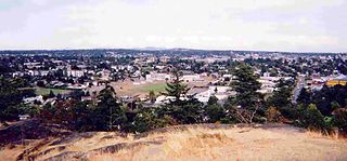
Saanich is a district municipality on the southern end of Vancouver Island in British Columbia, Canada, within the Greater Victoria area. The population was 117,735 at the 2021 census, making it the most populous municipality in the Capital Regional District and Vancouver Island, and the eighth-most populous in the province. With an area of 103.44 square kilometres (39.94 sq mi), Saanich is also the largest municipality in Greater Victoria. The district adopted its name after the Saanich First Nation, meaning "emerging land" or "emerging people".
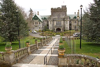
The Township of Esquimalt is a municipality at the southern tip of Vancouver Island, in British Columbia, Canada. It is bordered to the east by the provincial capital, Victoria, to the south by the Strait of Juan de Fuca, to the west by Esquimalt Harbour and Royal Roads, to the northwest by the New Songhees 1A Indian reserve and the town of View Royal, and to the north by a narrow inlet of water called the Gorge, across which is the district municipality of Saanich. It is almost tangential to Esquimalt 1 Indian Reserve near Admirals Road. It is one of the 13 municipalities of Greater Victoria and part of the Capital Regional District.
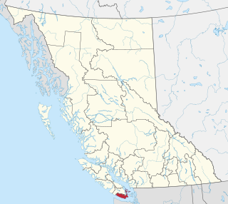
The Capital Regional District (CRD) is a local government administrative district encompassing the southern tip of Vancouver Island and the southern Gulf Islands in the Canadian province of British Columbia. The CRD is one of several regional districts in British Columbia and had an official population of 415,451 as of the Canada 2021 Census.

Greater Victoria is located in British Columbia, Canada, on the southern tip of Vancouver Island. It is usually defined as the thirteen municipalities of the Capital Regional District (CRD) on Vancouver Island as well as some adjacent areas and nearby islands.

Sooke is a district municipality on the southern tip of Vancouver Island, Canada, 38 kilometres (24 mi) by road from Victoria, the capital of British Columbia. Sooke, the westernmost of Greater Victoria's Western Communities, is to the north and west of the Sooke Basin. It is a regional centre for residents in neighbouring communities, including Otter Point, Shirley and Jordan River.

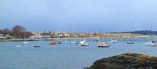
View Royal is a town in Greater Victoria and a member municipality of the Capital Regional District of British Columbia, Canada. View Royal has a population of 11,575 residents. With over 700 hectares of parkland, View Royal includes Thetis, McKenzie, Pike, and Prior Lakes and portions of Esquimalt Harbour and Portage Inlet.
Oak Bay is a municipality incorporated in 1906 that is located on the southern tip of Vancouver Island, in the Canadian province of British Columbia. It is one of thirteen member municipalities of the Capital Regional District, and is bordered to the west by the city of Victoria and to the north by the district of Saanich. It is an eastern residential suburb of Victoria.

Central Saanich is a district municipality in Greater Victoria, British Columbia, Canada, and a member municipality of the Capital Regional District. It is located on the Saanich Peninsula, in the far south-east of Vancouver Island. It is the traditional territory of the W̱SÁNEĆ people. The district began as a farming community, and many hobby farms, along working farms and vineyards, still exist. In recent decades, the area has seen increasing residential, commercial, and industrial development, especially around the neighbourhoods of Brentwood Bay and Saanichton, which are occasionally referred to as separate communities.

Langford is a city on southern Vancouver Island in the province of British Columbia, Canada. Langford is one of the 13 component municipalities of Greater Victoria and is within the Capital Regional District. Langford was incorporated in 1992 and has a population of over 40,000 people, the largest municipality in the Western Communities, and third-largest in the Capital Regional District after Saanich and Victoria.
The District of Metchosin is a municipality and community in Greater Victoria on the southern tip of Vancouver Island in British Columbia, Canada. It is a coastal community adjacent to the Strait of Juan de Fuca. Metchosin is part of the Western Communities and one of the 13 regional municipalities.

The Columbia–Shuswap Regional District is a regional district in the Canadian province of British Columbia, located in the Southern Interior region on the Trans-Canada Highway between Vancouver and Calgary, Alberta. The regional district borders the Province of Alberta across the Rocky Mountains.
Colwood is a city located on Vancouver Island to the southwest of Victoria, capital of British Columbia, Canada. Colwood was incorporated in 1985 and has a population of approximately 19,000 people. Colwood lies within the boundaries of the Greater Victoria area or Capital Regional District, in a region called the Western Communities, or the West Shore. It is one of the 13 component municipalities of Greater Victoria.

The Northern Rockies Regional Municipality (NRRM), formerly the Northern Rockies Regional District (NRRD), and before that the Fort Nelson–Liard Regional District, is a municipality in northeastern British Columbia, Canada. Although portrayed as a regional municipality in its official name, and existing on the same administrative level as a regional district, it is actually classified as a district municipality. The NRRM's offices are located in Fort Nelson, formerly an incorporated town that amalgamated with the NRRD on February 6, 2009, to form the NRRM. With the Peace River Regional District as the southern part, it was the northern part of the Peace River-Liard Regional District, which was split into two on October 31, 1987.

The Regional District of Kitimat–Stikine is a local government administration in northwestern British Columbia, Canada. As of the 2016 Canadian census, it had a population of 37,367 living on a land area of 104,464.61 square kilometres (40,334.01 sq mi). Its administrative offices are in the city of Terrace. The next-largest municipality in the regional district is the District Municipality of Kitimat. The other incorporated municipalities in the regional district are the Village of Hazelton, the District of New Hazelton and the District of Stewart. Unincorporated communities are many, most of them Indian Reserves which are not part of the governmental system of the regional district, which has limited powers relating mostly to municipal-type services. The remote settlement of Dease Lake, formerly in the Stikine Region, was added to the regional district on December 1, 2007. Thornhill is the largest unincorporated community in the regional District with a population of 5000+ residents.
Central Coast Regional District is a regional district in British Columbia, Canada. It has a total land area of 24,559.5 km2. When it was created in 1968, it was known as the Ocean Falls Regional District, named for the then-largest town in the region, the company town of Ocean Falls, which has since become a ghost town. The district name was confirmed in 1974, but changed to Central Coast Regional District in 1976.

Saddle Hills County is a municipal district situated in the central portion of the Peace Country in northwest Alberta, Canada. Located approximately 450 km (280 mi) northwest of Edmonton and 90 km (56 mi) north of Grande Prairie, its municipal office is located approximately 25 km (16 mi) west of the Town of Spirit River at the intersection of Highway 49 and Highway 725.

The District of Kent is a district municipality located 116 kilometres (72 mi) east of Vancouver, British Columbia. Part of the Fraser Valley Regional District, Kent consists of several communities, the largest and most well-known being Agassiz—the only town in the municipality—Harrison Mills, Kilby, Mount Woodside, Kent Prairie, Sea Bird Island and Ruby Creek. Included within the municipality's boundaries are several separately-governed Indian reserves, including the Seabird Island First Nation's reserves on and around the island of the same name.
Spallumcheen is a district municipality in the Canadian province of British Columbia. Located in the Okanagan region between Vernon and Enderby, the township had a population of 5,055 and land area of 255.77 square kilometres (98.75 sq mi) in the Canada 2011 Census. The district, whose official name is the Township of Spallumcheen and which is the oldest rural municipality in the British Columbia Interior, consists primarily of agricultural land surrounding the separately incorporated City of Armstrong. Both Spallumcheen and Armstrong are member municipalities of the Regional District of North Okanagan.


